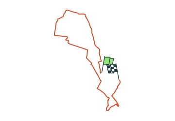
![](/images/other/stat-length.png)
![Tour Zu Fuß Billerbeck - Billerbeck Rundweg B9 - Photo](https://media.geolcdn.com/t/1900/400/fd9924ad-8ed3-41b5-affe-67c99106c9b3.jpeg&format=pjpeg&maxdim=2)
Billerbeck Rundweg B9
SityTrail - itinéraires balisés pédestres
Tous les sentiers balisés d’Europe GUIDE+
![Länge](/images/other/stat-length.png)
![Maximale Höhe](https://static1.geolcdn.com/siteimages/upload/files/1508320355ic_sort_altitude_max_24dp.png)
![Positive Höhendifferenz](https://static1.geolcdn.com/siteimages/upload/files/1508320355ic_sort_den_pos_24dp.png)
![Km-Effort](/images/other/stat-length.png)
![Min. Höhe](https://static1.geolcdn.com/siteimages/upload/files/1508320355ic_sort_altitude_min_24dp.png)
![Negative Höhendifferenz](https://static1.geolcdn.com/siteimages/upload/files/1508320355ic_sort_den_neg_24dp.png)
![Boucle](https://static1.geolcdn.com/siteimages/upload/files/16400158638029165_repeat_loop_refresh_sync_direction_icon.png)
![Zu Fuß](https://static1.geolcdn.com/sitytour/trail-icons/100.png)
3h41
Schwierigkeit : Einfach
![Scannen Sie diesen QR-Code, um die Tour in der SityTrail-Anwendung zu öffnen](https://capi.geolives.com/qq0zvz2zws4bq2lad0pu/sitytour/trails/3099651/qr.png?size=200)
Kostenlosegpshiking-Anwendung
Über SityTrail
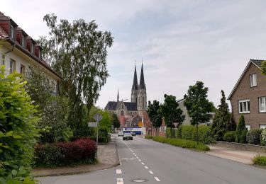
Tour Zu Fuß von 13,6 km verfügbar auf Nordrhein-Westfalen, Kreis Coesfeld, Billerbeck. Diese Tour wird von SityTrail - itinéraires balisés pédestres vorgeschlagen.
Beschreibung
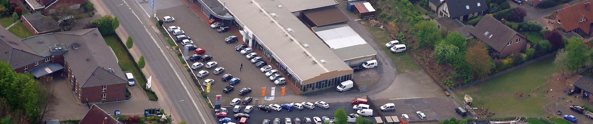
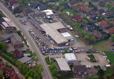
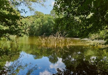
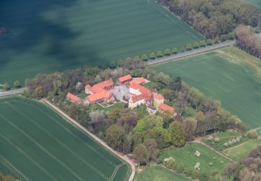
Die Baumberge im Münsterland - wunderschöne Parklandschaft. Besonders für Radfahrer und Wanderer ist die Region ein herrliches Urlaubsgebiet.
Website: http://www.baumberge-touristik.de
Ort
Kommentare
Touren in der Umgebung
![Tour Zu Fuß Rosendahl - Darfelder Rundweg D1 - Photo](https://media.geolcdn.com/t/375/260/4c0d051c-1208-43da-bfdd-73fc72f1558a.jpeg&format=jpg&maxdim=2)
![Zu Fuß Zu Fuß](https://static1.geolcdn.com/sitytour/trail-icons/100.png)
Zu Fuß
![](/images/other/stat-length.png)
![](https://static1.geolcdn.com/siteimages/upload/files/16400158638029165_repeat_loop_refresh_sync_direction_icon.png)
![Tour Zu Fuß Billerbeck - Billerbeck Rundweg B1 - Photo](https://media.geolcdn.com/t/375/260/fd9924ad-8ed3-41b5-affe-67c99106c9b3.jpeg&format=jpg&maxdim=2)
![Zu Fuß Zu Fuß](https://static1.geolcdn.com/sitytour/trail-icons/100.png)
Zu Fuß
![](/images/other/stat-length.png)
![](https://static1.geolcdn.com/siteimages/upload/files/16400158638029165_repeat_loop_refresh_sync_direction_icon.png)
![Tour Zu Fuß Billerbeck - Billerbeck Rundweg B2 - Photo](https://media.geolcdn.com/t/375/260/f4d71ddb-0aa5-4709-aec7-817db5e748c6.jpeg&format=jpg&maxdim=2)
![Zu Fuß Zu Fuß](https://static1.geolcdn.com/sitytour/trail-icons/100.png)
Zu Fuß
![](/images/other/stat-length.png)
![](https://static1.geolcdn.com/siteimages/upload/files/16400158638029165_repeat_loop_refresh_sync_direction_icon.png)
![Tour Zu Fuß Billerbeck - Billerbeck Rundweg B3 - Photo](https://media.geolcdn.com/t/375/260/043596c4-cd86-40eb-adb6-765e165930aa.jpeg&format=jpg&maxdim=2)
![Zu Fuß Zu Fuß](https://static1.geolcdn.com/sitytour/trail-icons/100.png)
Zu Fuß
![](/images/other/stat-length.png)
![](https://static1.geolcdn.com/siteimages/upload/files/16400158638029165_repeat_loop_refresh_sync_direction_icon.png)
![Tour Zu Fuß Billerbeck - Billerbeck Rundweg B7 - Photo](https://media.geolcdn.com/t/375/260/cf1e3666-d455-4dc1-9288-4fe456b7cec8.jpeg&format=jpg&maxdim=2)
![Zu Fuß Zu Fuß](https://static1.geolcdn.com/sitytour/trail-icons/100.png)
Zu Fuß
![](/images/other/stat-length.png)
![](https://static1.geolcdn.com/siteimages/upload/files/16400158638029165_repeat_loop_refresh_sync_direction_icon.png)
![Tour Zu Fuß Billerbeck - Billerbeck Rundweg B10 - Photo](https://media.geolcdn.com/t/375/260/fd9924ad-8ed3-41b5-affe-67c99106c9b3.jpeg&format=jpg&maxdim=2)
![Zu Fuß Zu Fuß](https://static1.geolcdn.com/sitytour/trail-icons/100.png)
Zu Fuß
![](/images/other/stat-length.png)
![](https://static1.geolcdn.com/siteimages/upload/files/16400158638029165_repeat_loop_refresh_sync_direction_icon.png)
![Tour Zu Fuß Billerbeck - Gerleve Rundweg A6 - Photo](https://media.geolcdn.com/t/375/260/a6207672-3bd0-4d10-bced-f0b066aac933.jpeg&format=jpg&maxdim=2)
![Zu Fuß Zu Fuß](https://static1.geolcdn.com/sitytour/trail-icons/100.png)
Zu Fuß
![](/images/other/stat-length.png)
![](https://static1.geolcdn.com/siteimages/upload/files/16400158638029165_repeat_loop_refresh_sync_direction_icon.png)
![Tour Zu Fuß Rosendahl - Rundweg Darfeld D2 - Photo](https://media.geolcdn.com/t/375/260/0b6d7878-3508-4b9f-b079-f6c586ab37ef.jpeg&format=jpg&maxdim=2)
![Zu Fuß Zu Fuß](https://static1.geolcdn.com/sitytour/trail-icons/100.png)
Zu Fuß
![](/images/other/stat-length.png)
![](https://static1.geolcdn.com/siteimages/upload/files/16400158638029165_repeat_loop_refresh_sync_direction_icon.png)