![](/images/other/stat-length.png)
![Tour Zu Fuß Landstuhl - Rundwanderweg Landstuhl L2 - Photo](https://media.geolcdn.com/t/1900/400/2511714c-70de-4e20-8e55-dc2f85ee70e4.jpeg&format=pjpeg&maxdim=2)
Rundwanderweg Landstuhl L2
SityTrail - itinéraires balisés pédestres
Tous les sentiers balisés d’Europe GUIDE+
![Länge](/images/other/stat-length.png)
Länge
4,1 km
![Maximale Höhe](https://static1.geolcdn.com/siteimages/upload/files/1508320355ic_sort_altitude_max_24dp.png)
Maximale Höhe
374 m
![Positive Höhendifferenz](https://static1.geolcdn.com/siteimages/upload/files/1508320355ic_sort_den_pos_24dp.png)
Positive Höhendifferenz
67 m
![Km-Effort](/images/other/stat-length.png)
Km-Effort
5 km
![Min. Höhe](https://static1.geolcdn.com/siteimages/upload/files/1508320355ic_sort_altitude_min_24dp.png)
Min. Höhe
329 m
![Negative Höhendifferenz](https://static1.geolcdn.com/siteimages/upload/files/1508320355ic_sort_den_neg_24dp.png)
Negative Höhendifferenz
62 m
![Boucle](https://static1.geolcdn.com/siteimages/upload/files/16400158638029165_repeat_loop_refresh_sync_direction_icon.png)
Boucle
Nein
Kennzeichnung
Erstellungsdatum :
2022-02-11 18:06:47.942
Letzte Änderung :
2022-02-11 18:06:47.942
![Zu Fuß](https://static1.geolcdn.com/sitytour/trail-icons/100.png)
1h07
Schwierigkeit : Einfach
![Scannen Sie diesen QR-Code, um die Tour in der SityTrail-Anwendung zu öffnen](https://capi.geolives.com/qq0zvz2zws4bq2lad0pu/sitytour/trails/3099040/qr.png?size=200)
Kostenlosegpshiking-Anwendung
Über SityTrail
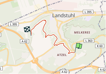
Tour Zu Fuß von 4,1 km verfügbar auf Rheinland-Pfalz, Landkreis Kaiserslautern, Landstuhl. Diese Tour wird von SityTrail - itinéraires balisés pédestres vorgeschlagen.
Beschreibung
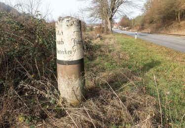
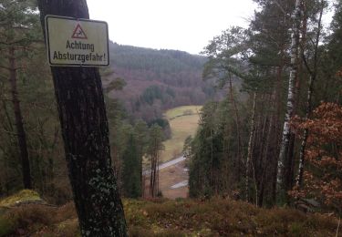
Ende 2016 teils schlecht markiert
Symbol: Weißes L2 auf blauem Grund
Ort
Land:
Germany
Region :
Rheinland-Pfalz
Abteilung/Provinz :
Landkreis Kaiserslautern
Kommune :
Landstuhl
Standort:
Unknown
Gehen Sie:(Dec)
Gehen Sie:(UTM)
396887 ; 5472917 (32U) N.
Kommentare
Touren in der Umgebung
![Tour Zu Fuß Maßweiler - Maßweilerer Keltenpfad - Photo](https://media.geolcdn.com/t/375/260/826912d5-a9bf-48eb-92c8-fd6535534497.jpeg&format=jpg&maxdim=2)
![Zu Fuß Zu Fuß](https://static1.geolcdn.com/sitytour/trail-icons/100.png)
Maßweilerer Keltenpfad
Zu Fuß
Einfach
Maßweiler,
Rheinland-Pfalz,
Südwestpfalz,
Germany
![](/images/other/stat-length.png)
14,4 km | 19,9 km-effort
4h 31min
![](https://static1.geolcdn.com/siteimages/upload/files/16400158638029165_repeat_loop_refresh_sync_direction_icon.png)
Ja
![Tour Zu Fuß Bruchmühlbach-Miesau - Sagenhafter Waldpfad - Photo](https://media.geolcdn.com/t/375/260/1b7336c2-b76a-44e0-9ccb-2ce87749a1dc.jpeg&format=jpg&maxdim=2)
![Zu Fuß Zu Fuß](https://static1.geolcdn.com/sitytour/trail-icons/100.png)
Sagenhafter Waldpfad
Zu Fuß
Medium
Bruchmühlbach-Miesau,
Rheinland-Pfalz,
Landkreis Kaiserslautern,
Germany
![](/images/other/stat-length.png)
16,2 km | 22 km-effort
5h 1min
![](https://static1.geolcdn.com/siteimages/upload/files/16400158638029165_repeat_loop_refresh_sync_direction_icon.png)
Ja
![Tour Zu Fuß - Wanderweg Erfenach 4, Rund um den Maienberg - Photo](https://media.geolcdn.com/t/375/260/ca6e4dd2-da62-4ca4-9bf9-cdb07d398274.jpeg&format=jpg&maxdim=2)
![Zu Fuß Zu Fuß](https://static1.geolcdn.com/sitytour/trail-icons/100.png)
Wanderweg Erfenach 4, Rund um den Maienberg
Zu Fuß
Einfach
,
Rheinland-Pfalz,
Kaiserslautern,
Germany
![](/images/other/stat-length.png)
7 km | 8,5 km-effort
1h 56min
![](https://static1.geolcdn.com/siteimages/upload/files/16400158638029165_repeat_loop_refresh_sync_direction_icon.png)
Ja
![Tour Zu Fuß Wolfstein - Ritschelbusch-Runde - Photo](https://media.geolcdn.com/t/375/260/3d91b98d-4fd8-4308-ad9b-757452b44742.jpeg&format=jpg&maxdim=2)
![Zu Fuß Zu Fuß](https://static1.geolcdn.com/sitytour/trail-icons/100.png)
Ritschelbusch-Runde
Zu Fuß
Einfach
Wolfstein,
Rheinland-Pfalz,
Landkreis Kusel,
Germany
![](/images/other/stat-length.png)
6 km | 7,9 km-effort
1h 47min
![](https://static1.geolcdn.com/siteimages/upload/files/16400158638029165_repeat_loop_refresh_sync_direction_icon.png)
Ja
![Tour Zu Fuß Gehrweiler - Rundwanderweg Rockenhausen: Vier-Bäche-Weg - Photo](https://media.geolcdn.com/t/375/260/bfb639af-8df0-4a5d-84c0-b25fb89d6fc2.jpeg&format=jpg&maxdim=2)
![Zu Fuß Zu Fuß](https://static1.geolcdn.com/sitytour/trail-icons/100.png)
Rundwanderweg Rockenhausen: Vier-Bäche-Weg
Zu Fuß
Medium
Gehrweiler,
Rheinland-Pfalz,
Donnersbergkreis,
Germany
![](/images/other/stat-length.png)
17,6 km | 24 km-effort
5h 30min
![](https://static1.geolcdn.com/siteimages/upload/files/16400158638029165_repeat_loop_refresh_sync_direction_icon.png)
Nein
![Tour Zu Fuß Höheinöd - Sickinger Höhenweg - Photo](https://media.geolcdn.com/t/375/260/727da6cf-efdc-4a33-ae1e-2852399361a8.jpeg&format=jpg&maxdim=2)
![Zu Fuß Zu Fuß](https://static1.geolcdn.com/sitytour/trail-icons/100.png)
Sickinger Höhenweg
Zu Fuß
Medium
Höheinöd,
Rheinland-Pfalz,
Südwestpfalz,
Germany
![](/images/other/stat-length.png)
20 km | 27 km-effort
6h 5min
![](https://static1.geolcdn.com/siteimages/upload/files/16400158638029165_repeat_loop_refresh_sync_direction_icon.png)
Nein
![Tour Zu Fuß Clausen - Wandern in Clausen C8 Rund um Clausen - Photo](https://media.geolcdn.com/t/375/260/65aba17d-e65f-41ac-9aaa-2c06d98c4adb.jpeg&format=jpg&maxdim=2)
![Zu Fuß Zu Fuß](https://static1.geolcdn.com/sitytour/trail-icons/100.png)
Wandern in Clausen C8 Rund um Clausen
Zu Fuß
Medium
Clausen,
Rheinland-Pfalz,
Südwestpfalz,
Germany
![](/images/other/stat-length.png)
18 km | 24 km-effort
5h 33min
![](https://static1.geolcdn.com/siteimages/upload/files/16400158638029165_repeat_loop_refresh_sync_direction_icon.png)
Ja
![Tour Zu Fuß Waldfischbach-Burgalben - Wandern in Clausen C5 - Photo](https://media.geolcdn.com/t/375/260/65aba17d-e65f-41ac-9aaa-2c06d98c4adb.jpeg&format=jpg&maxdim=2)
![Zu Fuß Zu Fuß](https://static1.geolcdn.com/sitytour/trail-icons/100.png)
Wandern in Clausen C5
Zu Fuß
Einfach
Waldfischbach-Burgalben,
Rheinland-Pfalz,
Südwestpfalz,
Germany
![](/images/other/stat-length.png)
8,1 km | 11,7 km-effort
2h 39min
![](https://static1.geolcdn.com/siteimages/upload/files/16400158638029165_repeat_loop_refresh_sync_direction_icon.png)
Ja
![Tour Zu Fuß Clausen - Wandern in Clausen C6 - Photo](https://media.geolcdn.com/t/375/260/0114e7e1-ac63-435d-8266-9a3926b8b6e0.jpeg&format=jpg&maxdim=2)
![Zu Fuß Zu Fuß](https://static1.geolcdn.com/sitytour/trail-icons/100.png)
Wandern in Clausen C6
Zu Fuß
Einfach
Clausen,
Rheinland-Pfalz,
Südwestpfalz,
Germany
![](/images/other/stat-length.png)
3,9 km | 5,2 km-effort
1h 11min
![](https://static1.geolcdn.com/siteimages/upload/files/16400158638029165_repeat_loop_refresh_sync_direction_icon.png)
Ja