![](/images/other/stat-length.png)
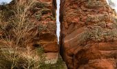
![Tour Zu Fuß Dahn - Eyberg-Tour - Photo](https://media.geolcdn.com/t/1900/400/2f8d3170-dd0f-4931-acb2-d74a880c97f4.jpeg&format=pjpeg&maxdim=2)
Eyberg-Tour
SityTrail - itinéraires balisés pédestres
Tous les sentiers balisés d’Europe GUIDE+
![Länge](/images/other/stat-length.png)
Länge
11,2 km
![Maximale Höhe](https://static1.geolcdn.com/siteimages/upload/files/1508320355ic_sort_altitude_max_24dp.png)
Maximale Höhe
521 m
![Positive Höhendifferenz](https://static1.geolcdn.com/siteimages/upload/files/1508320355ic_sort_den_pos_24dp.png)
Positive Höhendifferenz
413 m
![Km-Effort](/images/other/stat-length.png)
Km-Effort
16,7 km
![Min. Höhe](https://static1.geolcdn.com/siteimages/upload/files/1508320355ic_sort_altitude_min_24dp.png)
Min. Höhe
217 m
![Negative Höhendifferenz](https://static1.geolcdn.com/siteimages/upload/files/1508320355ic_sort_den_neg_24dp.png)
Negative Höhendifferenz
422 m
![Boucle](https://static1.geolcdn.com/siteimages/upload/files/16400158638029165_repeat_loop_refresh_sync_direction_icon.png)
Boucle
Ja
Kennzeichnung
Erstellungsdatum :
2022-02-11 17:38:44.702
Letzte Änderung :
2022-02-11 17:38:44.702
![Zu Fuß](https://static1.geolcdn.com/sitytour/trail-icons/100.png)
3h47
Schwierigkeit : Einfach
![Scannen Sie diesen QR-Code, um die Tour in der SityTrail-Anwendung zu öffnen](https://capi.geolives.com/qq0zvz2zws4bq2lad0pu/sitytour/trails/3098298/qr.png?size=200)
Kostenlosegpshiking-Anwendung
Über SityTrail
Tour Zu Fuß von 11,2 km verfügbar auf Rheinland-Pfalz, Südwestpfalz, Dahn. Diese Tour wird von SityTrail - itinéraires balisés pédestres vorgeschlagen.
Beschreibung
Trail created by Tourist Information Dahner Felsenland.
Symbol: Stilisiertes weißes E unter weißer Bergkuppe mit weißem Turm auf blauem Grund
Ort
Land:
Germany
Region :
Rheinland-Pfalz
Abteilung/Provinz :
Südwestpfalz
Kommune :
Dahn
Standort:
Unknown
Gehen Sie:(Dec)
Gehen Sie:(UTM)
409893 ; 5443120 (32U) N.
Kommentare
Touren in der Umgebung
![Tour Wandern Dahn - Dahner Felsenpfad - Photo](https://media.geolcdn.com/t/375/260/ext.jpg?maxdim=2&url=https%3A%2F%2Fservices.sitytrail.com%2FGeolivesWS%2FDownloadMedia.ashx%3FTrailID%3D732172%26Media%3Dfix__20170409162639.jpg)
![Wandern Wandern](https://static1.geolcdn.com/sitytour/trail-icons/101.png)
Dahner Felsenpfad
Wandern
Medium
(2)
Dahn,
Rheinland-Pfalz,
Südwestpfalz,
Germany
![](/images/other/stat-length.png)
13,5 km | 19 km-effort
6h 5min
![](https://static1.geolcdn.com/siteimages/upload/files/16400158638029165_repeat_loop_refresh_sync_direction_icon.png)
Ja
![Tour Zu Fuß Dahn - Drei Burgen-Tour - Photo](https://media.geolcdn.com/t/375/260/77d72ee6-9edd-4724-85e8-eabf605c660f.jpeg&format=jpg&maxdim=2)
![Zu Fuß Zu Fuß](https://static1.geolcdn.com/sitytour/trail-icons/100.png)
Drei Burgen-Tour
Zu Fuß
Einfach
Dahn,
Rheinland-Pfalz,
Südwestpfalz,
Germany
![](/images/other/stat-length.png)
4,1 km | 5,6 km-effort
1h 16min
![](https://static1.geolcdn.com/siteimages/upload/files/16400158638029165_repeat_loop_refresh_sync_direction_icon.png)
Ja
![Tour Zu Fuß Erfweiler - Rundwanderweg Erfweiler 64 - Photo](https://media.geolcdn.com/t/375/260/1d852591-6d35-428d-bded-b7bdb358413f.jpeg&format=jpg&maxdim=2)
![Zu Fuß Zu Fuß](https://static1.geolcdn.com/sitytour/trail-icons/100.png)
Rundwanderweg Erfweiler 64
Zu Fuß
Einfach
Erfweiler,
Rheinland-Pfalz,
Südwestpfalz,
Germany
![](/images/other/stat-length.png)
4,1 km | 6,1 km-effort
1h 22min
![](https://static1.geolcdn.com/siteimages/upload/files/16400158638029165_repeat_loop_refresh_sync_direction_icon.png)
Nein
![Tour Zu Fuß Erfweiler - Rundwanderweg Erfweiler 63 - Photo](https://media.geolcdn.com/t/375/260/d490a786-3cfb-49b1-a3dc-0106d24bee99.jpeg&format=jpg&maxdim=2)
![Zu Fuß Zu Fuß](https://static1.geolcdn.com/sitytour/trail-icons/100.png)
Rundwanderweg Erfweiler 63
Zu Fuß
Einfach
Erfweiler,
Rheinland-Pfalz,
Südwestpfalz,
Germany
![](/images/other/stat-length.png)
5,2 km | 6,4 km-effort
1h 26min
![](https://static1.geolcdn.com/siteimages/upload/files/16400158638029165_repeat_loop_refresh_sync_direction_icon.png)
Nein
![Tour Zu Fuß Erfweiler - Rundwanderweg Erfweiler 58 - Photo](https://media.geolcdn.com/t/375/260/053f9909-42ac-497f-b3c2-b0470bd3cf4b.jpeg&format=jpg&maxdim=2)
![Zu Fuß Zu Fuß](https://static1.geolcdn.com/sitytour/trail-icons/100.png)
Rundwanderweg Erfweiler 58
Zu Fuß
Einfach
Erfweiler,
Rheinland-Pfalz,
Südwestpfalz,
Germany
![](/images/other/stat-length.png)
8,6 km | 11,7 km-effort
2h 40min
![](https://static1.geolcdn.com/siteimages/upload/files/16400158638029165_repeat_loop_refresh_sync_direction_icon.png)
Ja
![Tour Zu Fuß Erfweiler - Rundwanderweg Erfweiler 57 - Photo](https://media.geolcdn.com/t/375/260/d490a786-3cfb-49b1-a3dc-0106d24bee99.jpeg&format=jpg&maxdim=2)
![Zu Fuß Zu Fuß](https://static1.geolcdn.com/sitytour/trail-icons/100.png)
Rundwanderweg Erfweiler 57
Zu Fuß
Einfach
Erfweiler,
Rheinland-Pfalz,
Südwestpfalz,
Germany
![](/images/other/stat-length.png)
4,6 km | 6,2 km-effort
1h 24min
![](https://static1.geolcdn.com/siteimages/upload/files/16400158638029165_repeat_loop_refresh_sync_direction_icon.png)
Nein
![Tour Zu Fuß Rumbach - Panoramaweg - Photo](https://media.geolcdn.com/t/375/260/0675f5af-b862-4dd0-9fc4-8b9355fa230b.jpeg&format=jpg&maxdim=2)
![Zu Fuß Zu Fuß](https://static1.geolcdn.com/sitytour/trail-icons/100.png)
Panoramaweg
Zu Fuß
Einfach
Rumbach,
Rheinland-Pfalz,
Südwestpfalz,
Germany
![](/images/other/stat-length.png)
4,8 km | 7,2 km-effort
1h 38min
![](https://static1.geolcdn.com/siteimages/upload/files/16400158638029165_repeat_loop_refresh_sync_direction_icon.png)
Ja
![Tour Zu Fuß Bruchweiler-Bärenbach - Schlangenberg-Tour - Photo](https://media.geolcdn.com/t/375/260/215d3bad-9592-4976-a950-5c40aafe104e.jpeg&format=jpg&maxdim=2)
![Zu Fuß Zu Fuß](https://static1.geolcdn.com/sitytour/trail-icons/100.png)
Schlangenberg-Tour
Zu Fuß
Einfach
Bruchweiler-Bärenbach,
Rheinland-Pfalz,
Südwestpfalz,
Germany
![](/images/other/stat-length.png)
6,8 km | 9,3 km-effort
2h 6min
![](https://static1.geolcdn.com/siteimages/upload/files/16400158638029165_repeat_loop_refresh_sync_direction_icon.png)
Ja
![Tour Zu Fuß Dahn - Kauert-Tour - Photo](https://media.geolcdn.com/t/375/260/05e17897-5601-4f04-bdba-6081bbe05204.jpeg&format=jpg&maxdim=2)
![Zu Fuß Zu Fuß](https://static1.geolcdn.com/sitytour/trail-icons/100.png)
Kauert-Tour
Zu Fuß
Einfach
Dahn,
Rheinland-Pfalz,
Südwestpfalz,
Germany
![](/images/other/stat-length.png)
5,5 km | 8 km-effort
1h 48min
![](https://static1.geolcdn.com/siteimages/upload/files/16400158638029165_repeat_loop_refresh_sync_direction_icon.png)
Ja