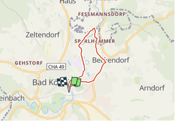
![](/images/other/stat-length.png)
![Tour Zu Fuß Bad Kötzting - K1 Rundwanderweg Sperlhammer - Photo](https://media.geolcdn.com/t/1900/400/ext.pjpeg?maxdim=2&url=https%3A%2F%2Fmedia.geolcdn.com%2Ff%2F3d4e08e8-355a-4dc6-b681-3e8b4fbead30.jpeg)
K1 Rundwanderweg Sperlhammer
SityTrail - itinéraires balisés pédestres
Tous les sentiers balisés d’Europe PRO
![Länge](/images/other/stat-length.png)
Länge
4,6 km
![Maximale Höhe](https://static1.geolcdn.com/siteimages/upload/files/1508320355ic_sort_altitude_max_24dp.png)
Maximale Höhe
416 m
![Positive Höhendifferenz](https://static1.geolcdn.com/siteimages/upload/files/1508320355ic_sort_den_pos_24dp.png)
Positive Höhendifferenz
36 m
![Km-Effort](/images/other/stat-length.png)
Km-Effort
5,1 km
![Min. Höhe](https://static1.geolcdn.com/siteimages/upload/files/1508320355ic_sort_altitude_min_24dp.png)
Min. Höhe
398 m
![Negative Höhendifferenz](https://static1.geolcdn.com/siteimages/upload/files/1508320355ic_sort_den_neg_24dp.png)
Negative Höhendifferenz
36 m
![Boucle](https://static1.geolcdn.com/siteimages/upload/files/16400158638029165_repeat_loop_refresh_sync_direction_icon.png)
Boucle
Ja
Kennzeichnung
Erstellungsdatum :
2022-02-11 17:30:52.306
Letzte Änderung :
2022-02-11 17:30:52.306
![Zu Fuß](https://static1.geolcdn.com/sitytour/trail-icons/100.png)
1h09
Schwierigkeit : Einfach
![Scannen Sie diesen QR-Code, um die Tour in der SityTrail-Anwendung zu öffnen](https://capi.geolives.com/qq0zvz2zws4bq2lad0pu/sitytour/trails/3098052/qr.png?size=200)
Kostenlosegpshiking-Anwendung
Über SityTrail
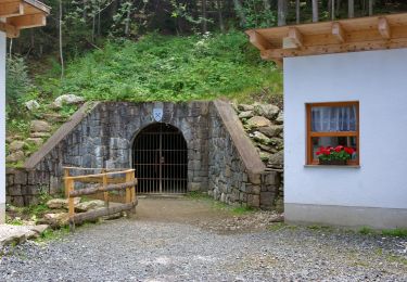
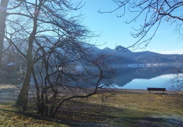
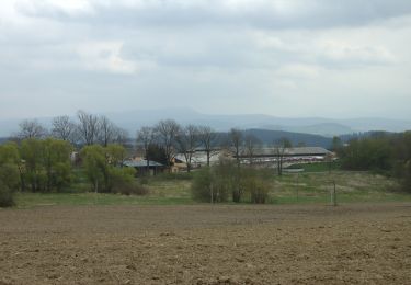
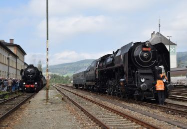
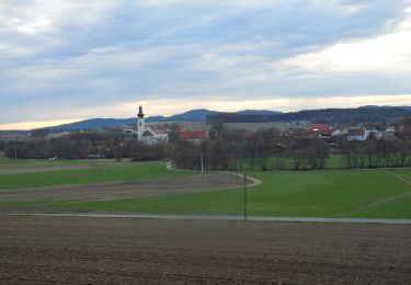
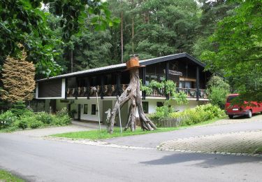
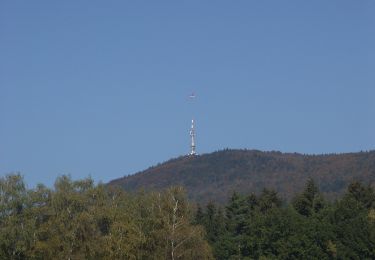
Tour Zu Fuß von 4,6 km verfügbar auf Bayern, Landkreis Cham, Bad Kötzting. Diese Tour wird von SityTrail - itinéraires balisés pédestres vorgeschlagen.
Beschreibung
Trail created by Stadt Kötzting.
Symbol: Rote Wegnummer im weißen Bereich des oben weißen / unten roten, rechteckigen Hintergrunds
Ort
Land:
Germany
Region :
Bayern
Abteilung/Provinz :
Landkreis Cham
Kommune :
Bad Kötzting
Standort:
Unknown
Gehen Sie:(Dec)
Gehen Sie:(UTM)
343864 ; 5448941 (33U) N.
Kommentare
Touren in der Umgebung
![Tour Zu Fuß Furth im Wald - Fu11 »Hammerschmiedeweg« (Furth im Wald) - Photo](https://media.geolcdn.com/t/375/260/ext.jpg?maxdim=2&url=https%3A%2F%2Fmedia.geolcdn.com%2Ff%2Fcdbb5a43-9cac-40d7-b43c-e7a2012f82b2.jpeg)
![Zu Fuß Zu Fuß](https://static1.geolcdn.com/sitytour/trail-icons/100.png)
Fu11 »Hammerschmiedeweg« (Furth im Wald)
Zu Fuß
Einfach
Furth im Wald,
Bayern,
Landkreis Cham,
Germany
![](/images/other/stat-length.png)
8,3 km | 10,7 km-effort
2h 25min
![](https://static1.geolcdn.com/siteimages/upload/files/16400158638029165_repeat_loop_refresh_sync_direction_icon.png)
Ja
![Tour Zu Fuß Furth im Wald - Fu05 Arnschwanger Weg - Photo](https://media.geolcdn.com/t/375/260/ext.jpg?maxdim=2&url=https%3A%2F%2Fmedia.geolcdn.com%2Ff%2F352f0aa5-db68-4e23-babc-b1d03c091cf4.jpeg)
![Zu Fuß Zu Fuß](https://static1.geolcdn.com/sitytour/trail-icons/100.png)
Fu05 Arnschwanger Weg
Zu Fuß
Einfach
Furth im Wald,
Bayern,
Landkreis Cham,
Germany
![](/images/other/stat-length.png)
8,8 km | 11,8 km-effort
2h 41min
![](https://static1.geolcdn.com/siteimages/upload/files/16400158638029165_repeat_loop_refresh_sync_direction_icon.png)
Nein
![Tour Zu Fuß Furth im Wald - Fu04 Steinbruchseeweg - Photo](https://media.geolcdn.com/t/375/260/ext.jpg?maxdim=2&url=https%3A%2F%2Fmedia.geolcdn.com%2Ff%2F457098b4-ffd5-4d32-ac88-228ffbf0283a.jpeg)
![Zu Fuß Zu Fuß](https://static1.geolcdn.com/sitytour/trail-icons/100.png)
Fu04 Steinbruchseeweg
Zu Fuß
Einfach
Furth im Wald,
Bayern,
Landkreis Cham,
Germany
![](/images/other/stat-length.png)
5,6 km | 7,8 km-effort
1h 45min
![](https://static1.geolcdn.com/siteimages/upload/files/16400158638029165_repeat_loop_refresh_sync_direction_icon.png)
Nein
![Tour Zu Fuß Furth im Wald - Fu03 Hohenbogenweg - Photo](https://media.geolcdn.com/t/375/260/ext.jpg?maxdim=2&url=https%3A%2F%2Fmedia.geolcdn.com%2Ff%2F3c4f947b-7ce4-437f-ba58-8a2d63e6bc8c.jpeg)
![Zu Fuß Zu Fuß](https://static1.geolcdn.com/sitytour/trail-icons/100.png)
Fu03 Hohenbogenweg
Zu Fuß
Schwierig
Furth im Wald,
Bayern,
Landkreis Cham,
Germany
![](/images/other/stat-length.png)
21 km | 31 km-effort
7h 3min
![](https://static1.geolcdn.com/siteimages/upload/files/16400158638029165_repeat_loop_refresh_sync_direction_icon.png)
Ja
![Tour Zu Fuß Arnschwang - As03 (Kalkofenrundweg, Arnschwang) - Photo](https://media.geolcdn.com/t/375/260/ext.jpg?maxdim=2&url=https%3A%2F%2Fmedia.geolcdn.com%2Ff%2F352f0aa5-db68-4e23-babc-b1d03c091cf4.jpeg)
![Zu Fuß Zu Fuß](https://static1.geolcdn.com/sitytour/trail-icons/100.png)
As03 (Kalkofenrundweg, Arnschwang)
Zu Fuß
Einfach
Arnschwang,
Bayern,
Landkreis Cham,
Germany
![](/images/other/stat-length.png)
11,7 km | 16 km-effort
3h 38min
![](https://static1.geolcdn.com/siteimages/upload/files/16400158638029165_repeat_loop_refresh_sync_direction_icon.png)
Ja
![Tour Zu Fuß Arnschwang - As02 (Kapellenweg, Arnschwang) - Photo](https://media.geolcdn.com/t/375/260/ext.jpg?maxdim=2&url=https%3A%2F%2Fmedia.geolcdn.com%2Ff%2F352f0aa5-db68-4e23-babc-b1d03c091cf4.jpeg)
![Zu Fuß Zu Fuß](https://static1.geolcdn.com/sitytour/trail-icons/100.png)
As02 (Kapellenweg, Arnschwang)
Zu Fuß
Einfach
Arnschwang,
Bayern,
Landkreis Cham,
Germany
![](/images/other/stat-length.png)
4,7 km | 6,7 km-effort
1h 30min
![](https://static1.geolcdn.com/siteimages/upload/files/16400158638029165_repeat_loop_refresh_sync_direction_icon.png)
Nein
![Tour Zu Fuß Arrach - Kaitersberg-Panorama-Weg - Photo](https://media.geolcdn.com/t/375/260/ext.jpg?maxdim=2&url=https%3A%2F%2Fmedia.geolcdn.com%2Ff%2F9a6f7fe4-88f4-4cf7-9770-b514d4cd75e5.jpeg)
![Zu Fuß Zu Fuß](https://static1.geolcdn.com/sitytour/trail-icons/100.png)
Kaitersberg-Panorama-Weg
Zu Fuß
Medium
Arrach,
Bayern,
Landkreis Cham,
Germany
![](/images/other/stat-length.png)
14,7 km | 24 km-effort
5h 27min
![](https://static1.geolcdn.com/siteimages/upload/files/16400158638029165_repeat_loop_refresh_sync_direction_icon.png)
Ja
![Tour Zu Fuß Miltach - A2 Altrandsberg – Moosbach – Altrandsberg - Photo](https://media.geolcdn.com/t/375/260/ext.jpg?maxdim=2&url=https%3A%2F%2Fmedia.geolcdn.com%2Ff%2Fad47f50f-b38c-41ac-86e4-ef618f9cb01f.jpeg)
![Zu Fuß Zu Fuß](https://static1.geolcdn.com/sitytour/trail-icons/100.png)
A2 Altrandsberg – Moosbach – Altrandsberg
Zu Fuß
Einfach
Miltach,
Bayern,
Landkreis Cham,
Germany
![](/images/other/stat-length.png)
7,8 km | 10,3 km-effort
2h 20min
![](https://static1.geolcdn.com/siteimages/upload/files/16400158638029165_repeat_loop_refresh_sync_direction_icon.png)
Ja
![Tour Zu Fuß Miltach - A3 Altransberg Riedern Hammersdorf - Photo](https://media.geolcdn.com/t/375/260/ext.jpg?maxdim=2&url=https%3A%2F%2Fmedia.geolcdn.com%2Ff%2F49129e21-578a-4924-8900-e181f3ae180c.jpeg)
![Zu Fuß Zu Fuß](https://static1.geolcdn.com/sitytour/trail-icons/100.png)
A3 Altransberg Riedern Hammersdorf
Zu Fuß
Einfach
Miltach,
Bayern,
Landkreis Cham,
Germany
![](/images/other/stat-length.png)
9 km | 13,3 km-effort
3h 1min
![](https://static1.geolcdn.com/siteimages/upload/files/16400158638029165_repeat_loop_refresh_sync_direction_icon.png)
Ja