![](/images/other/stat-length.png)
![Tour Zu Fuß Oberteuringen - Teuringertal Bahnweg (](https://media.geolcdn.com/t/1900/400/5799fd73-9e39-4461-9954-5af2d33bca70.jpeg&format=pjpeg&maxdim=2)
Teuringertal Bahnweg ("Wandern in Friedrichshafen")
SityTrail - itinéraires balisés pédestres
Tous les sentiers balisés d’Europe GUIDE+
![Länge](/images/other/stat-length.png)
Länge
5 km
![Maximale Höhe](https://static1.geolcdn.com/siteimages/upload/files/1508320355ic_sort_altitude_max_24dp.png)
Maximale Höhe
477 m
![Positive Höhendifferenz](https://static1.geolcdn.com/siteimages/upload/files/1508320355ic_sort_den_pos_24dp.png)
Positive Höhendifferenz
93 m
![Km-Effort](/images/other/stat-length.png)
Km-Effort
6,2 km
![Min. Höhe](https://static1.geolcdn.com/siteimages/upload/files/1508320355ic_sort_altitude_min_24dp.png)
Min. Höhe
430 m
![Negative Höhendifferenz](https://static1.geolcdn.com/siteimages/upload/files/1508320355ic_sort_den_neg_24dp.png)
Negative Höhendifferenz
78 m
![Boucle](https://static1.geolcdn.com/siteimages/upload/files/16400158638029165_repeat_loop_refresh_sync_direction_icon.png)
Boucle
Nein
Kennzeichnung
Erstellungsdatum :
2022-02-11 17:25:45.339
Letzte Änderung :
2022-02-11 17:25:45.339
![Zu Fuß](https://static1.geolcdn.com/sitytour/trail-icons/100.png)
1h24
Schwierigkeit : Einfach
![Scannen Sie diesen QR-Code, um die Tour in der SityTrail-Anwendung zu öffnen](https://capi.geolives.com/qq0zvz2zws4bq2lad0pu/sitytour/trails/3097911/qr.png?size=200)
Kostenlosegpshiking-Anwendung
Über SityTrail
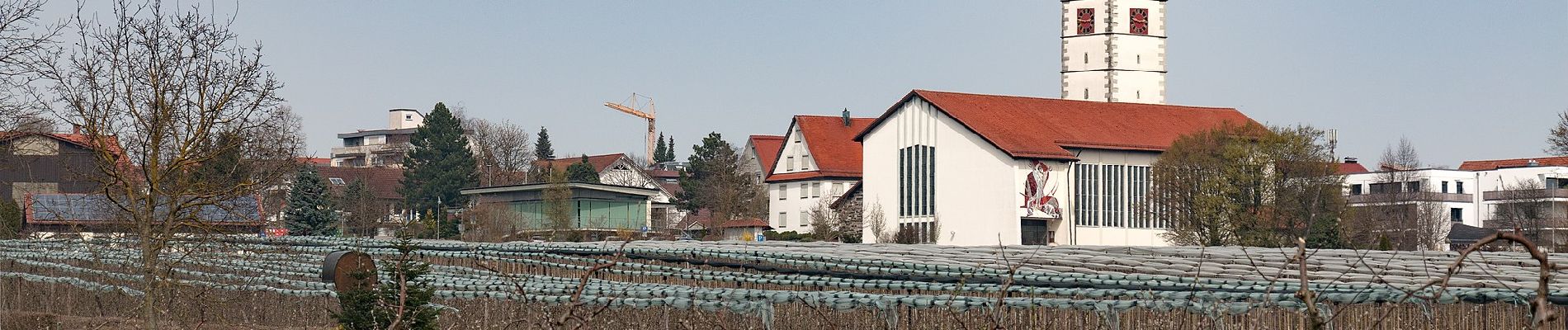
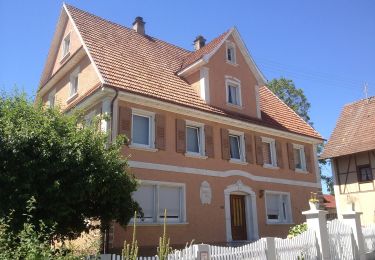
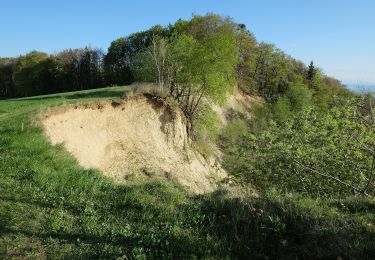
Tour Zu Fuß von 5 km verfügbar auf Baden-Württemberg, Bodenseekreis, Oberteuringen. Diese Tour wird von SityTrail - itinéraires balisés pédestres vorgeschlagen.
Beschreibung
Symbol: gelbe Raute zusammen mit Text "Teuringertal Bahnweg"
Foto-Galerie
"
data-pinterest-text="Pin it"
data-tweet-text="share on twitter"
data-facebook-share-url="https://www.sitytrail.com/de/trails/3097911-oberteuringen--teuringertal-bahnweg-xxwandern-in-friedrichshafenxx/?photo=0#lg=1&slide=0"
data-twitter-share-url="https://www.sitytrail.com/de/trails/3097911-oberteuringen--teuringertal-bahnweg-xxwandern-in-friedrichshafenxx/?photo=0#lg=1&slide=0"
data-googleplus-share-url="https://www.sitytrail.com/de/trails/3097911-oberteuringen--teuringertal-bahnweg-xxwandern-in-friedrichshafenxx/?photo=0#lg=1&slide=0"
data-pinterest-share-url="https://www.sitytrail.com/de/trails/3097911-oberteuringen--teuringertal-bahnweg-xxwandern-in-friedrichshafenxx/?photo=0#lg=1&slide=0">
"
data-pinterest-text="Pin it"
data-tweet-text="share on twitter"
data-facebook-share-url="https://www.sitytrail.com/de/trails/3097911-oberteuringen--teuringertal-bahnweg-xxwandern-in-friedrichshafenxx/?photo=1#lg=1&slide=1"
data-twitter-share-url="https://www.sitytrail.com/de/trails/3097911-oberteuringen--teuringertal-bahnweg-xxwandern-in-friedrichshafenxx/?photo=1#lg=1&slide=1"
data-googleplus-share-url="https://www.sitytrail.com/de/trails/3097911-oberteuringen--teuringertal-bahnweg-xxwandern-in-friedrichshafenxx/?photo=1#lg=1&slide=1"
data-pinterest-share-url="https://www.sitytrail.com/de/trails/3097911-oberteuringen--teuringertal-bahnweg-xxwandern-in-friedrichshafenxx/?photo=1#lg=1&slide=1">
![Tour Zu Fuß Oberteuringen - Teuringertal Bahnweg ( Tour Zu Fuß Oberteuringen - Teuringertal Bahnweg (](https://media.geolcdn.com/t/170/100/94001f49-8284-4680-98a7-85a1cc7a99cb.jpeg&format=jpg&maxdim=2)
![Tour Zu Fuß Oberteuringen - Teuringertal Bahnweg ( Tour Zu Fuß Oberteuringen - Teuringertal Bahnweg (](https://media.geolcdn.com/t/170/100/5799fd73-9e39-4461-9954-5af2d33bca70.jpeg&format=jpg&maxdim=2)
Ort
Land:
Germany
Region :
Baden-Württemberg
Abteilung/Provinz :
Bodenseekreis
Kommune :
Oberteuringen
Standort:
Unknown
Gehen Sie:(Dec)
Gehen Sie:(UTM)
534587 ; 5284616 (32T) N.
Kommentare
Touren in der Umgebung
![Tour Zu Fuß Friedrichshafen - Planetenweg Kluftern - Photo](https://media.geolcdn.com/t/375/260/46733009-a77d-469a-8bf1-fb80e19f2d17.jpeg&format=jpg&maxdim=2)
![Zu Fuß Zu Fuß](https://static1.geolcdn.com/sitytour/trail-icons/100.png)
Planetenweg Kluftern
Zu Fuß
Einfach
Friedrichshafen,
Baden-Württemberg,
Bodenseekreis,
Germany
![](/images/other/stat-length.png)
5,5 km | 6,5 km-effort
1h 28min
![](https://static1.geolcdn.com/siteimages/upload/files/16400158638029165_repeat_loop_refresh_sync_direction_icon.png)
Ja
![Tour Zu Fuß Markdorf - Wanderwege Markdorf: Froschweg - Photo](https://media.geolcdn.com/t/375/260/925776c0-f370-41fd-bf89-cf33cc203a47.jpeg&format=jpg&maxdim=2)
![Zu Fuß Zu Fuß](https://static1.geolcdn.com/sitytour/trail-icons/100.png)
Wanderwege Markdorf: Froschweg
Zu Fuß
Einfach
Markdorf,
Baden-Württemberg,
Bodenseekreis,
Germany
![](/images/other/stat-length.png)
4,9 km | 6 km-effort
1h 22min
![](https://static1.geolcdn.com/siteimages/upload/files/16400158638029165_repeat_loop_refresh_sync_direction_icon.png)
Nein
![Tour Zu Fuß Friedrichshafen - Teuringer Bächlepfad - Photo](https://media.geolcdn.com/t/375/260/658a6b00-cada-4a62-b9f7-1373ac7f923a.jpeg&format=jpg&maxdim=2)
![Zu Fuß Zu Fuß](https://static1.geolcdn.com/sitytour/trail-icons/100.png)
Teuringer Bächlepfad
Zu Fuß
Einfach
Friedrichshafen,
Baden-Württemberg,
Bodenseekreis,
Germany
![](/images/other/stat-length.png)
12,9 km | 15,1 km-effort
3h 26min
![](https://static1.geolcdn.com/siteimages/upload/files/16400158638029165_repeat_loop_refresh_sync_direction_icon.png)
Ja
![Tour Zu Fuß Friedrichshafen - Ortsrundweg Kluftern - Südrunde - Photo](https://media.geolcdn.com/t/375/260/24eac72b-5d33-4d11-abeb-8e8d2d4a2164.jpeg&format=jpg&maxdim=2)
![Zu Fuß Zu Fuß](https://static1.geolcdn.com/sitytour/trail-icons/100.png)
Ortsrundweg Kluftern - Südrunde
Zu Fuß
Einfach
Friedrichshafen,
Baden-Württemberg,
Bodenseekreis,
Germany
![](/images/other/stat-length.png)
7,1 km | 8,6 km-effort
1h 57min
![](https://static1.geolcdn.com/siteimages/upload/files/16400158638029165_repeat_loop_refresh_sync_direction_icon.png)
Ja
![Tour Zu Fuß Friedrichshafen - Hirschlatter Runde - Photo](https://media.geolcdn.com/t/375/260/09582146-948f-4df4-ad5b-14d65b5403bd.jpeg&format=jpg&maxdim=2)
![Zu Fuß Zu Fuß](https://static1.geolcdn.com/sitytour/trail-icons/100.png)
Hirschlatter Runde
Zu Fuß
Einfach
Friedrichshafen,
Baden-Württemberg,
Bodenseekreis,
Germany
![](/images/other/stat-length.png)
3,3 km | 3,8 km-effort
51min
![](https://static1.geolcdn.com/siteimages/upload/files/16400158638029165_repeat_loop_refresh_sync_direction_icon.png)
Nein
![Tour Zu Fuß Markdorf - Wanderwege Markdorf: Eulenweg - Photo](https://media.geolcdn.com/t/375/260/78ca37e7-f2e3-42d1-8b66-6e327f07ed06.jpeg&format=jpg&maxdim=2)
![Zu Fuß Zu Fuß](https://static1.geolcdn.com/sitytour/trail-icons/100.png)
Wanderwege Markdorf: Eulenweg
Zu Fuß
Einfach
Markdorf,
Baden-Württemberg,
Bodenseekreis,
Germany
![](/images/other/stat-length.png)
7,1 km | 10,3 km-effort
2h 20min
![](https://static1.geolcdn.com/siteimages/upload/files/16400158638029165_repeat_loop_refresh_sync_direction_icon.png)
Ja
![Tour Zu Fuß Deggenhausertal - Wanderwege Markdorf: Wildschweinweg - Photo](https://media.geolcdn.com/t/375/260/afa192a0-e87f-4ef3-afad-46250377cc42.jpeg&format=jpg&maxdim=2)
![Zu Fuß Zu Fuß](https://static1.geolcdn.com/sitytour/trail-icons/100.png)
Wanderwege Markdorf: Wildschweinweg
Zu Fuß
Einfach
Deggenhausertal,
Baden-Württemberg,
Bodenseekreis,
Germany
![](/images/other/stat-length.png)
5,6 km | 7,5 km-effort
1h 41min
![](https://static1.geolcdn.com/siteimages/upload/files/16400158638029165_repeat_loop_refresh_sync_direction_icon.png)
Ja
![Tour Zu Fuß Friedrichshafen - Ortsrundweg Kluftern - Nordrunde - Photo](https://media.geolcdn.com/t/375/260/a2a346b3-6d0a-41ec-bf52-3be9d53c8492.jpeg&format=jpg&maxdim=2)
![Zu Fuß Zu Fuß](https://static1.geolcdn.com/sitytour/trail-icons/100.png)
Ortsrundweg Kluftern - Nordrunde
Zu Fuß
Einfach
Friedrichshafen,
Baden-Württemberg,
Bodenseekreis,
Germany
![](/images/other/stat-length.png)
5,3 km | 6,2 km-effort
1h 24min
![](https://static1.geolcdn.com/siteimages/upload/files/16400158638029165_repeat_loop_refresh_sync_direction_icon.png)
Ja
![Tour Zu Fuß Oberteuringen - Rotachweg - Photo](https://media.geolcdn.com/t/375/260/658a6b00-cada-4a62-b9f7-1373ac7f923a.jpeg&format=jpg&maxdim=2)
![Zu Fuß Zu Fuß](https://static1.geolcdn.com/sitytour/trail-icons/100.png)
Rotachweg
Zu Fuß
Einfach
Oberteuringen,
Baden-Württemberg,
Bodenseekreis,
Germany
![](/images/other/stat-length.png)
5,3 km | 5,9 km-effort
1h 19min
![](https://static1.geolcdn.com/siteimages/upload/files/16400158638029165_repeat_loop_refresh_sync_direction_icon.png)
Ja