


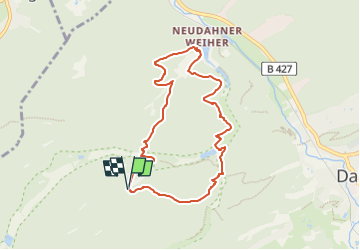

13,5 km | 19 km-effort


Tous les sentiers balisés d’Europe GUIDE+


Kostenlosegpshiking-Anwendung
 SityTrail
IGN / Geografische Institute
SityTrail World
Die Welt öffnet sich für Sie
Tour Zu Fuß von 7,3 km verfügbar auf Rheinland-Pfalz, Südwestpfalz, Dahn. Diese Tour wird von SityTrail - itinéraires balisés pédestres vorgeschlagen.
Trail created by Tourist Information Dahner Felsenland.
Symbol: Schwarze Wolfstatze auf weißem Grund mit schwarzer Unterschrift "Wolfs-Tour"


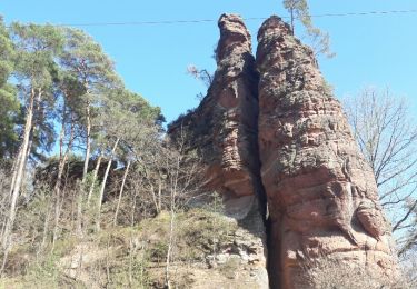
Wandern
Zu Fuß

Zu Fuß
Zu Fuß

Zu Fuß

Zu Fuß

Zu Fuß
Zu Fuß
Zu Fuß