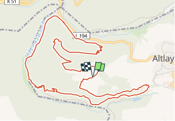
![](/images/other/stat-length.png)
![Tour Zu Fuß Altlay - Traumschleife Altlayer Schweiz - Photo](https://media.geolcdn.com/t/1900/400/ext.pjpeg?maxdim=2&url=https%3A%2F%2Fmedia.geolcdn.com%2Ff%2F05fe5872-8a58-4743-81d1-cc11a1157505.jpeg)
Traumschleife Altlayer Schweiz
SityTrail - itinéraires balisés pédestres
Tous les sentiers balisés d’Europe PRO
![Länge](/images/other/stat-length.png)
Länge
7,2 km
![Maximale Höhe](https://static1.geolcdn.com/siteimages/upload/files/1508320355ic_sort_altitude_max_24dp.png)
Maximale Höhe
415 m
![Positive Höhendifferenz](https://static1.geolcdn.com/siteimages/upload/files/1508320355ic_sort_den_pos_24dp.png)
Positive Höhendifferenz
262 m
![Km-Effort](/images/other/stat-length.png)
Km-Effort
10,7 km
![Min. Höhe](https://static1.geolcdn.com/siteimages/upload/files/1508320355ic_sort_altitude_min_24dp.png)
Min. Höhe
223 m
![Negative Höhendifferenz](https://static1.geolcdn.com/siteimages/upload/files/1508320355ic_sort_den_neg_24dp.png)
Negative Höhendifferenz
266 m
![Boucle](https://static1.geolcdn.com/siteimages/upload/files/16400158638029165_repeat_loop_refresh_sync_direction_icon.png)
Boucle
Ja
Kennzeichnung
Erstellungsdatum :
2022-02-11 17:14:57.16
Letzte Änderung :
2022-02-11 17:14:57.16
![Zu Fuß](https://static1.geolcdn.com/sitytour/trail-icons/100.png)
2h25
Schwierigkeit : Einfach
![Scannen Sie diesen QR-Code, um die Tour in der SityTrail-Anwendung zu öffnen](https://capi.geolives.com/qq0zvz2zws4bq2lad0pu/sitytour/trails/3097554/qr.png?size=200)
Kostenlosegpshiking-Anwendung
Über SityTrail
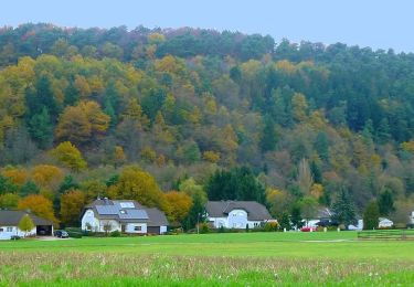
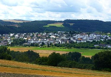
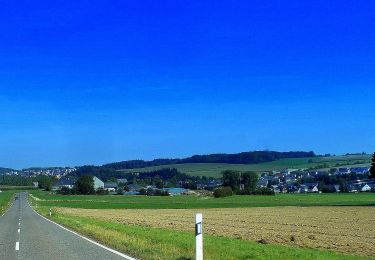
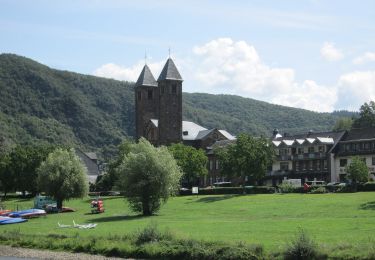
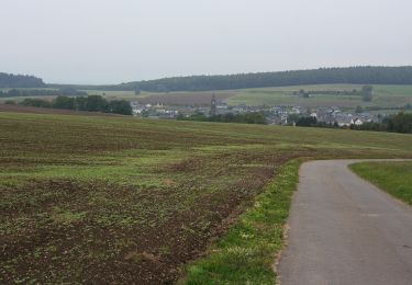
Tour Zu Fuß von 7,2 km verfügbar auf Rheinland-Pfalz, Landkreis Cochem-Zell, Altlay. Diese Tour wird von SityTrail - itinéraires balisés pédestres vorgeschlagen.
Beschreibung
Symbol: stilisiertes S und H auf lila Grund
Ort
Land:
Germany
Region :
Rheinland-Pfalz
Abteilung/Provinz :
Landkreis Cochem-Zell
Kommune :
Altlay
Standort:
Unknown
Gehen Sie:(Dec)
Gehen Sie:(UTM)
375058 ; 5538576 (32U) N.
Kommentare
Touren in der Umgebung
![Tour Wandern Mörsdorf - Promenade vers le pont de Geierlay - Photo](https://media.geolcdn.com/t/375/260/ext.jpg?maxdim=2&url=https%3A%2F%2Fmedia.geolcdn.com%2Ff%2F0d007229-5338-45e8-9509-5159d63bf2a7.jpg)
![Wandern Wandern](https://static1.geolcdn.com/sitytour/trail-icons/101.png)
Promenade vers le pont de Geierlay
Wandern
Schwierig
(2)
Mörsdorf,
Rheinland-Pfalz,
Rhein-Hunsrück-Kreis,
Germany
![](/images/other/stat-length.png)
9 km | 12,1 km-effort
2h 45min
![](https://static1.geolcdn.com/siteimages/upload/files/16400158638029165_repeat_loop_refresh_sync_direction_icon.png)
Ja
![Tour Zu Fuß Mengerschied - Traumschleife Soonwald - Photo](https://media.geolcdn.com/t/375/260/ext.jpg?maxdim=2&url=https%3A%2F%2Fmedia.geolcdn.com%2Ff%2F05861b49-ac78-4214-b70c-b3a57214a51c.jpeg)
![Zu Fuß Zu Fuß](https://static1.geolcdn.com/sitytour/trail-icons/100.png)
Traumschleife Soonwald
Zu Fuß
Einfach
Mengerschied,
Rheinland-Pfalz,
Rhein-Hunsrück-Kreis,
Germany
![](/images/other/stat-length.png)
10 km | 13 km-effort
2h 57min
![](https://static1.geolcdn.com/siteimages/upload/files/16400158638029165_repeat_loop_refresh_sync_direction_icon.png)
Ja
![Tour Zu Fuß Rhaunen - Traumschleife Stumm-Orgel-Weg - Photo](https://media.geolcdn.com/t/375/260/ext.jpg?maxdim=2&url=https%3A%2F%2Fmedia.geolcdn.com%2Ff%2Fb71eca11-e9f7-427d-8986-3e823bb8d862.jpeg)
![Zu Fuß Zu Fuß](https://static1.geolcdn.com/sitytour/trail-icons/100.png)
Traumschleife Stumm-Orgel-Weg
Zu Fuß
Einfach
Rhaunen,
Rheinland-Pfalz,
Landkreis Birkenfeld,
Germany
![](/images/other/stat-length.png)
14 km | 18 km-effort
4h 5min
![](https://static1.geolcdn.com/siteimages/upload/files/16400158638029165_repeat_loop_refresh_sync_direction_icon.png)
Ja
![Tour Zu Fuß Horbruch - Traumschleife Via Molarum - Photo](https://media.geolcdn.com/t/375/260/ext.jpg?maxdim=2&url=https%3A%2F%2Fmedia.geolcdn.com%2Ff%2Fa31b90b0-63bf-49c0-aca7-fc2ae292a7d4.jpeg)
![Zu Fuß Zu Fuß](https://static1.geolcdn.com/sitytour/trail-icons/100.png)
Traumschleife Via Molarum
Zu Fuß
Medium
Horbruch,
Rheinland-Pfalz,
Landkreis Birkenfeld,
Germany
![](/images/other/stat-length.png)
16 km | 20 km-effort
4h 36min
![](https://static1.geolcdn.com/siteimages/upload/files/16400158638029165_repeat_loop_refresh_sync_direction_icon.png)
Ja
![Tour Zu Fuß Bernkastel-Kues - Moselsteig Seitensprung Bernkasteler Bärensteig - Photo](https://media.geolcdn.com/t/375/260/ext.jpg?maxdim=2&url=https%3A%2F%2Fmedia.geolcdn.com%2Ff%2F7fd007be-cf57-41d6-aef3-4b117491e3df.jpeg)
![Zu Fuß Zu Fuß](https://static1.geolcdn.com/sitytour/trail-icons/100.png)
Moselsteig Seitensprung Bernkasteler Bärensteig
Zu Fuß
Einfach
Bernkastel-Kues,
Rheinland-Pfalz,
Landkreis Bernkastel-Wittlich,
Germany
![](/images/other/stat-length.png)
6,3 km | 10,5 km-effort
2h 23min
![](https://static1.geolcdn.com/siteimages/upload/files/16400158638029165_repeat_loop_refresh_sync_direction_icon.png)
Ja
![Tour Zu Fuß Bruttig-Fankel - Breva Wein & Weg - Photo](https://media.geolcdn.com/t/375/260/ext.jpg?maxdim=2&url=https%3A%2F%2Fmedia.geolcdn.com%2Ff%2F56952485-9d4a-4d83-90e9-ca781cd3a6b9.jpeg)
![Zu Fuß Zu Fuß](https://static1.geolcdn.com/sitytour/trail-icons/100.png)
Breva Wein & Weg
Zu Fuß
Einfach
Bruttig-Fankel,
Rheinland-Pfalz,
Landkreis Cochem-Zell,
Germany
![](/images/other/stat-length.png)
4,1 km | 7,8 km-effort
1h 46min
![](https://static1.geolcdn.com/siteimages/upload/files/16400158638029165_repeat_loop_refresh_sync_direction_icon.png)
Nein
![Tour Zu Fuß Valwig - Apolloweg - Photo](https://media.geolcdn.com/t/375/260/ext.jpg?maxdim=2&url=https%3A%2F%2Fmedia.geolcdn.com%2Ff%2F56952485-9d4a-4d83-90e9-ca781cd3a6b9.jpeg)
![Zu Fuß Zu Fuß](https://static1.geolcdn.com/sitytour/trail-icons/100.png)
Apolloweg
Zu Fuß
Einfach
(1)
Valwig,
Rheinland-Pfalz,
Landkreis Cochem-Zell,
Germany
![](/images/other/stat-length.png)
5,4 km | 9 km-effort
2h 2min
![](https://static1.geolcdn.com/siteimages/upload/files/16400158638029165_repeat_loop_refresh_sync_direction_icon.png)
Nein
![Tour Zu Fuß Veldenz - Jakob-Maria-Mierscheid-Weg - Photo](https://media.geolcdn.com/t/375/260/ext.jpg?maxdim=2&url=https%3A%2F%2Fmedia.geolcdn.com%2Ff%2Fdf270117-5716-49f6-92b3-8d70da3fb659.jpeg)
![Zu Fuß Zu Fuß](https://static1.geolcdn.com/sitytour/trail-icons/100.png)
Jakob-Maria-Mierscheid-Weg
Zu Fuß
Einfach
Veldenz,
Rheinland-Pfalz,
Landkreis Bernkastel-Wittlich,
Germany
![](/images/other/stat-length.png)
14,8 km | 20 km-effort
4h 32min
![](https://static1.geolcdn.com/siteimages/upload/files/16400158638029165_repeat_loop_refresh_sync_direction_icon.png)
Ja
![Tour Zu Fuß Mörsdorf - Schieferhöhlen-Runde - Photo](https://media.geolcdn.com/t/375/260/ext.jpg?maxdim=2&url=https%3A%2F%2Fmedia.geolcdn.com%2Ff%2F031404a8-6053-492c-aeca-9b1c706317e9.jpeg)
![Zu Fuß Zu Fuß](https://static1.geolcdn.com/sitytour/trail-icons/100.png)
Schieferhöhlen-Runde
Zu Fuß
Einfach
Mörsdorf,
Rheinland-Pfalz,
Rhein-Hunsrück-Kreis,
Germany
![](/images/other/stat-length.png)
14,3 km | 19,8 km-effort
4h 30min
![](https://static1.geolcdn.com/siteimages/upload/files/16400158638029165_repeat_loop_refresh_sync_direction_icon.png)
Ja