![](/images/other/stat-length.png)
![Tour Zu Fuß Sinntal - Altengronau - Rundweg am Grauberg - Marder - Photo](https://media.geolcdn.com/t/1900/400/ebd9626f-dc33-4061-98a8-e6766f40ff47.jpeg&format=pjpeg&maxdim=2)
Altengronau - Rundweg am Grauberg - Marder
SityTrail - itinéraires balisés pédestres
Tous les sentiers balisés d’Europe GUIDE+
![Länge](/images/other/stat-length.png)
![Maximale Höhe](https://static1.geolcdn.com/siteimages/upload/files/1508320355ic_sort_altitude_max_24dp.png)
![Positive Höhendifferenz](https://static1.geolcdn.com/siteimages/upload/files/1508320355ic_sort_den_pos_24dp.png)
![Km-Effort](/images/other/stat-length.png)
![Min. Höhe](https://static1.geolcdn.com/siteimages/upload/files/1508320355ic_sort_altitude_min_24dp.png)
![Negative Höhendifferenz](https://static1.geolcdn.com/siteimages/upload/files/1508320355ic_sort_den_neg_24dp.png)
![Boucle](https://static1.geolcdn.com/siteimages/upload/files/16400158638029165_repeat_loop_refresh_sync_direction_icon.png)
![Zu Fuß](https://static1.geolcdn.com/sitytour/trail-icons/100.png)
1h56
Schwierigkeit : Einfach
![Scannen Sie diesen QR-Code, um die Tour in der SityTrail-Anwendung zu öffnen](https://capi.geolives.com/qq0zvz2zws4bq2lad0pu/sitytour/trails/3097234/qr.png?size=200)
Kostenlosegpshiking-Anwendung
Über SityTrail
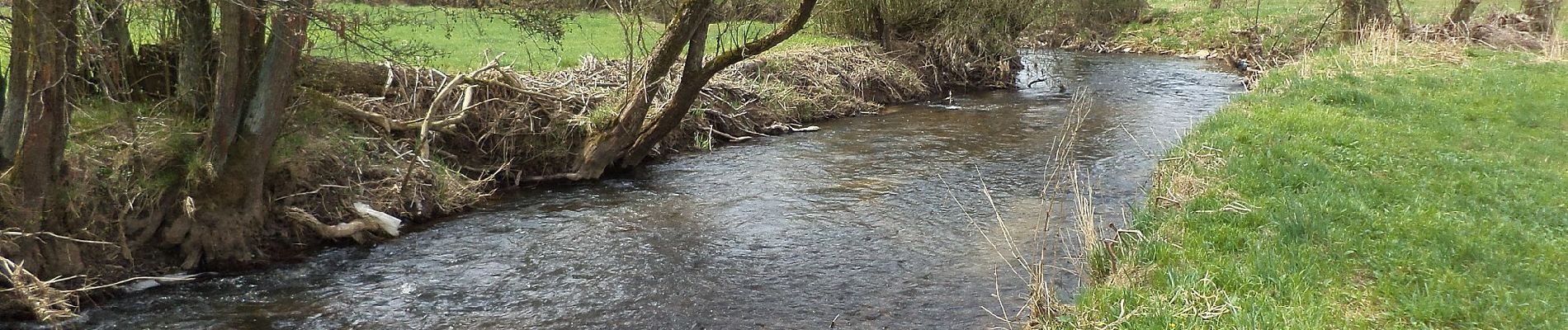
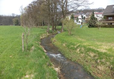
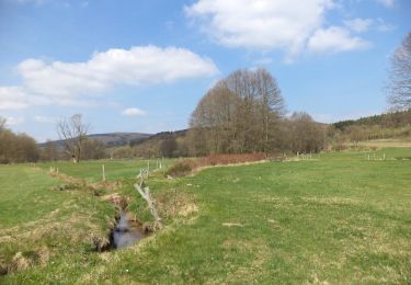
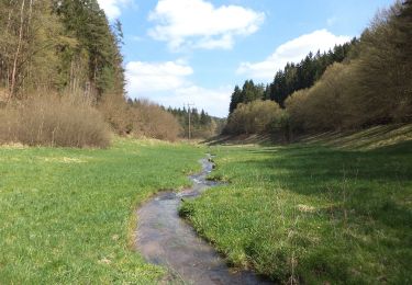
Tour Zu Fuß von 6,3 km verfügbar auf Hessen, Main-Kinzig-Kreis, Sinntal. Diese Tour wird von SityTrail - itinéraires balisés pédestres vorgeschlagen.
Beschreibung
Trail created by Verkehrs- u. Heimatverein Altengronau.
sehr schlecht ausgeschildert
Symbol: Schwarzer Marder auf weißem Hintergrund
Website: http://www.altengronau.de/wanderwege-1.html
Ort
Kommentare
Touren in der Umgebung
![Tour Zu Fuß Sinntal - Spessartspuren - Jossa-Sinn-Blick - Photo](https://media.geolcdn.com/t/375/260/cd33c038-9e0b-4efb-b676-5a195b30aedb.jpeg&format=jpg&maxdim=2)
![Zu Fuß Zu Fuß](https://static1.geolcdn.com/sitytour/trail-icons/100.png)
Zu Fuß
![](/images/other/stat-length.png)
![](https://static1.geolcdn.com/siteimages/upload/files/16400158638029165_repeat_loop_refresh_sync_direction_icon.png)
![Tour Zu Fuß Sinntal - Spessartspuren - Schwarzenfelser Sonnenseite - Photo](https://media.geolcdn.com/t/375/260/2a05401e-dc40-44c1-afe1-0448727b6160.jpeg&format=jpg&maxdim=2)
![Zu Fuß Zu Fuß](https://static1.geolcdn.com/sitytour/trail-icons/100.png)
Zu Fuß
![](/images/other/stat-length.png)
![](https://static1.geolcdn.com/siteimages/upload/files/16400158638029165_repeat_loop_refresh_sync_direction_icon.png)
![Tour Zu Fuß Sinntal - Schwarzenfels - Rundweg Hopfenberg - Photo](https://media.geolcdn.com/t/375/260/0c5ed552-a6a0-4bda-8d29-34005d04c934.jpeg&format=jpg&maxdim=2)
![Zu Fuß Zu Fuß](https://static1.geolcdn.com/sitytour/trail-icons/100.png)
Zu Fuß
![](/images/other/stat-length.png)
![](https://static1.geolcdn.com/siteimages/upload/files/16400158638029165_repeat_loop_refresh_sync_direction_icon.png)
![Tour Zu Fuß Sinntal - Altengronau - Rundweg am Grauberg - Tanne - Photo](https://media.geolcdn.com/t/375/260/0ef20a43-b85e-4c2a-83fd-467522358db3.jpeg&format=jpg&maxdim=2)
![Zu Fuß Zu Fuß](https://static1.geolcdn.com/sitytour/trail-icons/100.png)
Zu Fuß
![](/images/other/stat-length.png)
![](https://static1.geolcdn.com/siteimages/upload/files/16400158638029165_repeat_loop_refresh_sync_direction_icon.png)
![Tour Zu Fuß Sinntal - Gebietswanderweg Roter Doppelbalken Altengronau - Streitrain - Photo](https://media.geolcdn.com/t/375/260/0ef20a43-b85e-4c2a-83fd-467522358db3.jpeg&format=jpg&maxdim=2)
![Zu Fuß Zu Fuß](https://static1.geolcdn.com/sitytour/trail-icons/100.png)
Zu Fuß
![](/images/other/stat-length.png)
![](https://static1.geolcdn.com/siteimages/upload/files/16400158638029165_repeat_loop_refresh_sync_direction_icon.png)
![Tour Zu Fuß Sinntal - Spessartbogen Zubringer Jossa - Willingsgrundweiher - Photo](https://media.geolcdn.com/t/375/260/cd33c038-9e0b-4efb-b676-5a195b30aedb.jpeg&format=jpg&maxdim=2)
![Zu Fuß Zu Fuß](https://static1.geolcdn.com/sitytour/trail-icons/100.png)
Zu Fuß
![](/images/other/stat-length.png)
![](https://static1.geolcdn.com/siteimages/upload/files/16400158638029165_repeat_loop_refresh_sync_direction_icon.png)
![Tour Zu Fuß Sinntal - Jossa - Rundwanderweg Geweih - Photo](https://media.geolcdn.com/t/375/260/00e2761a-eb87-45c0-a571-0f475fa19fbc.jpeg&format=jpg&maxdim=2)
![Zu Fuß Zu Fuß](https://static1.geolcdn.com/sitytour/trail-icons/100.png)
Zu Fuß
![](/images/other/stat-length.png)
![](https://static1.geolcdn.com/siteimages/upload/files/16400158638029165_repeat_loop_refresh_sync_direction_icon.png)
![Tour Zu Fuß Sinntal - Spessartbogen Zubringer Jossa - Marjoß - Photo](https://media.geolcdn.com/t/375/260/00e2761a-eb87-45c0-a571-0f475fa19fbc.jpeg&format=jpg&maxdim=2)
![Zu Fuß Zu Fuß](https://static1.geolcdn.com/sitytour/trail-icons/100.png)
Zu Fuß
![](/images/other/stat-length.png)
![](https://static1.geolcdn.com/siteimages/upload/files/16400158638029165_repeat_loop_refresh_sync_direction_icon.png)
![Tour Zu Fuß Forst Aura - Roter Schmetterling, Rundwanderweg Emmerichsthal - Photo](https://media.geolcdn.com/t/375/260/b1daa40a-349b-48bc-a968-82d0fdbd5301.jpeg&format=jpg&maxdim=2)
![Zu Fuß Zu Fuß](https://static1.geolcdn.com/sitytour/trail-icons/100.png)
Zu Fuß
![](/images/other/stat-length.png)
![](https://static1.geolcdn.com/siteimages/upload/files/16400158638029165_repeat_loop_refresh_sync_direction_icon.png)