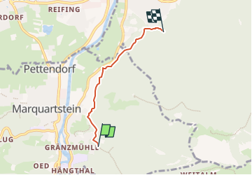
![](/images/other/stat-length.png)
![Tour Zu Fuß Marquartstein - SalzAlpenTour - Marquartstein - Photo](https://media.geolcdn.com/t/1900/400/6a08c7a4-18e6-432b-8d18-6c58893e510c.jpeg&format=pjpeg&maxdim=2)
SalzAlpenTour - Marquartstein
SityTrail - itinéraires balisés pédestres
Tous les sentiers balisés d’Europe GUIDE+
![Länge](/images/other/stat-length.png)
![Maximale Höhe](https://static1.geolcdn.com/siteimages/upload/files/1508320355ic_sort_altitude_max_24dp.png)
![Positive Höhendifferenz](https://static1.geolcdn.com/siteimages/upload/files/1508320355ic_sort_den_pos_24dp.png)
![Km-Effort](/images/other/stat-length.png)
![Min. Höhe](https://static1.geolcdn.com/siteimages/upload/files/1508320355ic_sort_altitude_min_24dp.png)
![Negative Höhendifferenz](https://static1.geolcdn.com/siteimages/upload/files/1508320355ic_sort_den_neg_24dp.png)
![Boucle](https://static1.geolcdn.com/siteimages/upload/files/16400158638029165_repeat_loop_refresh_sync_direction_icon.png)
![Zu Fuß](https://static1.geolcdn.com/sitytour/trail-icons/100.png)
1h06
Schwierigkeit : Einfach
![Scannen Sie diesen QR-Code, um die Tour in der SityTrail-Anwendung zu öffnen](https://capi.geolives.com/qq0zvz2zws4bq2lad0pu/sitytour/trails/3097005/qr.png?size=200)
Kostenlosegpshiking-Anwendung
Über SityTrail
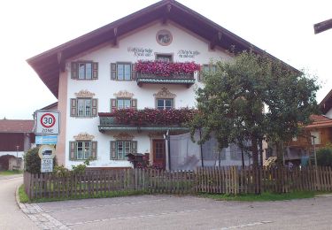
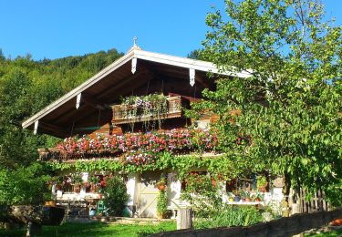
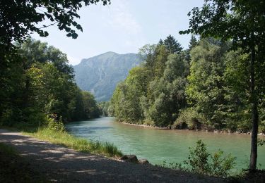
Tour Zu Fuß von 3,2 km verfügbar auf Bayern, Landkreis Traunstein, Marquartstein. Diese Tour wird von SityTrail - itinéraires balisés pédestres vorgeschlagen.
Beschreibung
Symbol: Gelber Hintergrund mit den Silhouetten dreier Gipfel in blauer Farbe. Symbole sind an Bäumen gesprüht oder als Aufkleber auf bestehenden Wegweisern. Auf neuen gelben Blechschilder als "SalzAlpenTour - Chiemsee-Alpenland" bezeichnet
Ort
Kommentare
Touren in der Umgebung
![Tour Zu Fuß Grassau - Wanderweg 4 - Grassau - Photo](https://media.geolcdn.com/t/375/260/d24c11c6-c82e-4efd-b811-b1ed9001aaff.jpeg&format=jpg&maxdim=2)
![Zu Fuß Zu Fuß](https://static1.geolcdn.com/sitytour/trail-icons/100.png)
Zu Fuß
![](/images/other/stat-length.png)
![](https://static1.geolcdn.com/siteimages/upload/files/16400158638029165_repeat_loop_refresh_sync_direction_icon.png)
![Tour Zu Fuß Grassau - Wanderweg 23 - Grassau - Photo](https://media.geolcdn.com/t/375/260/939b449c-8bfe-4713-8ba8-45392e182414.jpeg&format=jpg&maxdim=2)
![Zu Fuß Zu Fuß](https://static1.geolcdn.com/sitytour/trail-icons/100.png)
Zu Fuß
![](/images/other/stat-length.png)
![](https://static1.geolcdn.com/siteimages/upload/files/16400158638029165_repeat_loop_refresh_sync_direction_icon.png)
![Tour Zu Fuß Staudach-Egerndach - Wanderweg 1 - Grassau - Photo](https://media.geolcdn.com/t/375/260/601be0dc-08da-414f-ba1d-ce5a53e79f8c.jpeg&format=jpg&maxdim=2)
![Zu Fuß Zu Fuß](https://static1.geolcdn.com/sitytour/trail-icons/100.png)
Zu Fuß
![](/images/other/stat-length.png)
![](https://static1.geolcdn.com/siteimages/upload/files/16400158638029165_repeat_loop_refresh_sync_direction_icon.png)
![Tour Zu Fuß Grassau - SalzAlpenTour - Über die Grassauer Almen - Photo](https://media.geolcdn.com/t/375/260/5cc8f884-fa03-4b69-aeeb-fdd283aca3e7.jpeg&format=jpg&maxdim=2)
![Zu Fuß Zu Fuß](https://static1.geolcdn.com/sitytour/trail-icons/100.png)
Zu Fuß
![](/images/other/stat-length.png)
![](https://static1.geolcdn.com/siteimages/upload/files/16400158638029165_repeat_loop_refresh_sync_direction_icon.png)
![Tour Zu Fuß Unterwössen - Wanderweg 93 - Wössen - Photo](https://media.geolcdn.com/t/375/260/11de7d60-3fb6-429e-a430-a43a8954de8f.jpeg&format=jpg&maxdim=2)
![Zu Fuß Zu Fuß](https://static1.geolcdn.com/sitytour/trail-icons/100.png)
Zu Fuß
![](/images/other/stat-length.png)
![](https://static1.geolcdn.com/siteimages/upload/files/16400158638029165_repeat_loop_refresh_sync_direction_icon.png)
![Tour Zu Fuß Unterwössen - Wanderweg 91 - Wössen - Photo](https://media.geolcdn.com/t/375/260/11de7d60-3fb6-429e-a430-a43a8954de8f.jpeg&format=jpg&maxdim=2)
![Zu Fuß Zu Fuß](https://static1.geolcdn.com/sitytour/trail-icons/100.png)
Zu Fuß
![](/images/other/stat-length.png)
![](https://static1.geolcdn.com/siteimages/upload/files/16400158638029165_repeat_loop_refresh_sync_direction_icon.png)
![Tour Zu Fuß Unterwössen - Wanderweg 52 - Unterwössen - Kaltenbachtal - Jochbergalm - Photo](https://media.geolcdn.com/t/375/260/7f5d93d2-3c58-4918-9976-edf4f9437fd1.jpeg&format=jpg&maxdim=2)
![Zu Fuß Zu Fuß](https://static1.geolcdn.com/sitytour/trail-icons/100.png)
Zu Fuß
![](/images/other/stat-length.png)
![](https://static1.geolcdn.com/siteimages/upload/files/16400158638029165_repeat_loop_refresh_sync_direction_icon.png)
![Tour Zu Fuß Unterwössen - Wanderweg 16 - Wössen - Photo](https://media.geolcdn.com/t/375/260/ffedbfd1-ec18-4b77-b8ae-ea49318dd4de.jpeg&format=jpg&maxdim=2)
![Zu Fuß Zu Fuß](https://static1.geolcdn.com/sitytour/trail-icons/100.png)
Zu Fuß
![](/images/other/stat-length.png)
![](https://static1.geolcdn.com/siteimages/upload/files/16400158638029165_repeat_loop_refresh_sync_direction_icon.png)
![Tour Zu Fuß Grassau - eon - Trail - Photo](https://media.geolcdn.com/t/375/260/601be0dc-08da-414f-ba1d-ce5a53e79f8c.jpeg&format=jpg&maxdim=2)
![Zu Fuß Zu Fuß](https://static1.geolcdn.com/sitytour/trail-icons/100.png)
Zu Fuß
![](/images/other/stat-length.png)
![](https://static1.geolcdn.com/siteimages/upload/files/16400158638029165_repeat_loop_refresh_sync_direction_icon.png)