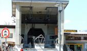

G - Winterwanderung zur Gaisalpe
SityTrail - itinéraires balisés pédestres
Tous les sentiers balisés d’Europe GUIDE+

Länge
4,6 km

Maximale Höhe
1199 m

Positive Höhendifferenz
36 m

Km-Effort
6,2 km

Min. Höhe
823 m

Negative Höhendifferenz
372 m
Boucle
Nein
Kennzeichnung
Erstellungsdatum :
2022-02-11 16:40:29.172
Letzte Änderung :
2022-02-11 16:40:29.172
1h24
Schwierigkeit : Einfach

Kostenlosegpshiking-Anwendung
Über SityTrail
Tour Zu Fuß von 4,6 km verfügbar auf Bayern, Landkreis Oberallgäu, Oberstdorf. Diese Tour wird von SityTrail - itinéraires balisés pédestres vorgeschlagen.
Beschreibung
Trail created by Tourismus Oberstdorf.
Ort
Land:
Germany
Region :
Bayern
Abteilung/Provinz :
Landkreis Oberallgäu
Kommune :
Oberstdorf
Standort:
Unknown
Gehen Sie:(Dec)
Gehen Sie:(UTM)
598089 ; 5253834 (32T) N.
Kommentare
Touren in der Umgebung
K - Über Kornau zum Bergkristall


Zu Fuß
Einfach
Oberstdorf,
Bayern,
Landkreis Oberallgäu,
Germany

6,4 km | 9,8 km-effort
2h 14min
Nein
B - Winterwanderung ins Stillachtal


Zu Fuß
Einfach
Oberstdorf,
Bayern,
Landkreis Oberallgäu,
Germany

4,4 km | 6,2 km-effort
1h 24min
Nein

O - Winterwanderung ins Oytal


Zu Fuß
Einfach
Oberstdorf,
Bayern,
Landkreis Oberallgäu,
Germany

4,9 km | 5,7 km-effort
1h 17min
Nein
Ru - Im Winter zur Schöllanger Burgkirche


Zu Fuß
Einfach
Oberstdorf,
Bayern,
Landkreis Oberallgäu,
Germany

3,6 km | 4,4 km-effort
59min
Nein
Hindelanger Klettersteig


Zu Fuß
Einfach
Oberstdorf,
Bayern,
Landkreis Oberallgäu,
Germany

6,7 km | 13,1 km-effort
2h 58min
Nein
Nebelhorn


Wandern
Medium
Oberstdorf,
Bayern,
Landkreis Oberallgäu,
Germany

12,6 km | 20 km-effort
2h 18min
Nein

M - Über den Moorweiher ins Trettachtal


Zu Fuß
Einfach
Oberstdorf,
Bayern,
Landkreis Oberallgäu,
Germany

6,7 km | 8,4 km-effort
1h 54min
Nein

F - Winterwanderung zum Freibergsee


Zu Fuß
Einfach
Oberstdorf,
Bayern,
Landkreis Oberallgäu,
Germany

7,9 km | 11,9 km-effort
2h 42min
Nein

H - Vom Schönblick nach Hochleite


Zu Fuß
Einfach
Oberstdorf,
Bayern,
Landkreis Oberallgäu,
Germany

9,5 km | 17,2 km-effort
3h 54min
Nein


 SityTrail


