


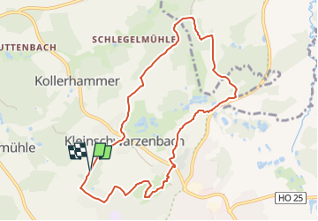

11,5 km | 15,7 km-effort

Tous les sentiers balisés d’Europe GUIDE+


Kostenlosegpshiking-Anwendung
 SityTrail
IGN / Geografische Institute
SityTrail World
Die Welt öffnet sich für Sie
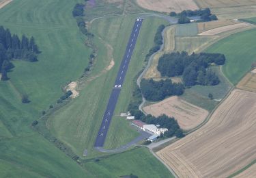
Tour Zu Fuß von 8,5 km verfügbar auf Bayern, Landkreis Hof, Helmbrechts. Diese Tour wird von SityTrail - itinéraires balisés pédestres vorgeschlagen.
Trail created by Frankenwaldverein e.V..
Symbol: green:white::OS13:green


Zu Fuß

Zu Fuß

Zu Fuß
Zu Fuß
Zu Fuß

Zu Fuß
Zu Fuß

Zu Fuß
Zu Fuß