![](/images/other/stat-length.png)
![Tour Zu Fuß Unbekannt - Rheinsteig-Zuweg Dotzheim - Photo](https://media.geolcdn.com/t/1900/400/ext.pjpeg?maxdim=2&url=https%3A%2F%2Fmedia.geolcdn.com%2Ff%2F31beef47-d5a6-4c5c-b727-2ab898f7bcef.jpeg)
Rheinsteig-Zuweg Dotzheim
SityTrail - itinéraires balisés pédestres
Tous les sentiers balisés d’Europe PRO
![Länge](/images/other/stat-length.png)
Länge
3,1 km
![Maximale Höhe](https://static1.geolcdn.com/siteimages/upload/files/1508320355ic_sort_altitude_max_24dp.png)
Maximale Höhe
241 m
![Positive Höhendifferenz](https://static1.geolcdn.com/siteimages/upload/files/1508320355ic_sort_den_pos_24dp.png)
Positive Höhendifferenz
71 m
![Km-Effort](/images/other/stat-length.png)
Km-Effort
4,1 km
![Min. Höhe](https://static1.geolcdn.com/siteimages/upload/files/1508320355ic_sort_altitude_min_24dp.png)
Min. Höhe
161 m
![Negative Höhendifferenz](https://static1.geolcdn.com/siteimages/upload/files/1508320355ic_sort_den_neg_24dp.png)
Negative Höhendifferenz
90 m
![Boucle](https://static1.geolcdn.com/siteimages/upload/files/16400158638029165_repeat_loop_refresh_sync_direction_icon.png)
Boucle
Nein
Kennzeichnung
Erstellungsdatum :
2022-02-11 15:44:11.609
Letzte Änderung :
2022-02-11 15:44:11.609
![Zu Fuß](https://static1.geolcdn.com/sitytour/trail-icons/100.png)
55m
Schwierigkeit : Einfach
![Scannen Sie diesen QR-Code, um die Tour in der SityTrail-Anwendung zu öffnen](https://capi.geolives.com/qq0zvz2zws4bq2lad0pu/sitytour/trails/3095156/qr.png?size=200)
Kostenlosegpshiking-Anwendung
Über SityTrail
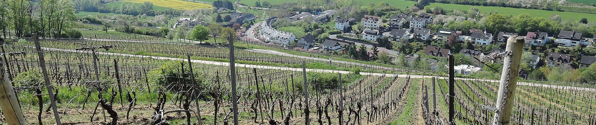
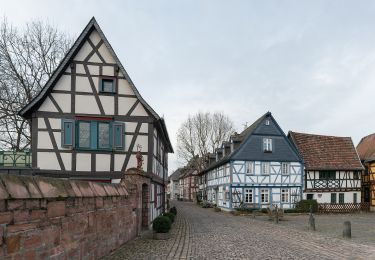
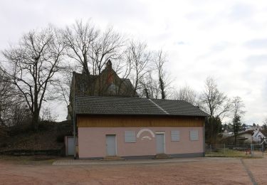
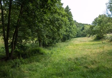
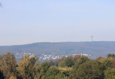
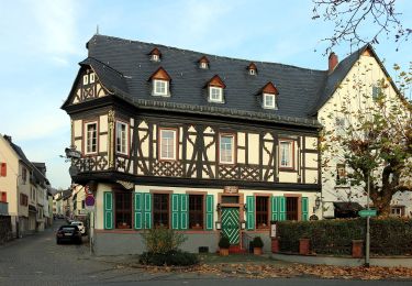
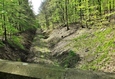
Tour Zu Fuß von 3,1 km verfügbar auf Hessen, Wiesbaden, Unbekannt. Diese Tour wird von SityTrail - itinéraires balisés pédestres vorgeschlagen.
Beschreibung
Trail created by Romantischer Rhein Tourismus GmbH.
Symbol: Stilisiertes weißes R auf gelbem Grund
Ort
Land:
Germany
Region :
Hessen
Abteilung/Provinz :
Wiesbaden
Kommune :
Unbekannt
Standort:
Frauenstein
Gehen Sie:(Dec)
Gehen Sie:(UTM)
440478 ; 5546034 (32U) N.
Kommentare
Touren in der Umgebung
![Tour Zu Fuß Eltville am Rhein - Gutenbergweg - Photo](https://media.geolcdn.com/t/375/260/ext.jpg?maxdim=2&url=https%3A%2F%2Fmedia.geolcdn.com%2Ff%2Fcd0c3ee6-7087-46a1-8c63-f960173d82e9.jpeg)
![Zu Fuß Zu Fuß](https://static1.geolcdn.com/sitytour/trail-icons/100.png)
Gutenbergweg
Zu Fuß
Medium
Eltville am Rhein,
Hessen,
Rheingau-Taunus-Kreis,
Germany
![](/images/other/stat-length.png)
24 km | 30 km-effort
6h 46min
![](https://static1.geolcdn.com/siteimages/upload/files/16400158638029165_repeat_loop_refresh_sync_direction_icon.png)
Ja
![Tour Zu Fuß Unbekannt - DE-WZM - Photo](https://media.geolcdn.com/t/375/260/ext.jpg?maxdim=2&url=https%3A%2F%2Fmedia.geolcdn.com%2Ff%2Fae51d730-0855-473a-a471-aa58236b690e.jpeg)
![Zu Fuß Zu Fuß](https://static1.geolcdn.com/sitytour/trail-icons/100.png)
![Tour Zu Fuß Unbekannt - DE-WZW - Photo](https://media.geolcdn.com/t/375/260/ext.jpg?maxdim=2&url=https%3A%2F%2Fmedia.geolcdn.com%2Ff%2F7744ce21-6559-42a5-b047-76243d245733.jpeg)
![Zu Fuß Zu Fuß](https://static1.geolcdn.com/sitytour/trail-icons/100.png)
![Tour Zu Fuß Unbekannt - DE-WZN - Photo](https://media.geolcdn.com/t/375/260/ext.jpg?maxdim=2&url=https%3A%2F%2Fmedia.geolcdn.com%2Ff%2Fc7c1e036-904a-4684-957e-7f25e97d8cb9.jpeg)
![Zu Fuß Zu Fuß](https://static1.geolcdn.com/sitytour/trail-icons/100.png)
![Tour Zu Fuß Eltville am Rhein - Rheinsteig-Zuweg Niederwalluf (West) - Photo](https://media.geolcdn.com/t/375/260/ext.jpg?maxdim=2&url=https%3A%2F%2Fmedia.geolcdn.com%2Ff%2F37c3ad44-bffd-4d35-9f40-789cd2c4f541.jpeg)
![Zu Fuß Zu Fuß](https://static1.geolcdn.com/sitytour/trail-icons/100.png)
Rheinsteig-Zuweg Niederwalluf (West)
Zu Fuß
Einfach
Eltville am Rhein,
Hessen,
Rheingau-Taunus-Kreis,
Germany
![](/images/other/stat-length.png)
5,8 km | 8,2 km-effort
1h 51min
![](https://static1.geolcdn.com/siteimages/upload/files/16400158638029165_repeat_loop_refresh_sync_direction_icon.png)
Nein
![Tour Zu Fuß Eltville am Rhein - Rheinsteig Rundtour: Rauenthaler Spange - Photo](https://media.geolcdn.com/t/375/260/ext.jpg?maxdim=2&url=https%3A%2F%2Fmedia.geolcdn.com%2Ff%2Ff17f7bce-e902-429b-8a92-95a9e738d243.jpeg)
![Zu Fuß Zu Fuß](https://static1.geolcdn.com/sitytour/trail-icons/100.png)
Rheinsteig Rundtour: Rauenthaler Spange
Zu Fuß
Einfach
Eltville am Rhein,
Hessen,
Rheingau-Taunus-Kreis,
Germany
![](/images/other/stat-length.png)
7,5 km | 9,8 km-effort
2h 13min
![](https://static1.geolcdn.com/siteimages/upload/files/16400158638029165_repeat_loop_refresh_sync_direction_icon.png)
Nein
![Tour Zu Fuß Eltville am Rhein - Wanderweg 2 Pfeile - Photo](https://media.geolcdn.com/t/375/260/ext.jpg?maxdim=2&url=https%3A%2F%2Fmedia.geolcdn.com%2Ff%2F7f050105-329f-4490-aedd-e05ef6c47d1b.jpeg)
![Zu Fuß Zu Fuß](https://static1.geolcdn.com/sitytour/trail-icons/100.png)
Wanderweg 2 Pfeile
Zu Fuß
Einfach
Eltville am Rhein,
Hessen,
Rheingau-Taunus-Kreis,
Germany
![](/images/other/stat-length.png)
3,9 km | 5,1 km-effort
1h 9min
![](https://static1.geolcdn.com/siteimages/upload/files/16400158638029165_repeat_loop_refresh_sync_direction_icon.png)
Ja
![Tour Zu Fuß Unbekannt - Rundwanderweg schwarze Flagge - Photo](https://media.geolcdn.com/t/375/260/ext.jpg?maxdim=2&url=https%3A%2F%2Fmedia.geolcdn.com%2Ff%2Ffa7b56ed-e4cf-4290-b555-85cce3a47808.jpeg)
![Zu Fuß Zu Fuß](https://static1.geolcdn.com/sitytour/trail-icons/100.png)
Rundwanderweg schwarze Flagge
Zu Fuß
Einfach
Unbekannt,
Hessen,
Wiesbaden,
Germany
![](/images/other/stat-length.png)
7,6 km | 10,7 km-effort
2h 25min
![](https://static1.geolcdn.com/siteimages/upload/files/16400158638029165_repeat_loop_refresh_sync_direction_icon.png)
Nein
![Tour Zu Fuß Unbekannt - Rundwanderweg Fuchs - Photo](https://media.geolcdn.com/t/375/260/ext.jpg?maxdim=2&url=https%3A%2F%2Fmedia.geolcdn.com%2Ff%2F95729a3c-d906-4c38-8925-a2081945e3f9.jpeg)
![Zu Fuß Zu Fuß](https://static1.geolcdn.com/sitytour/trail-icons/100.png)
Rundwanderweg Fuchs
Zu Fuß
Einfach
Unbekannt,
Hessen,
Wiesbaden,
Germany
![](/images/other/stat-length.png)
7 km | 9,8 km-effort
2h 13min
![](https://static1.geolcdn.com/siteimages/upload/files/16400158638029165_repeat_loop_refresh_sync_direction_icon.png)
Ja