


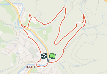

8,9 km | 11,8 km-effort

Tous les sentiers balisés d’Europe GUIDE+


Kostenlosegpshiking-Anwendung
 SityTrail
IGN / Geografische Institute
SityTrail World
Die Welt öffnet sich für Sie
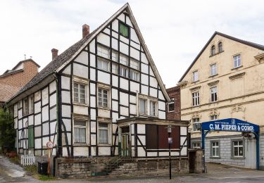
Tour Zu Fuß von 5,8 km verfügbar auf Nordrhein-Westfalen, Hagen, Unbekannt. Diese Tour wird von SityTrail - itinéraires balisés pédestres vorgeschlagen.
Trail created by Sauerländischer Gebirgsverein-Abt. Hagen.
Symbol: weisser Text A2
 - Photo 1")
 - Photo 2")
 - Photo 3")
Zu Fuß
Zu Fuß
![Tour Zu Fuß Breckerfeld - [A10]Rundweg Breckerfeld (zur Glörtalsperre) - Photo](https://media.geolcdn.com/t/375/260/497900ac-296a-4d0b-bf58-8b261fe038d7.jpeg&format=jpg&maxdim=2)
Zu Fuß
Zu Fuß
Zu Fuß
Zu Fuß
Zu Fuß

Zu Fuß
Zu Fuß