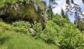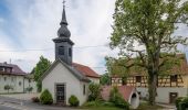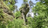

Haßlacher Rundwanderweg
SityTrail - itinéraires balisés pédestres
Tous les sentiers balisés d’Europe GUIDE+

Länge
7,3 km

Maximale Höhe
482 m

Positive Höhendifferenz
147 m

Km-Effort
9,2 km

Min. Höhe
393 m

Negative Höhendifferenz
149 m
Boucle
Ja
Kennzeichnung
Erstellungsdatum :
2022-02-11 14:58:03.488
Letzte Änderung :
2022-02-11 14:58:03.488
2h06
Schwierigkeit : Einfach

Kostenlosegpshiking-Anwendung
Über SityTrail
Tour Zu Fuß von 7,3 km verfügbar auf Bayern, Landkreis Bayreuth, Pottenstein. Diese Tour wird von SityTrail - itinéraires balisés pédestres vorgeschlagen.
Beschreibung
Trail created by Stadt Pottenstein.
abeschossen (April 2013 by cycling_zno)
Symbol: Gelber Ring auf weißem Grund
Ort
Land:
Germany
Region :
Bayern
Abteilung/Provinz :
Landkreis Bayreuth
Kommune :
Pottenstein
Standort:
Unknown
Gehen Sie:(Dec)
Gehen Sie:(UTM)
670969 ; 5517887 (32U) N.
Kommentare
Touren in der Umgebung
Zu Höhlenbär und Millionär


Zu Fuß
Einfach
Ahorntal,
Bayern,
Landkreis Bayreuth,
Germany

8,3 km | 11,6 km-effort
2h 38min
Ja
Rundweg durch die Bärenschlucht


Zu Fuß
Einfach
Pottenstein,
Bayern,
Landkreis Bayreuth,
Germany

5,2 km | 7 km-effort
1h 35min
Ja
Wallfahrerweg PW2


Zu Fuß
Einfach
Pottenstein,
Bayern,
Landkreis Bayreuth,
Germany

5 km | 6,6 km-effort
1h 30min
Ja
Wallfahrerweg PW1


Zu Fuß
Einfach
Pottenstein,
Bayern,
Landkreis Bayreuth,
Germany

12,4 km | 16,8 km-effort
3h 49min
Ja
Rundweg Pottenstein-Siegmannsbrunn


Zu Fuß
Einfach
Pottenstein,
Bayern,
Landkreis Bayreuth,
Germany

4 km | 5,5 km-effort
1h 15min
Ja
Rundweg Haselbrunn


Zu Fuß
Einfach
Pottenstein,
Bayern,
Landkreis Bayreuth,
Germany

4,8 km | 6,5 km-effort
1h 29min
Ja
Kirchenbirkig-Regenthal-Weidenloh


Zu Fuß
Einfach
Pottenstein,
Bayern,
Landkreis Bayreuth,
Germany

10 km | 12,9 km-effort
2h 56min
Ja
Gößweinstein-Kohlstein


Zu Fuß
Einfach
Gößweinstein,
Bayern,
Landkreis Forchheim,
Germany

5 km | 7 km-effort
1h 35min
Ja
Rundweg Rackersberg Arnleithen


Zu Fuß
Einfach
Pottenstein,
Bayern,
Landkreis Bayreuth,
Germany

5 km | 6,6 km-effort
1h 29min
Ja


 SityTrail


