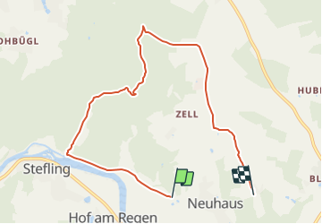
![](/images/other/stat-length.png)
![Tour Zu Fuß Nittenau - Wanderwege rund um Nittenau - 01 - Wasserstein - Photo](https://media.geolcdn.com/t/1900/400/c6556976-d120-4c26-ac90-4c44d35627fa.jpeg&format=pjpeg&maxdim=2)
Wanderwege rund um Nittenau - 01 - Wasserstein
SityTrail - itinéraires balisés pédestres
Tous les sentiers balisés d’Europe GUIDE+
![Länge](/images/other/stat-length.png)
![Maximale Höhe](https://static1.geolcdn.com/siteimages/upload/files/1508320355ic_sort_altitude_max_24dp.png)
![Positive Höhendifferenz](https://static1.geolcdn.com/siteimages/upload/files/1508320355ic_sort_den_pos_24dp.png)
![Km-Effort](/images/other/stat-length.png)
![Min. Höhe](https://static1.geolcdn.com/siteimages/upload/files/1508320355ic_sort_altitude_min_24dp.png)
![Negative Höhendifferenz](https://static1.geolcdn.com/siteimages/upload/files/1508320355ic_sort_den_neg_24dp.png)
![Boucle](https://static1.geolcdn.com/siteimages/upload/files/16400158638029165_repeat_loop_refresh_sync_direction_icon.png)
![Zu Fuß](https://static1.geolcdn.com/sitytour/trail-icons/100.png)
2h13
Schwierigkeit : Einfach
![Scannen Sie diesen QR-Code, um die Tour in der SityTrail-Anwendung zu öffnen](https://capi.geolives.com/qq0zvz2zws4bq2lad0pu/sitytour/trails/3092801/qr.png?size=200)
Kostenlosegpshiking-Anwendung
Über SityTrail
Tour Zu Fuß von 7,5 km verfügbar auf Bayern, Landkreis Schwandorf, Nittenau. Diese Tour wird von SityTrail - itinéraires balisés pédestres vorgeschlagen.
Beschreibung
Trail created by Stadt Nittenau.
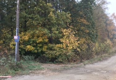
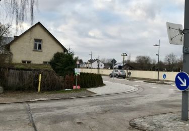
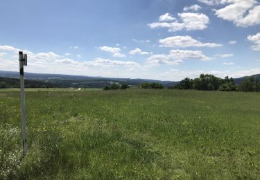
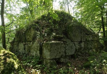
FIXME: Nicht alle Segmente erfaßt.
Symbol: Auf weißem Grund unten in rot die Wegnummer, darüber in schwarz der Wegname und oben ein kleines gelb/grünes Quadrat mit diagonaler, blauer Wellenlinie.
Ort
Kommentare
Touren in der Umgebung
![Tour Zu Fuß Regenstauf - Tour 9 »Flusswanderung« - Photo](https://media.geolcdn.com/t/375/260/82c6bac3-13b2-423e-8be9-687a1b5300a6.jpeg&format=jpg&maxdim=2)
![Zu Fuß Zu Fuß](https://static1.geolcdn.com/sitytour/trail-icons/100.png)
Zu Fuß
![](/images/other/stat-length.png)
![](https://static1.geolcdn.com/siteimages/upload/files/16400158638029165_repeat_loop_refresh_sync_direction_icon.png)
![Tour Zu Fuß Nittenau - Wilder Mann 009 »Regentalwanderweg«, Naturpark Vorderer Bayerischer Wald - Photo](https://media.geolcdn.com/t/375/260/1c5de2b3-781f-493a-8e5f-c504ed68cfc5.jpeg&format=jpg&maxdim=2)
![Zu Fuß Zu Fuß](https://static1.geolcdn.com/sitytour/trail-icons/100.png)
Zu Fuß
![](/images/other/stat-length.png)
![](https://static1.geolcdn.com/siteimages/upload/files/16400158638029165_repeat_loop_refresh_sync_direction_icon.png)
![Tour Zu Fuß Nittenau - Wilder Mann 008, Naturpark Vorderer Bayerischer Wald - Photo](https://media.geolcdn.com/t/375/260/5e7385f0-182f-4a14-8c7b-a014f82a934c.jpeg&format=jpg&maxdim=2)
![Zu Fuß Zu Fuß](https://static1.geolcdn.com/sitytour/trail-icons/100.png)
Zu Fuß
![](/images/other/stat-length.png)
![](https://static1.geolcdn.com/siteimages/upload/files/16400158638029165_repeat_loop_refresh_sync_direction_icon.png)
![Tour Zu Fuß Nittenau - Wilder Mann 001](https://media.geolcdn.com/t/375/260/29912832-82cf-486b-b328-f1633f38e9da.jpeg&format=jpg&maxdim=2)
![Zu Fuß Zu Fuß](https://static1.geolcdn.com/sitytour/trail-icons/100.png)
Zu Fuß
![](/images/other/stat-length.png)
![](https://static1.geolcdn.com/siteimages/upload/files/16400158638029165_repeat_loop_refresh_sync_direction_icon.png)
![Tour Zu Fuß Regenstauf - Wilder Mann 005, Naturpark Vorderer Bayerischer Wald - Photo](https://media.geolcdn.com/t/375/260/82c6bac3-13b2-423e-8be9-687a1b5300a6.jpeg&format=jpg&maxdim=2)
![Zu Fuß Zu Fuß](https://static1.geolcdn.com/sitytour/trail-icons/100.png)
Zu Fuß
![](/images/other/stat-length.png)
![](https://static1.geolcdn.com/siteimages/upload/files/16400158638029165_repeat_loop_refresh_sync_direction_icon.png)
![Tour Zu Fuß Regenstauf - Wanderwege rund um Nittenau - 02 - Wackelstein - Photo](https://media.geolcdn.com/t/375/260/82c6bac3-13b2-423e-8be9-687a1b5300a6.jpeg&format=jpg&maxdim=2)
![Zu Fuß Zu Fuß](https://static1.geolcdn.com/sitytour/trail-icons/100.png)
Zu Fuß
![](/images/other/stat-length.png)
![](https://static1.geolcdn.com/siteimages/upload/files/16400158638029165_repeat_loop_refresh_sync_direction_icon.png)
![Tour Zu Fuß Nittenau - Drei-Burgen-Weg (Nittenau) - Photo](https://media.geolcdn.com/t/375/260/1cabed54-af42-41ae-b0b5-002009ace729.jpeg&format=jpg&maxdim=2)
![Zu Fuß Zu Fuß](https://static1.geolcdn.com/sitytour/trail-icons/100.png)
Zu Fuß
![](/images/other/stat-length.png)
![](https://static1.geolcdn.com/siteimages/upload/files/16400158638029165_repeat_loop_refresh_sync_direction_icon.png)
![Tour Zu Fuß Nittenau - Wilder Mann 011, Naturpark Vorderer Bayerischer Wald - Photo](https://media.geolcdn.com/t/375/260/ae168eb1-17f7-4deb-8741-30aba347f873.jpeg&format=jpg&maxdim=2)
![Zu Fuß Zu Fuß](https://static1.geolcdn.com/sitytour/trail-icons/100.png)
Zu Fuß
![](/images/other/stat-length.png)
![](https://static1.geolcdn.com/siteimages/upload/files/16400158638029165_repeat_loop_refresh_sync_direction_icon.png)
![Tour Zu Fuß Nittenau - O 58 Stefling - Marienthal (Rotes Rechteck) - Photo](https://media.geolcdn.com/t/375/260/82c6bac3-13b2-423e-8be9-687a1b5300a6.jpeg&format=jpg&maxdim=2)
![Zu Fuß Zu Fuß](https://static1.geolcdn.com/sitytour/trail-icons/100.png)
Zu Fuß
![](/images/other/stat-length.png)
![](https://static1.geolcdn.com/siteimages/upload/files/16400158638029165_repeat_loop_refresh_sync_direction_icon.png)