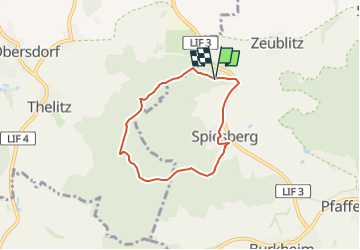
![](/images/other/stat-length.png)
![Tour Zu Fuß Altenkunstadt - Eulenberg Rundweg - Photo](https://media.geolcdn.com/t/1900/400/5ac01461-a1fc-4bc6-81aa-05aaf0afdaac.jpeg&format=pjpeg&maxdim=2)
Eulenberg Rundweg
SityTrail - itinéraires balisés pédestres
Tous les sentiers balisés d’Europe GUIDE+
![Länge](/images/other/stat-length.png)
![Maximale Höhe](https://static1.geolcdn.com/siteimages/upload/files/1508320355ic_sort_altitude_max_24dp.png)
![Positive Höhendifferenz](https://static1.geolcdn.com/siteimages/upload/files/1508320355ic_sort_den_pos_24dp.png)
![Km-Effort](/images/other/stat-length.png)
![Min. Höhe](https://static1.geolcdn.com/siteimages/upload/files/1508320355ic_sort_altitude_min_24dp.png)
![Negative Höhendifferenz](https://static1.geolcdn.com/siteimages/upload/files/1508320355ic_sort_den_neg_24dp.png)
![Boucle](https://static1.geolcdn.com/siteimages/upload/files/16400158638029165_repeat_loop_refresh_sync_direction_icon.png)
![Zu Fuß](https://static1.geolcdn.com/sitytour/trail-icons/100.png)
1h31
Schwierigkeit : Einfach
![Scannen Sie diesen QR-Code, um die Tour in der SityTrail-Anwendung zu öffnen](https://capi.geolives.com/qq0zvz2zws4bq2lad0pu/sitytour/trails/3090829/qr.png?size=200)
Kostenlosegpshiking-Anwendung
Über SityTrail
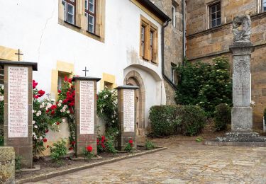
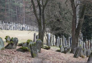
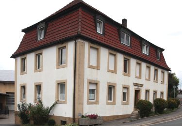
Tour Zu Fuß von 5 km verfügbar auf Bayern, Landkreis Lichtenfels, Altenkunstadt. Diese Tour wird von SityTrail - itinéraires balisés pédestres vorgeschlagen.
Beschreibung
Trail created by Landkreis Lichtenfels.
Derzeit existieren zwei Markierungen: rote 6 auf weißem Grund (alte Wegzeichen) und weiße 6 zwischen zwei Punkten auf rotem Grund (auf den Tafeln und Karten). Künftig soll es wieder einheitlich angeglichen werden: rote 6 auf weißem Grund.
Symbol: Rote 6 auf weißem Hintergrund
Ort
Kommentare
Touren in der Umgebung
![Tour Zu Fuß Redwitz a.d.Rodach - Trainauer Weg - Photo](https://media.geolcdn.com/t/375/260/c780133a-3ce0-4d7e-bd56-d8344030174b.jpeg&format=jpg&maxdim=2)
![Zu Fuß Zu Fuß](https://static1.geolcdn.com/sitytour/trail-icons/100.png)
Zu Fuß
![](/images/other/stat-length.png)
![](https://static1.geolcdn.com/siteimages/upload/files/16400158638029165_repeat_loop_refresh_sync_direction_icon.png)
![Tour Zu Fuß Redwitz a.d.Rodach - Redwitzer Runde - Photo](https://media.geolcdn.com/t/375/260/0a9daf24-74a6-4529-aec9-bc4f74a01100.jpeg&format=jpg&maxdim=2)
![Zu Fuß Zu Fuß](https://static1.geolcdn.com/sitytour/trail-icons/100.png)
Zu Fuß
![](/images/other/stat-length.png)
![](https://static1.geolcdn.com/siteimages/upload/files/16400158638029165_repeat_loop_refresh_sync_direction_icon.png)
![Tour Zu Fuß Redwitz a.d.Rodach - Redwitzer Kleeblattrunde - Photo](https://media.geolcdn.com/t/375/260/0a9daf24-74a6-4529-aec9-bc4f74a01100.jpeg&format=jpg&maxdim=2)
![Zu Fuß Zu Fuß](https://static1.geolcdn.com/sitytour/trail-icons/100.png)
Zu Fuß
![](/images/other/stat-length.png)
![](https://static1.geolcdn.com/siteimages/upload/files/16400158638029165_repeat_loop_refresh_sync_direction_icon.png)
![Tour Zu Fuß Redwitz a.d.Rodach - Redwitzer Biotoprunde - Photo](https://media.geolcdn.com/t/375/260/4692316d-4b47-4112-8f39-76a58a3a47c4.jpeg&format=jpg&maxdim=2)
![Zu Fuß Zu Fuß](https://static1.geolcdn.com/sitytour/trail-icons/100.png)
Zu Fuß
![](/images/other/stat-length.png)
![](https://static1.geolcdn.com/siteimages/upload/files/16400158638029165_repeat_loop_refresh_sync_direction_icon.png)
![Tour Zu Fuß Redwitz a.d.Rodach - Frutschbrunnen Runde - Photo](https://media.geolcdn.com/t/375/260/0a9daf24-74a6-4529-aec9-bc4f74a01100.jpeg&format=jpg&maxdim=2)
![Zu Fuß Zu Fuß](https://static1.geolcdn.com/sitytour/trail-icons/100.png)
Zu Fuß
![](/images/other/stat-length.png)
![](https://static1.geolcdn.com/siteimages/upload/files/16400158638029165_repeat_loop_refresh_sync_direction_icon.png)
![Tour Zu Fuß Burgkunstadt - Räuberpfad - Photo](https://media.geolcdn.com/t/375/260/220640e8-8155-4f3d-ba73-c9277146149e.jpeg&format=jpg&maxdim=2)
![Zu Fuß Zu Fuß](https://static1.geolcdn.com/sitytour/trail-icons/100.png)
Zu Fuß
![](/images/other/stat-length.png)
![](https://static1.geolcdn.com/siteimages/upload/files/16400158638029165_repeat_loop_refresh_sync_direction_icon.png)
![Tour Zu Fuß Burgkunstadt - Felsensteig - Photo](https://media.geolcdn.com/t/375/260/220640e8-8155-4f3d-ba73-c9277146149e.jpeg&format=jpg&maxdim=2)
![Zu Fuß Zu Fuß](https://static1.geolcdn.com/sitytour/trail-icons/100.png)
Zu Fuß
![](/images/other/stat-length.png)
![](https://static1.geolcdn.com/siteimages/upload/files/16400158638029165_repeat_loop_refresh_sync_direction_icon.png)
![Tour Zu Fuß Marktzeuln - Marktzeulner Spitzbergrunde - Photo](https://media.geolcdn.com/t/375/260/5b8039ae-2f57-4278-af8e-9bba7c5db977.jpeg&format=jpg&maxdim=2)
![Zu Fuß Zu Fuß](https://static1.geolcdn.com/sitytour/trail-icons/100.png)
Zu Fuß
![](/images/other/stat-length.png)
![](https://static1.geolcdn.com/siteimages/upload/files/16400158638029165_repeat_loop_refresh_sync_direction_icon.png)
![Tour Zu Fuß Marktzeuln - Marktzeulner Bergleitenrunde - Photo](https://media.geolcdn.com/t/375/260/5b8039ae-2f57-4278-af8e-9bba7c5db977.jpeg&format=jpg&maxdim=2)
![Zu Fuß Zu Fuß](https://static1.geolcdn.com/sitytour/trail-icons/100.png)
Zu Fuß
![](/images/other/stat-length.png)
![](https://static1.geolcdn.com/siteimages/upload/files/16400158638029165_repeat_loop_refresh_sync_direction_icon.png)