


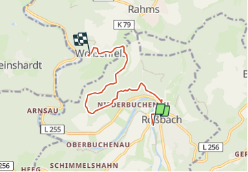

18,8 km | 24 km-effort


Tous les sentiers balisés d’Europe GUIDE+


Kostenlosegpshiking-Anwendung
 SityTrail
IGN / Geografische Institute
SityTrail World
Die Welt öffnet sich für Sie
Tour Zu Fuß von 4,8 km verfügbar auf Rheinland-Pfalz, Landkreis Neuwied, Roßbach. Diese Tour wird von SityTrail - itinéraires balisés pédestres vorgeschlagen.
Symbol: Markierung schwarzer Hintergrund, gelbe Zahl
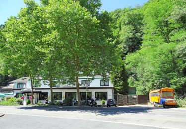
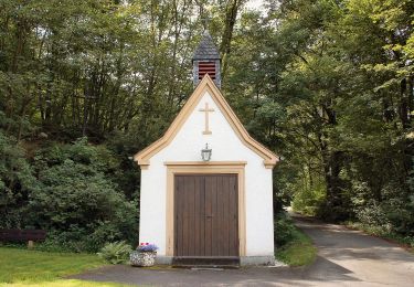
![Tour Zu Fuß Asbach - [A2] Kapellenweg - Photo](https://media.geolcdn.com/t/375/260/cbe88fbf-390b-407f-8f63-05cd1398c451.jpeg&format=jpg&maxdim=2)
Zu Fuß
Zu Fuß
Zu Fuß
Zu Fuß
Zu Fuß
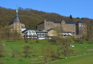
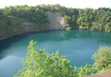
![Tour Zu Fuß Neustadt (Wied) - [N1] Bertenauer Weg - Photo](https://media.geolcdn.com/t/375/260/23673f5b-8e9e-4aac-bd57-d7ced4e8cded.jpeg&format=jpg&maxdim=2)
Zu Fuß
Zu Fuß
Zu Fuß
Zu Fuß