![](/images/other/stat-length.png)
![Tour Zu Fuß Untermerzbach - Fränkischer Bibelweg - Photo](https://media.geolcdn.com/t/1900/400/6b8bf001-3dc5-405f-9d7a-c07018ca8184.jpeg&format=pjpeg&maxdim=2)
Fränkischer Bibelweg
SityTrail - itinéraires balisés pédestres
Tous les sentiers balisés d’Europe GUIDE+
![Länge](/images/other/stat-length.png)
Länge
10,8 km
![Maximale Höhe](https://static1.geolcdn.com/siteimages/upload/files/1508320355ic_sort_altitude_max_24dp.png)
Maximale Höhe
356 m
![Positive Höhendifferenz](https://static1.geolcdn.com/siteimages/upload/files/1508320355ic_sort_den_pos_24dp.png)
Positive Höhendifferenz
205 m
![Km-Effort](/images/other/stat-length.png)
Km-Effort
13,5 km
![Min. Höhe](https://static1.geolcdn.com/siteimages/upload/files/1508320355ic_sort_altitude_min_24dp.png)
Min. Höhe
260 m
![Negative Höhendifferenz](https://static1.geolcdn.com/siteimages/upload/files/1508320355ic_sort_den_neg_24dp.png)
Negative Höhendifferenz
205 m
![Boucle](https://static1.geolcdn.com/siteimages/upload/files/16400158638029165_repeat_loop_refresh_sync_direction_icon.png)
Boucle
Nein
Kennzeichnung
Erstellungsdatum :
2022-02-11 12:48:22.227
Letzte Änderung :
2022-02-11 12:48:22.227
![Zu Fuß](https://static1.geolcdn.com/sitytour/trail-icons/100.png)
3h03
Schwierigkeit : Einfach
![Scannen Sie diesen QR-Code, um die Tour in der SityTrail-Anwendung zu öffnen](https://capi.geolives.com/qq0zvz2zws4bq2lad0pu/sitytour/trails/3087987/qr.png?size=200)
Kostenlosegpshiking-Anwendung
Über SityTrail
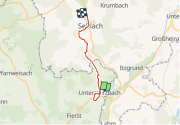
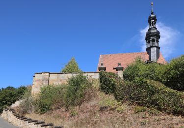
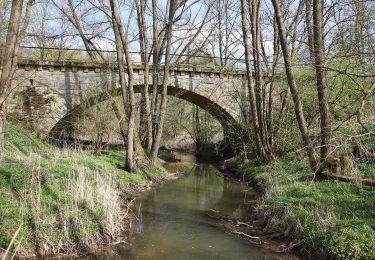
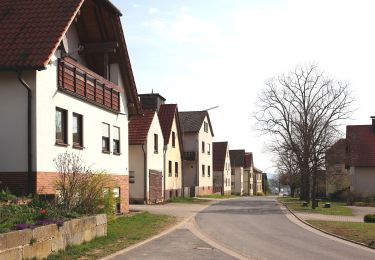
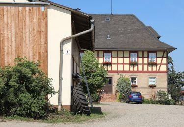
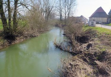
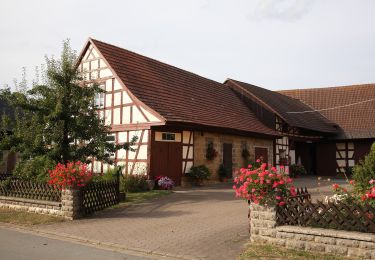
Tour Zu Fuß von 10,8 km verfügbar auf Bayern, Landkreis Haßberge, Untermerzbach. Diese Tour wird von SityTrail - itinéraires balisés pédestres vorgeschlagen.
Beschreibung
Trail created by Landkreis Coburg.
Symbol: Violettes Alpha und Omega auf weißem Hintergrund
Ort
Land:
Germany
Region :
Bayern
Abteilung/Provinz :
Landkreis Haßberge
Kommune :
Untermerzbach
Standort:
Unknown
Gehen Sie:(Dec)
Gehen Sie:(UTM)
632614 ; 5554046 (32U) N.
Kommentare
Touren in der Umgebung
![Tour Zu Fuß Ebern - Rundwanderweg Fuchs Ebern - Photo](https://media.geolcdn.com/t/375/260/165d2066-6818-4585-b90f-324c67da351e.jpeg&format=jpg&maxdim=2)
![Zu Fuß Zu Fuß](https://static1.geolcdn.com/sitytour/trail-icons/100.png)
Rundwanderweg Fuchs Ebern
Zu Fuß
Einfach
Ebern,
Bayern,
Landkreis Haßberge,
Germany
![](/images/other/stat-length.png)
13,5 km | 16,8 km-effort
3h 49min
![](https://static1.geolcdn.com/siteimages/upload/files/16400158638029165_repeat_loop_refresh_sync_direction_icon.png)
Ja
![Tour Zu Fuß Untermerzbach - Lauftour UMB2 - Photo](https://media.geolcdn.com/t/375/260/4ed320aa-2756-41d5-8141-45b621c02473.jpeg&format=jpg&maxdim=2)
![Zu Fuß Zu Fuß](https://static1.geolcdn.com/sitytour/trail-icons/100.png)
Lauftour UMB2
Zu Fuß
Einfach
Untermerzbach,
Bayern,
Landkreis Haßberge,
Germany
![](/images/other/stat-length.png)
12,7 km | 17 km-effort
3h 51min
![](https://static1.geolcdn.com/siteimages/upload/files/16400158638029165_repeat_loop_refresh_sync_direction_icon.png)
Ja
![Tour Zu Fuß Untermerzbach - Lauftour UMB1 - Photo](https://media.geolcdn.com/t/375/260/21453a26-95bc-441c-88d0-4bed9e22b2ca.jpeg&format=jpg&maxdim=2)
![Zu Fuß Zu Fuß](https://static1.geolcdn.com/sitytour/trail-icons/100.png)
Lauftour UMB1
Zu Fuß
Einfach
Untermerzbach,
Bayern,
Landkreis Haßberge,
Germany
![](/images/other/stat-length.png)
9,8 km | 13,7 km-effort
3h 6min
![](https://static1.geolcdn.com/siteimages/upload/files/16400158638029165_repeat_loop_refresh_sync_direction_icon.png)
Ja
![Tour Zu Fuß Untermerzbach - Rundwanderweg Reh Untermerzbach - Photo](https://media.geolcdn.com/t/375/260/1905219e-42ea-4d27-9f76-d27a128abdae.jpeg&format=jpg&maxdim=2)
![Zu Fuß Zu Fuß](https://static1.geolcdn.com/sitytour/trail-icons/100.png)
Rundwanderweg Reh Untermerzbach
Zu Fuß
Einfach
Untermerzbach,
Bayern,
Landkreis Haßberge,
Germany
![](/images/other/stat-length.png)
3,3 km | 4,5 km-effort
1h 2min
![](https://static1.geolcdn.com/siteimages/upload/files/16400158638029165_repeat_loop_refresh_sync_direction_icon.png)
Nein
![Tour Zu Fuß Seßlach - Rund um den Christenstein - Photo](https://media.geolcdn.com/t/375/260/6b8bf001-3dc5-405f-9d7a-c07018ca8184.jpeg&format=jpg&maxdim=2)
![Zu Fuß Zu Fuß](https://static1.geolcdn.com/sitytour/trail-icons/100.png)
Rund um den Christenstein
Zu Fuß
Einfach
Seßlach,
Bayern,
Landkreis Coburg,
Germany
![](/images/other/stat-length.png)
15,4 km | 19,6 km-effort
4h 26min
![](https://static1.geolcdn.com/siteimages/upload/files/16400158638029165_repeat_loop_refresh_sync_direction_icon.png)
Nein
![Tour Zu Fuß Ebensfeld - Verbindungsweg gelber Balken (Gleusdorf) - Busendorf - Tafel 2688 - Photo](https://media.geolcdn.com/t/375/260/f6fb59a1-0b68-48d8-85fd-eef716c17b1f.jpeg&format=jpg&maxdim=2)
![Zu Fuß Zu Fuß](https://static1.geolcdn.com/sitytour/trail-icons/100.png)
Verbindungsweg gelber Balken (Gleusdorf) - Busendorf - Tafel 2688
Zu Fuß
Einfach
Ebensfeld,
Bayern,
Landkreis Lichtenfels,
Germany
![](/images/other/stat-length.png)
3,7 km | 4,3 km-effort
58min
![](https://static1.geolcdn.com/siteimages/upload/files/16400158638029165_repeat_loop_refresh_sync_direction_icon.png)
Nein
![Tour Zu Fuß Itzgrund - Rundwanderweg Storch Kaltenbrunn - Photo](https://media.geolcdn.com/t/375/260/00a1c6b0-b4d9-4ecf-b054-ea71ceee960e.jpeg&format=jpg&maxdim=2)
![Zu Fuß Zu Fuß](https://static1.geolcdn.com/sitytour/trail-icons/100.png)
Rundwanderweg Storch Kaltenbrunn
Zu Fuß
Einfach
Itzgrund,
Bayern,
Landkreis Coburg,
Germany
![](/images/other/stat-length.png)
11,9 km | 14,1 km-effort
3h 12min
![](https://static1.geolcdn.com/siteimages/upload/files/16400158638029165_repeat_loop_refresh_sync_direction_icon.png)
Ja
![Tour Zu Fuß Untermerzbach - Rundwanderweg Milan Untermerzbach - Photo](https://media.geolcdn.com/t/375/260/034060a3-2758-4779-931d-0d7b2bb16eba.jpeg&format=jpg&maxdim=2)
![Zu Fuß Zu Fuß](https://static1.geolcdn.com/sitytour/trail-icons/100.png)
Rundwanderweg Milan Untermerzbach
Zu Fuß
Einfach
Untermerzbach,
Bayern,
Landkreis Haßberge,
Germany
![](/images/other/stat-length.png)
13 km | 16,9 km-effort
3h 50min
![](https://static1.geolcdn.com/siteimages/upload/files/16400158638029165_repeat_loop_refresh_sync_direction_icon.png)
Ja
![Tour Zu Fuß Ebensfeld - Kleine Döringstädter Runde - Photo](https://media.geolcdn.com/t/375/260/fe7ca50c-73e6-4322-9c79-2d13983beab7.jpeg&format=jpg&maxdim=2)
![Zu Fuß Zu Fuß](https://static1.geolcdn.com/sitytour/trail-icons/100.png)
Kleine Döringstädter Runde
Zu Fuß
Einfach
Ebensfeld,
Bayern,
Landkreis Lichtenfels,
Germany
![](/images/other/stat-length.png)
11 km | 14 km-effort
3h 11min
![](https://static1.geolcdn.com/siteimages/upload/files/16400158638029165_repeat_loop_refresh_sync_direction_icon.png)
Ja