![](/images/other/stat-length.png)
![Tour Zu Fuß Unbekannt - Aaperwald Rundweg A4 - Photo](https://media.geolcdn.com/t/1900/400/cc10fb3b-0b55-4811-9c85-f69bb325738c.jpeg&format=pjpeg&maxdim=2)
Aaperwald Rundweg A4
SityTrail - itinéraires balisés pédestres
Tous les sentiers balisés d’Europe GUIDE+
![Länge](/images/other/stat-length.png)
Länge
5,1 km
![Maximale Höhe](https://static1.geolcdn.com/siteimages/upload/files/1508320355ic_sort_altitude_max_24dp.png)
Maximale Höhe
122 m
![Positive Höhendifferenz](https://static1.geolcdn.com/siteimages/upload/files/1508320355ic_sort_den_pos_24dp.png)
Positive Höhendifferenz
76 m
![Km-Effort](/images/other/stat-length.png)
Km-Effort
6,1 km
![Min. Höhe](https://static1.geolcdn.com/siteimages/upload/files/1508320355ic_sort_altitude_min_24dp.png)
Min. Höhe
68 m
![Negative Höhendifferenz](https://static1.geolcdn.com/siteimages/upload/files/1508320355ic_sort_den_neg_24dp.png)
Negative Höhendifferenz
77 m
![Boucle](https://static1.geolcdn.com/siteimages/upload/files/16400158638029165_repeat_loop_refresh_sync_direction_icon.png)
Boucle
Nein
Kennzeichnung
Erstellungsdatum :
2022-02-11 12:41:34.496
Letzte Änderung :
2022-02-11 12:41:34.496
![Zu Fuß](https://static1.geolcdn.com/sitytour/trail-icons/100.png)
1h23
Schwierigkeit : Einfach
![Scannen Sie diesen QR-Code, um die Tour in der SityTrail-Anwendung zu öffnen](https://capi.geolives.com/qq0zvz2zws4bq2lad0pu/sitytour/trails/3087590/qr.png?size=200)
Kostenlosegpshiking-Anwendung
Über SityTrail
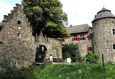
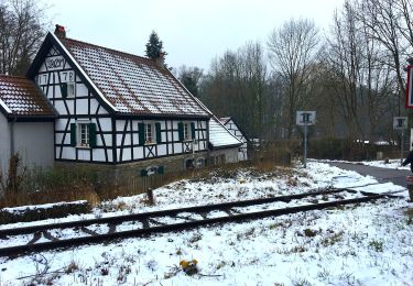
Tour Zu Fuß von 5,1 km verfügbar auf Nordrhein-Westfalen, Düsseldorf, Unbekannt. Diese Tour wird von SityTrail - itinéraires balisés pédestres vorgeschlagen.
Beschreibung
Website: https://sgv-duesseldorf.de/
Ort
Land:
Germany
Region :
Nordrhein-Westfalen
Abteilung/Provinz :
Düsseldorf
Kommune :
Unbekannt
Standort:
Stadtbezirk 6
Gehen Sie:(Dec)
Gehen Sie:(UTM)
349706 ; 5681278 (32U) N.
Kommentare
Touren in der Umgebung
![Tour Zu Fuß Erkrath - Neanderlandsteig Entdeckerschleife](https://media.geolcdn.com/t/375/260/f0a4c676-b45d-44ca-9d2f-c9554313404f.jpeg&format=jpg&maxdim=2)
![Zu Fuß Zu Fuß](https://static1.geolcdn.com/sitytour/trail-icons/100.png)
Neanderlandsteig Entdeckerschleife "Denkmalroute Alt-Erkrath"
Zu Fuß
Einfach
Erkrath,
Nordrhein-Westfalen,
Kreis Mettmann,
Germany
![](/images/other/stat-length.png)
12,4 km | 15,7 km-effort
3h 34min
![](https://static1.geolcdn.com/siteimages/upload/files/16400158638029165_repeat_loop_refresh_sync_direction_icon.png)
Nein
![Tour Zu Fuß Unbekannt - Aaperwald Rundweg A2 - Photo](https://media.geolcdn.com/t/375/260/ca0b790a-7d1f-4d5e-b73b-8c860418e106.jpeg&format=jpg&maxdim=2)
![Zu Fuß Zu Fuß](https://static1.geolcdn.com/sitytour/trail-icons/100.png)
Aaperwald Rundweg A2
Zu Fuß
Einfach
Unbekannt,
Nordrhein-Westfalen,
Düsseldorf,
Germany
![](/images/other/stat-length.png)
3,8 km | 4,4 km-effort
1h 0min
![](https://static1.geolcdn.com/siteimages/upload/files/16400158638029165_repeat_loop_refresh_sync_direction_icon.png)
Ja
![Tour Zu Fuß Unbekannt - Industriepfad Düsseldorf-Gerresheim - Photo](https://media.geolcdn.com/t/375/260/d0cb714a-becf-4430-8992-a4b859ea4a1c.jpeg&format=jpg&maxdim=2)
![Zu Fuß Zu Fuß](https://static1.geolcdn.com/sitytour/trail-icons/100.png)
Industriepfad Düsseldorf-Gerresheim
Zu Fuß
Einfach
Unbekannt,
Nordrhein-Westfalen,
Düsseldorf,
Germany
![](/images/other/stat-length.png)
4,5 km | 4,9 km-effort
1h 6min
![](https://static1.geolcdn.com/siteimages/upload/files/16400158638029165_repeat_loop_refresh_sync_direction_icon.png)
Nein
![Tour Zu Fuß Ratingen - Ratingen Aue Rundweg A2 - Photo](https://media.geolcdn.com/t/375/260/40237fbf-2cf7-4c3e-b1ca-73a824c7531e.jpeg&format=jpg&maxdim=2)
![Zu Fuß Zu Fuß](https://static1.geolcdn.com/sitytour/trail-icons/100.png)
Ratingen Aue Rundweg A2
Zu Fuß
Einfach
Ratingen,
Nordrhein-Westfalen,
Kreis Mettmann,
Germany
![](/images/other/stat-length.png)
6,8 km | 8,2 km-effort
1h 51min
![](https://static1.geolcdn.com/siteimages/upload/files/16400158638029165_repeat_loop_refresh_sync_direction_icon.png)
Ja
![Tour Zu Fuß Ratingen - Balken Ratingen-Hösel - Photo](https://media.geolcdn.com/t/375/260/8053d605-bad8-4a6d-94b8-0773bda60b95.jpeg&format=jpg&maxdim=2)
![Zu Fuß Zu Fuß](https://static1.geolcdn.com/sitytour/trail-icons/100.png)
Balken Ratingen-Hösel
Zu Fuß
Einfach
Ratingen,
Nordrhein-Westfalen,
Kreis Mettmann,
Germany
![](/images/other/stat-length.png)
6,1 km | 7,2 km-effort
1h 38min
![](https://static1.geolcdn.com/siteimages/upload/files/16400158638029165_repeat_loop_refresh_sync_direction_icon.png)
Nein
![Tour Zu Fuß Ratingen - Ratingen Aue Rundweg A1 - Photo](https://media.geolcdn.com/t/375/260/40237fbf-2cf7-4c3e-b1ca-73a824c7531e.jpeg&format=jpg&maxdim=2)
![Zu Fuß Zu Fuß](https://static1.geolcdn.com/sitytour/trail-icons/100.png)
Ratingen Aue Rundweg A1
Zu Fuß
Einfach
Ratingen,
Nordrhein-Westfalen,
Kreis Mettmann,
Germany
![](/images/other/stat-length.png)
12,1 km | 14,9 km-effort
3h 22min
![](https://static1.geolcdn.com/siteimages/upload/files/16400158638029165_repeat_loop_refresh_sync_direction_icon.png)
Ja
![Tour Zu Fuß Erkrath - Rechteck Erkrath-Eller - Photo](https://media.geolcdn.com/t/375/260/869ed9d6-13d5-459e-9f12-6811fc83e378.jpeg&format=jpg&maxdim=2)
![Zu Fuß Zu Fuß](https://static1.geolcdn.com/sitytour/trail-icons/100.png)
Rechteck Erkrath-Eller
Zu Fuß
Einfach
Erkrath,
Nordrhein-Westfalen,
Kreis Mettmann,
Germany
![](/images/other/stat-length.png)
5,7 km | 6,7 km-effort
1h 31min
![](https://static1.geolcdn.com/siteimages/upload/files/16400158638029165_repeat_loop_refresh_sync_direction_icon.png)
Nein
![Tour Zu Fuß Unbekannt - Aaperwald Rundweg A1 - Photo](https://media.geolcdn.com/t/375/260/4d07ddde-f9f0-4046-a6db-7f628bc2b8e3.jpeg&format=jpg&maxdim=2)
![Zu Fuß Zu Fuß](https://static1.geolcdn.com/sitytour/trail-icons/100.png)
Aaperwald Rundweg A1
Zu Fuß
Einfach
Unbekannt,
Nordrhein-Westfalen,
Düsseldorf,
Germany
![](/images/other/stat-length.png)
3,5 km | 4,4 km-effort
59min
![](https://static1.geolcdn.com/siteimages/upload/files/16400158638029165_repeat_loop_refresh_sync_direction_icon.png)
Nein
![Tour Zu Fuß Unbekannt - [D] Düsseldorfer Weg - Photo](https://media.geolcdn.com/t/375/260/02398625-9783-4a6b-913e-ce79bc76d8b1.jpeg&format=jpg&maxdim=2)
![Zu Fuß Zu Fuß](https://static1.geolcdn.com/sitytour/trail-icons/100.png)
[D] Düsseldorfer Weg
Zu Fuß
Sehr schwierig
Unbekannt,
Nordrhein-Westfalen,
Düsseldorf,
Germany
![](/images/other/stat-length.png)
39 km | 45 km-effort
10h 7min
![](https://static1.geolcdn.com/siteimages/upload/files/16400158638029165_repeat_loop_refresh_sync_direction_icon.png)
Nein