


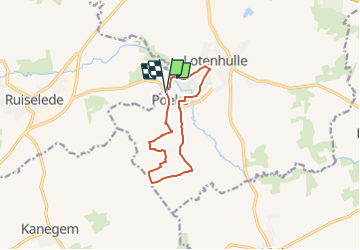

8,8 km | 9,5 km-effort


Tous les sentiers balisés d’Europe GUIDE+


Kostenlosegpshiking-Anwendung
 SityTrail
IGN / Geografische Institute
SityTrail World
Die Welt öffnet sich für Sie
Tour Zu Fuß von 8,9 km verfügbar auf Flandern, Ostflandern, Aalter. Diese Tour wird von SityTrail - itinéraires balisés pédestres vorgeschlagen.
Het huidige neoclassicistische kerkje kwam er in 1842 nadat de oude gotische kerk er bouwvallig bijstond in het begin va
Website: https://www.toerismemeetjesland.be/nl/poekekasteel-wandelroute

Wandern

Zu Fuß
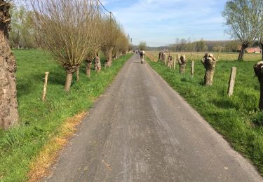
Wandern

Fahrrad
Zu Fuß
Wandern
Wandern
Elektrofahrrad
Nordic Walking