![](/images/other/stat-length.png)
![Tour Zu Fuß Oudsbergen - Moorsberg Paarse trapezium - Photo](https://media.geolcdn.com/t/1900/400/4c7fd886-c3d5-4662-96ec-c951a3de83c7.jpeg&format=pjpeg&maxdim=2)
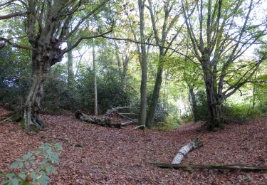
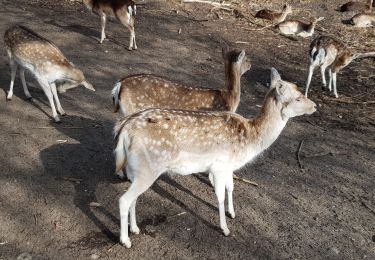
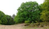
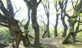
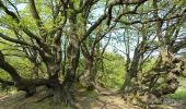
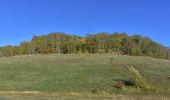
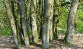
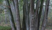
Moorsberg Paarse trapezium
SityTrail - itinéraires balisés pédestres
Tous les sentiers balisés d’Europe GUIDE+
![Länge](/images/other/stat-length.png)
Länge
6,3 km
![Maximale Höhe](https://static1.geolcdn.com/siteimages/upload/files/1508320355ic_sort_altitude_max_24dp.png)
Maximale Höhe
95 m
![Positive Höhendifferenz](https://static1.geolcdn.com/siteimages/upload/files/1508320355ic_sort_den_pos_24dp.png)
Positive Höhendifferenz
53 m
![Km-Effort](/images/other/stat-length.png)
Km-Effort
7 km
![Min. Höhe](https://static1.geolcdn.com/siteimages/upload/files/1508320355ic_sort_altitude_min_24dp.png)
Min. Höhe
79 m
![Negative Höhendifferenz](https://static1.geolcdn.com/siteimages/upload/files/1508320355ic_sort_den_neg_24dp.png)
Negative Höhendifferenz
50 m
![Boucle](https://static1.geolcdn.com/siteimages/upload/files/16400158638029165_repeat_loop_refresh_sync_direction_icon.png)
Boucle
Ja
Kennzeichnung
Erstellungsdatum :
2022-02-09 19:00:29.814
Letzte Änderung :
2022-02-09 19:00:29.814
![Zu Fuß](https://static1.geolcdn.com/sitytour/trail-icons/100.png)
1h35
Schwierigkeit : Einfach
![Scannen Sie diesen QR-Code, um die Tour in der SityTrail-Anwendung zu öffnen](https://capi.geolives.com/qq0zvz2zws4bq2lad0pu/sitytour/trails/3085050/qr.png?size=200)
Kostenlosegpshiking-Anwendung
Über SityTrail
Tour Zu Fuß von 6,3 km verfügbar auf Flandern, Limburg, Oudsbergen. Diese Tour wird von SityTrail - itinéraires balisés pédestres vorgeschlagen.
Beschreibung
Trail created by Regionaal Landschap Kempen en Maasland.
Symbol: trapezium
Ort
Land:
Belgium
Region :
Flandern
Abteilung/Provinz :
Limburg
Kommune :
Oudsbergen
Standort:
Opglabbeek
Gehen Sie:(Dec)
Gehen Sie:(UTM)
677562 ; 5655587 (31U) N.
Kommentare
Touren in der Umgebung
![Tour Zu Fuß As - Heiderbos blauwe ruit - Photo](https://media.geolcdn.com/t/375/260/e65c145e-dca4-4d58-ae17-fc8ca78c84c8.jpeg&format=jpg&maxdim=2)
![Zu Fuß Zu Fuß](https://static1.geolcdn.com/sitytour/trail-icons/100.png)
Heiderbos blauwe ruit
Zu Fuß
Einfach
As,
Flandern,
Limburg,
Belgium
![](/images/other/stat-length.png)
7,7 km | 8,5 km-effort
1h 56min
![](https://static1.geolcdn.com/siteimages/upload/files/16400158638029165_repeat_loop_refresh_sync_direction_icon.png)
Ja
![Tour Zu Fuß Genk - Thorpark Groene rechthoek - Photo](https://media.geolcdn.com/t/375/260/5d7a6518-21eb-43eb-96c3-b85d7a924753.jpeg&format=jpg&maxdim=2)
![Zu Fuß Zu Fuß](https://static1.geolcdn.com/sitytour/trail-icons/100.png)
Thorpark Groene rechthoek
Zu Fuß
Einfach
Genk,
Flandern,
Limburg,
Belgium
![](/images/other/stat-length.png)
4,1 km | 4,4 km-effort
1h 0min
![](https://static1.geolcdn.com/siteimages/upload/files/16400158638029165_repeat_loop_refresh_sync_direction_icon.png)
Ja
![Tour Zu Fuß Genk - Thorpark - De Kolonie Rode driehoek - Photo](https://media.geolcdn.com/t/375/260/1c715178-bd32-42a8-8c79-dfbf5aac80a5.jpeg&format=jpg&maxdim=2)
![Zu Fuß Zu Fuß](https://static1.geolcdn.com/sitytour/trail-icons/100.png)
Thorpark - De Kolonie Rode driehoek
Zu Fuß
Einfach
Genk,
Flandern,
Limburg,
Belgium
![](/images/other/stat-length.png)
12,5 km | 14,1 km-effort
3h 12min
![](https://static1.geolcdn.com/siteimages/upload/files/16400158638029165_repeat_loop_refresh_sync_direction_icon.png)
Ja
![Tour Zu Fuß Genk - Thorpark Blauwe ruit - Photo](https://media.geolcdn.com/t/375/260/5d7a6518-21eb-43eb-96c3-b85d7a924753.jpeg&format=jpg&maxdim=2)
![Zu Fuß Zu Fuß](https://static1.geolcdn.com/sitytour/trail-icons/100.png)
Thorpark Blauwe ruit
Zu Fuß
Einfach
Genk,
Flandern,
Limburg,
Belgium
![](/images/other/stat-length.png)
7,6 km | 8,7 km-effort
1h 58min
![](https://static1.geolcdn.com/siteimages/upload/files/16400158638029165_repeat_loop_refresh_sync_direction_icon.png)
Ja
![Tour Zu Fuß Genk - Thorpark - Heiderbos Gele zeshoek - Photo](https://media.geolcdn.com/t/375/260/c6f79672-6cbb-4c88-882a-ca6add2e9582.jpeg&format=jpg&maxdim=2)
![Zu Fuß Zu Fuß](https://static1.geolcdn.com/sitytour/trail-icons/100.png)
Thorpark - Heiderbos Gele zeshoek
Zu Fuß
Einfach
Genk,
Flandern,
Limburg,
Belgium
![](/images/other/stat-length.png)
16,3 km | 18,5 km-effort
4h 12min
![](https://static1.geolcdn.com/siteimages/upload/files/16400158638029165_repeat_loop_refresh_sync_direction_icon.png)
Ja
![Tour Zu Fuß Genk - Thorpark Erfgoedroute - Photo](https://media.geolcdn.com/t/375/260/cb1f562b-a158-4abb-b585-f6a3e885b845.jpeg&format=jpg&maxdim=2)
![Zu Fuß Zu Fuß](https://static1.geolcdn.com/sitytour/trail-icons/100.png)
Thorpark Erfgoedroute
Zu Fuß
Einfach
Genk,
Flandern,
Limburg,
Belgium
![](/images/other/stat-length.png)
12 km | 13,4 km-effort
3h 2min
![](https://static1.geolcdn.com/siteimages/upload/files/16400158638029165_repeat_loop_refresh_sync_direction_icon.png)
Ja
![Tour Zu Fuß As - Heiderbos groen - Photo](https://media.geolcdn.com/t/375/260/e65c145e-dca4-4d58-ae17-fc8ca78c84c8.jpeg&format=jpg&maxdim=2)
![Zu Fuß Zu Fuß](https://static1.geolcdn.com/sitytour/trail-icons/100.png)
![Tour Zu Fuß Oudsbergen - Station As Groene rechthoek - Photo](https://media.geolcdn.com/t/375/260/4138f70f-918d-4b66-9d0e-0a0acf4d2d20.jpeg&format=jpg&maxdim=2)
![Zu Fuß Zu Fuß](https://static1.geolcdn.com/sitytour/trail-icons/100.png)
Station As Groene rechthoek
Zu Fuß
Einfach
Oudsbergen,
Flandern,
Limburg,
Belgium
![](/images/other/stat-length.png)
3,8 km | 4,2 km-effort
57min
![](https://static1.geolcdn.com/siteimages/upload/files/16400158638029165_repeat_loop_refresh_sync_direction_icon.png)
Ja
![Tour Wandern Genk - 2021-03-01_18h19m00_1064 - Photo](https://media.geolcdn.com/t/375/260/0f01ba13-08ba-4091-8289-741eb85bca4a.jpg&format=jpg&maxdim=2)
![Wandern Wandern](https://static1.geolcdn.com/sitytour/trail-icons/101.png)
2021-03-01_18h19m00_1064
Wandern
Sehr leicht
Genk,
Flandern,
Limburg,
Belgium
![](/images/other/stat-length.png)
17,8 km | 19,7 km-effort
4h 28min
![](https://static1.geolcdn.com/siteimages/upload/files/16400158638029165_repeat_loop_refresh_sync_direction_icon.png)
Ja