![](/images/other/stat-length.png)
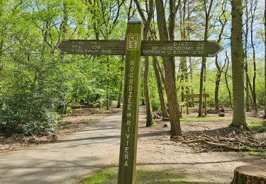
![Tour Zu Fuß Zonhoven - Holsteen-Molenheide Gele wandeling - Photo](https://media.geolcdn.com/t/1900/400/f6f5713b-6cf3-40c6-af71-1f4650f1512b.jpeg&format=pjpeg&maxdim=2)
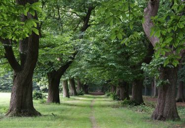
Holsteen-Molenheide Gele wandeling
SityTrail - itinéraires balisés pédestres
Tous les sentiers balisés d’Europe GUIDE+
![Länge](/images/other/stat-length.png)
Länge
5,9 km
![Maximale Höhe](https://static1.geolcdn.com/siteimages/upload/files/1508320355ic_sort_altitude_max_24dp.png)
Maximale Höhe
92 m
![Positive Höhendifferenz](https://static1.geolcdn.com/siteimages/upload/files/1508320355ic_sort_den_pos_24dp.png)
Positive Höhendifferenz
56 m
![Km-Effort](/images/other/stat-length.png)
Km-Effort
6,6 km
![Min. Höhe](https://static1.geolcdn.com/siteimages/upload/files/1508320355ic_sort_altitude_min_24dp.png)
Min. Höhe
59 m
![Negative Höhendifferenz](https://static1.geolcdn.com/siteimages/upload/files/1508320355ic_sort_den_neg_24dp.png)
Negative Höhendifferenz
56 m
![Boucle](https://static1.geolcdn.com/siteimages/upload/files/16400158638029165_repeat_loop_refresh_sync_direction_icon.png)
Boucle
Ja
Kennzeichnung
Erstellungsdatum :
2022-02-09 15:25:22.535
Letzte Änderung :
2022-02-09 18:04:13.308
![Zu Fuß](https://static1.geolcdn.com/sitytour/trail-icons/100.png)
1h29
Schwierigkeit : Einfach
![Scannen Sie diesen QR-Code, um die Tour in der SityTrail-Anwendung zu öffnen](https://capi.geolives.com/qq0zvz2zws4bq2lad0pu/sitytour/trails/3083582/qr.png?size=200)
Kostenlosegpshiking-Anwendung
Über SityTrail
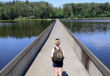
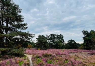
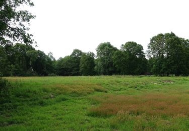
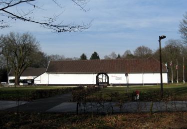
Tour Zu Fuß von 5,9 km verfügbar auf Flandern, Limburg, Zonhoven. Diese Tour wird von SityTrail - itinéraires balisés pédestres vorgeschlagen.
Beschreibung
Trail created by RLLK Regionaal Landschap Lage Kempen.
Symbol: hexagon
Ort
Land:
Belgium
Region :
Flandern
Abteilung/Provinz :
Limburg
Kommune :
Zonhoven
Standort:
Unknown
Gehen Sie:(Dec)
Gehen Sie:(UTM)
669613 ; 5652071 (31U) N.
Kommentare
Touren in der Umgebung
![Tour Wandern Hasselt - Domaine Kiewit &](https://media.geolcdn.com/t/375/260/24e338e2-ab75-48fb-ae32-0abbc38a1902.jpg&format=jpg&maxdim=2)
![Wandern Wandern](https://static1.geolcdn.com/sitytour/trail-icons/101.png)
Domaine Kiewit & " Fietsen door het water"
Wandern
Einfach
Hasselt,
Flandern,
Limburg,
Belgium
![](/images/other/stat-length.png)
10,9 km | 12,1 km-effort
2h 33min
![](https://static1.geolcdn.com/siteimages/upload/files/16400158638029165_repeat_loop_refresh_sync_direction_icon.png)
Ja
![Tour Wandern Genk - Promenade vers la piste dans l'eau, dans le magnifique domaine de Bokrijk - Photo](https://media.geolcdn.com/t/375/260/45cc0ed2-db94-4d5d-a7c6-1096a930a2ab.jpg&format=jpg&maxdim=2)
![Wandern Wandern](https://static1.geolcdn.com/sitytour/trail-icons/101.png)
Promenade vers la piste dans l'eau, dans le magnifique domaine de Bokrijk
Wandern
Einfach
(3)
Genk,
Flandern,
Limburg,
Belgium
![](/images/other/stat-length.png)
4,1 km | 4,6 km-effort
1h 2min
![](https://static1.geolcdn.com/siteimages/upload/files/16400158638029165_repeat_loop_refresh_sync_direction_icon.png)
Ja
![Tour Wandern Zonhoven - de-wijers-de-teut-instapplaats-donderslagseweg-blauw - Photo](https://media.geolcdn.com/t/375/260/b2e8aeaf-7e73-4433-bd25-55a9739e6f87.jpeg&format=jpg&maxdim=2)
![Wandern Wandern](https://static1.geolcdn.com/sitytour/trail-icons/101.png)
de-wijers-de-teut-instapplaats-donderslagseweg-blauw
Wandern
Einfach
Zonhoven,
Flandern,
Limburg,
Belgium
![](/images/other/stat-length.png)
3,8 km | 4,3 km-effort
58min
![](https://static1.geolcdn.com/siteimages/upload/files/16400158638029165_repeat_loop_refresh_sync_direction_icon.png)
Ja
![Tour Zu Fuß Zonhoven - Kolveren blauw - Photo](https://media.geolcdn.com/t/375/260/bc17152d-ab26-44bb-88d5-504f91b41443.jpeg&format=jpg&maxdim=2)
![Zu Fuß Zu Fuß](https://static1.geolcdn.com/sitytour/trail-icons/100.png)
![Tour Zu Fuß Houthalen-Helchteren - Kelchterhoef Blauwe ruit - Photo](https://media.geolcdn.com/t/375/260/607a7d4c-26ee-4efc-8e48-7bf7b864aabc.jpeg&format=jpg&maxdim=2)
![Zu Fuß Zu Fuß](https://static1.geolcdn.com/sitytour/trail-icons/100.png)
Kelchterhoef Blauwe ruit
Zu Fuß
Einfach
Houthalen-Helchteren,
Flandern,
Limburg,
Belgium
![](/images/other/stat-length.png)
3,8 km | 4,3 km-effort
58min
![](https://static1.geolcdn.com/siteimages/upload/files/16400158638029165_repeat_loop_refresh_sync_direction_icon.png)
Ja
![Tour Zu Fuß Houthalen-Helchteren - Kelchterhoef Gele zeshoek - Photo](https://media.geolcdn.com/t/375/260/607a7d4c-26ee-4efc-8e48-7bf7b864aabc.jpeg&format=jpg&maxdim=2)
![Zu Fuß Zu Fuß](https://static1.geolcdn.com/sitytour/trail-icons/100.png)
Kelchterhoef Gele zeshoek
Zu Fuß
Einfach
Houthalen-Helchteren,
Flandern,
Limburg,
Belgium
![](/images/other/stat-length.png)
9,2 km | 10,3 km-effort
2h 21min
![](https://static1.geolcdn.com/siteimages/upload/files/16400158638029165_repeat_loop_refresh_sync_direction_icon.png)
Ja
![Tour Zu Fuß Houthalen-Helchteren - Kelchterhoef Oranje bol - Photo](https://media.geolcdn.com/t/375/260/49dcc599-2463-4f59-8ee4-11e855da3936.jpeg&format=jpg&maxdim=2)
![Zu Fuß Zu Fuß](https://static1.geolcdn.com/sitytour/trail-icons/100.png)
Kelchterhoef Oranje bol
Zu Fuß
Einfach
Houthalen-Helchteren,
Flandern,
Limburg,
Belgium
![](/images/other/stat-length.png)
6,4 km | 7,1 km-effort
1h 36min
![](https://static1.geolcdn.com/siteimages/upload/files/16400158638029165_repeat_loop_refresh_sync_direction_icon.png)
Ja
![Tour Zu Fuß Genk - De Maten oranje - Photo](https://media.geolcdn.com/t/375/260/5daa36df-5a45-46f0-9e87-234b3c303469.jpeg&format=jpg&maxdim=2)
![Zu Fuß Zu Fuß](https://static1.geolcdn.com/sitytour/trail-icons/100.png)
![Tour Zu Fuß Genk - Bokrijk Gele zeshoek (voor rolstoel/buggy) - Photo](https://media.geolcdn.com/t/375/260/abfb207d-dc7b-4a70-b673-1e7d6075a286.jpeg&format=jpg&maxdim=2)
![Zu Fuß Zu Fuß](https://static1.geolcdn.com/sitytour/trail-icons/100.png)
Bokrijk Gele zeshoek (voor rolstoel/buggy)
Zu Fuß
Einfach
Genk,
Flandern,
Limburg,
Belgium
![](/images/other/stat-length.png)
4,1 km | 4,7 km-effort
1h 3min
![](https://static1.geolcdn.com/siteimages/upload/files/16400158638029165_repeat_loop_refresh_sync_direction_icon.png)
Ja