![](/images/other/stat-length.png)
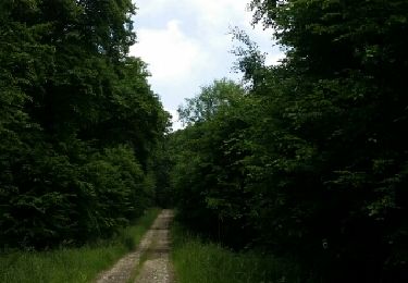
![Tour Zu Fuß Düdelingen - Auto-Pédestre Dudelange 1 - Photo](https://media.geolcdn.com/t/1900/400/4604b46c-e658-438b-bbb1-3c17c8ec28c2.jpeg&format=pjpeg&maxdim=2)
Auto-Pédestre Dudelange 1
SityTrail - itinéraires balisés pédestres
Tous les sentiers balisés d’Europe GUIDE+
![Länge](/images/other/stat-length.png)
Länge
10,1 km
![Maximale Höhe](https://static1.geolcdn.com/siteimages/upload/files/1508320355ic_sort_altitude_max_24dp.png)
Maximale Höhe
435 m
![Positive Höhendifferenz](https://static1.geolcdn.com/siteimages/upload/files/1508320355ic_sort_den_pos_24dp.png)
Positive Höhendifferenz
227 m
![Km-Effort](/images/other/stat-length.png)
Km-Effort
13,2 km
![Min. Höhe](https://static1.geolcdn.com/siteimages/upload/files/1508320355ic_sort_altitude_min_24dp.png)
Min. Höhe
285 m
![Negative Höhendifferenz](https://static1.geolcdn.com/siteimages/upload/files/1508320355ic_sort_den_neg_24dp.png)
Negative Höhendifferenz
225 m
![Boucle](https://static1.geolcdn.com/siteimages/upload/files/16400158638029165_repeat_loop_refresh_sync_direction_icon.png)
Boucle
Ja
Kennzeichnung
Erstellungsdatum :
2022-02-09 15:19:31.632
Letzte Änderung :
2022-03-10 09:23:40.271
![Zu Fuß](https://static1.geolcdn.com/sitytour/trail-icons/100.png)
2h59
Schwierigkeit : Einfach
![Scannen Sie diesen QR-Code, um die Tour in der SityTrail-Anwendung zu öffnen](https://capi.geolives.com/qq0zvz2zws4bq2lad0pu/sitytour/trails/3083504/qr.png?size=200)
Kostenlosegpshiking-Anwendung
Über SityTrail
Tour Zu Fuß von 10,1 km verfügbar auf Unbekannt, Kanton Esch an der Alzette, Düdelingen. Diese Tour wird von SityTrail - itinéraires balisés pédestres vorgeschlagen.
Beschreibung
Trail created by Ministère de l´Économie.
Website: https://map.geoportail.lu/theme/tourisme?fid=176_4250936
Ort
Land:
Luxembourg
Region :
Unbekannt
Abteilung/Provinz :
Kanton Esch an der Alzette
Kommune :
Düdelingen
Standort:
Unknown
Gehen Sie:(Dec)
Gehen Sie:(UTM)
289935 ; 5485556 (32U) N.
Kommentare
Touren in der Umgebung
![Tour Zu Fuß Düdelingen - Auto-Pédestre Dudelange 2 - Photo](https://media.geolcdn.com/t/375/260/af1bad0c-3221-4446-bdc1-63f6fbf66e3d.jpeg&format=jpg&maxdim=2)
![Zu Fuß Zu Fuß](https://static1.geolcdn.com/sitytour/trail-icons/100.png)
Auto-Pédestre Dudelange 2
Zu Fuß
Einfach
Düdelingen,
Unbekannt,
Kanton Esch an der Alzette,
Luxembourg
![](/images/other/stat-length.png)
5,8 km | 7,5 km-effort
1h 42min
![](https://static1.geolcdn.com/siteimages/upload/files/16400158638029165_repeat_loop_refresh_sync_direction_icon.png)
Nein
![Tour Wandern Bettemburg - Luxembourg-Parc Merveilleux - Photo](https://media.geolcdn.com/t/375/260/e96577b3-989a-4bed-a24d-623f11b117db.jpg&format=jpg&maxdim=2)
![Wandern Wandern](https://static1.geolcdn.com/sitytour/trail-icons/101.png)
Luxembourg-Parc Merveilleux
Wandern
Einfach
Bettemburg,
Unbekannt,
Kanton Esch an der Alzette,
Luxembourg
![](/images/other/stat-length.png)
3,3 km | 3,7 km-effort
1h 14min
![](https://static1.geolcdn.com/siteimages/upload/files/16400158638029165_repeat_loop_refresh_sync_direction_icon.png)
Ja
![Tour Zu Fuß Wollmeringen - Promenade Transfrontalière - Photo](https://media.geolcdn.com/t/375/260/d2239583-1f94-4d90-95bb-22cf9acd8889.jpeg&format=jpg&maxdim=2)
![Zu Fuß Zu Fuß](https://static1.geolcdn.com/sitytour/trail-icons/100.png)
Promenade Transfrontalière
Zu Fuß
Einfach
Wollmeringen,
Großer Osten,
Mosel,
France
![](/images/other/stat-length.png)
9,9 km | 13,4 km-effort
3h 2min
![](https://static1.geolcdn.com/siteimages/upload/files/16400158638029165_repeat_loop_refresh_sync_direction_icon.png)
Ja
![Tour Zu Fuß Wollmeringen - Club Vosgiens Sentier de la Minette - Volmerange - Dudelange - Photo](https://media.geolcdn.com/t/375/260/ec7e514b-60dc-406a-a533-2ed713e164f9.jpeg&format=jpg&maxdim=2)
![Zu Fuß Zu Fuß](https://static1.geolcdn.com/sitytour/trail-icons/100.png)
Club Vosgiens Sentier de la Minette - Volmerange - Dudelange
Zu Fuß
Einfach
Wollmeringen,
Großer Osten,
Mosel,
France
![](/images/other/stat-length.png)
9,4 km | 12,2 km-effort
2h 45min
![](https://static1.geolcdn.com/siteimages/upload/files/16400158638029165_repeat_loop_refresh_sync_direction_icon.png)
Ja
![Tour Zu Fuß Suftgen - Club Vosgien Circle Rouge - Photo](https://media.geolcdn.com/t/375/260/c69700f0-845f-4ae8-acf6-6bf770288c2e.jpeg&format=jpg&maxdim=2)
![Zu Fuß Zu Fuß](https://static1.geolcdn.com/sitytour/trail-icons/100.png)
Club Vosgien Circle Rouge
Zu Fuß
Einfach
Suftgen,
Großer Osten,
Mosel,
France
![](/images/other/stat-length.png)
10,6 km | 13 km-effort
2h 56min
![](https://static1.geolcdn.com/siteimages/upload/files/16400158638029165_repeat_loop_refresh_sync_direction_icon.png)
Ja
![Tour Zu Fuß Kayl - Sentier Didactique Papillon Bleu - Photo](https://media.geolcdn.com/t/375/260/2ef201b9-b029-4bb7-8a7c-7a9dc1c14130.jpeg&format=jpg&maxdim=2)
![Zu Fuß Zu Fuß](https://static1.geolcdn.com/sitytour/trail-icons/100.png)
Sentier Didactique Papillon Bleu
Zu Fuß
Einfach
Kayl,
Unbekannt,
Kanton Esch an der Alzette,
Luxembourg
![](/images/other/stat-length.png)
3,8 km | 5,3 km-effort
1h 11min
![](https://static1.geolcdn.com/siteimages/upload/files/16400158638029165_repeat_loop_refresh_sync_direction_icon.png)
Nein
![Tour Zu Fuß Monnerich - Auto-Pédestre Bergem - Photo](https://media.geolcdn.com/t/375/260/ccc67415-fb84-467a-903d-218df48f0f32.jpeg&format=jpg&maxdim=2)
![Zu Fuß Zu Fuß](https://static1.geolcdn.com/sitytour/trail-icons/100.png)
Auto-Pédestre Bergem
Zu Fuß
Einfach
Monnerich,
Unbekannt,
Kanton Esch an der Alzette,
Luxembourg
![](/images/other/stat-length.png)
7 km | 8,5 km-effort
1h 55min
![](https://static1.geolcdn.com/siteimages/upload/files/16400158638029165_repeat_loop_refresh_sync_direction_icon.png)
Ja
![Tour Zu Fuß Rümelingen - Auto-Pédestre Rumelange 2 - Photo](https://media.geolcdn.com/t/375/260/ext.jpg?maxdim=2&url=https%3A%2F%2Fstatic1.geolcdn.com%2Fsiteimages%2Fupload%2Ffiles%2F1545311037marcheuse_200dpi.jpg)
![Zu Fuß Zu Fuß](https://static1.geolcdn.com/sitytour/trail-icons/100.png)
Auto-Pédestre Rumelange 2
Zu Fuß
Einfach
Rümelingen,
Unbekannt,
Kanton Esch an der Alzette,
Luxembourg
![](/images/other/stat-length.png)
8 km | 10,1 km-effort
2h 18min
![](https://static1.geolcdn.com/siteimages/upload/files/16400158638029165_repeat_loop_refresh_sync_direction_icon.png)
Ja
![Tour Wandern Suftgen - zoufftgen - Photo](https://media.geolcdn.com/t/375/260/ext.jpg?maxdim=2&url=https%3A%2F%2Fservices.sitytrail.com%2FGeolivesWS%2FDownloadMedia.ashx%3FTrailID%3D308497%26Media%3Dfix__20140602123819.jpg)
![Wandern Wandern](https://static1.geolcdn.com/sitytour/trail-icons/101.png)
zoufftgen
Wandern
Einfach
(1)
Suftgen,
Großer Osten,
Mosel,
France
![](/images/other/stat-length.png)
13,1 km | 15,8 km-effort
3h 25min
![](https://static1.geolcdn.com/siteimages/upload/files/16400158638029165_repeat_loop_refresh_sync_direction_icon.png)
Ja