![](/images/other/stat-length.png)
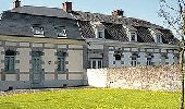
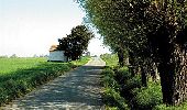
![Tour Zu Fuß Ath - Circuit des chapelles - Photo](https://media.geolcdn.com/t/1900/400/ext.pjpeg?maxdim=2&url=https%3A%2F%2Fpivotmedia.tourismewallonie.be%2FANX-02-000EST%2FANX-02-000EST.jpg)
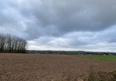
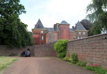
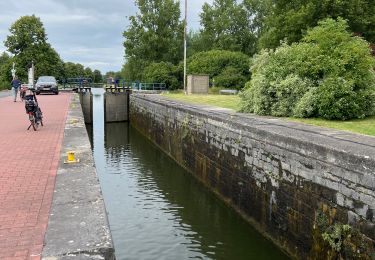
Circuit des chapelles
Commissariat général au Tourisme
Randonnées du CGT GUIDE+
![Länge](/images/other/stat-length.png)
Länge
11,1 km
![Maximale Höhe](https://static1.geolcdn.com/siteimages/upload/files/1508320355ic_sort_altitude_max_24dp.png)
Maximale Höhe
62 m
![Positive Höhendifferenz](https://static1.geolcdn.com/siteimages/upload/files/1508320355ic_sort_den_pos_24dp.png)
Positive Höhendifferenz
92 m
![Km-Effort](/images/other/stat-length.png)
Km-Effort
12,3 km
![Min. Höhe](https://static1.geolcdn.com/siteimages/upload/files/1508320355ic_sort_altitude_min_24dp.png)
Min. Höhe
23 m
![Negative Höhendifferenz](https://static1.geolcdn.com/siteimages/upload/files/1508320355ic_sort_den_neg_24dp.png)
Negative Höhendifferenz
94 m
![Boucle](https://static1.geolcdn.com/siteimages/upload/files/16400158638029165_repeat_loop_refresh_sync_direction_icon.png)
Boucle
Ja
Erstellungsdatum :
2022-02-08 11:36:10.545
Letzte Änderung :
2022-02-21 10:17:36.352
![Zu Fuß](https://static1.geolcdn.com/sitytour/trail-icons/100.png)
2h47
Schwierigkeit : Einfach
![Scannen Sie diesen QR-Code, um die Tour in der SityTrail-Anwendung zu öffnen](https://capi.geolives.com/qq0zvz2zws4bq2lad0pu/sitytour/trails/3081376/qr.png?size=200)
Kostenlosegpshiking-Anwendung
Über SityTrail
Tour Zu Fuß von 11,1 km verfügbar auf Wallonien, Hennegau, Ath. Diese Tour wird von Commissariat général au Tourisme vorgeschlagen.
Beschreibung
Trail created by Wallonie Picarde (Antenne Tournai) .
Ort
Land:
Belgium
Region :
Wallonien
Abteilung/Provinz :
Hennegau
Kommune :
Ath
Standort:
Unknown
Gehen Sie:(Dec)
Gehen Sie:(UTM)
559863 ; 5611079 (31U) N.
Kommentare
Touren in der Umgebung
![Tour Wandern Ath - GG2-Ha-26_Ath-Erbisoeul_2021-11-04 - Photo](https://media.geolcdn.com/t/375/260/92330c27-b822-40ac-9b26-3b2e2e0e14fe.jpg&format=jpg&maxdim=2)
![Wandern Wandern](https://static1.geolcdn.com/sitytour/trail-icons/101.png)
GG2-Ha-26_Ath-Erbisoeul_2021-11-04
Wandern
Medium
(1)
Ath,
Wallonien,
Hennegau,
Belgium
![](/images/other/stat-length.png)
24 km | 26 km-effort
5h 59min
![](https://static1.geolcdn.com/siteimages/upload/files/16400158638029165_repeat_loop_refresh_sync_direction_icon.png)
Nein
![Tour Wandern Ath - Dimanche 20/12/2020 - Photo](https://media.geolcdn.com/t/375/260/e7853499-b082-4f1a-bcac-5b446950aa41.jpg&format=jpg&maxdim=2)
![Wandern Wandern](https://static1.geolcdn.com/sitytour/trail-icons/101.png)
Dimanche 20/12/2020
Wandern
Einfach
(1)
Ath,
Wallonien,
Hennegau,
Belgium
![](/images/other/stat-length.png)
12,9 km | 14,4 km-effort
2h 42min
![](https://static1.geolcdn.com/siteimages/upload/files/16400158638029165_repeat_loop_refresh_sync_direction_icon.png)
Ja
![Tour Zu Fuß Ath - Sur les traces des tailleurs de pierre - Photo](https://media.geolcdn.com/t/375/260/ext.jpg?maxdim=2&url=https%3A%2F%2Fpivotmedia.tourismewallonie.be%2FANX-02-04JL-01MH%2FANX-02-04JL-01MH.jpg)
![Zu Fuß Zu Fuß](https://static1.geolcdn.com/sitytour/trail-icons/100.png)
Sur les traces des tailleurs de pierre
Zu Fuß
Einfach
Ath,
Wallonien,
Hennegau,
Belgium
![](/images/other/stat-length.png)
3,3 km | 3,6 km-effort
49min
![](https://static1.geolcdn.com/siteimages/upload/files/16400158638029165_repeat_loop_refresh_sync_direction_icon.png)
Ja
![Tour Zu Fuß Silly - Promenade des Châteaux et du Bois de la Provision - Photo](https://media.geolcdn.com/t/375/260/ext.jpg?maxdim=2&url=https%3A%2F%2Fpivotmedia.tourismewallonie.be%2FANX-02-04OE-001F%2FANX-02-04OE-001F.JPG)
![Zu Fuß Zu Fuß](https://static1.geolcdn.com/sitytour/trail-icons/100.png)
Promenade des Châteaux et du Bois de la Provision
Zu Fuß
Einfach
Silly,
Wallonien,
Hennegau,
Belgium
![](/images/other/stat-length.png)
10,2 km | 11,8 km-effort
2h 40min
![](https://static1.geolcdn.com/siteimages/upload/files/16400158638029165_repeat_loop_refresh_sync_direction_icon.png)
Ja
![Tour Zu Fuß Ath - Circuit Plaine de la Dendre - Photo](https://media.geolcdn.com/t/375/260/ext.jpg?maxdim=2&url=https%3A%2F%2Fpivotmedia.tourismewallonie.be%2FANX-02-000ESY%2FANX-02-000ESY.jpg)
![Zu Fuß Zu Fuß](https://static1.geolcdn.com/sitytour/trail-icons/100.png)
Circuit Plaine de la Dendre
Zu Fuß
Einfach
(1)
Ath,
Wallonien,
Hennegau,
Belgium
![](/images/other/stat-length.png)
8,9 km | 9,7 km-effort
2h 12min
![](https://static1.geolcdn.com/siteimages/upload/files/16400158638029165_repeat_loop_refresh_sync_direction_icon.png)
Ja
![Tour Wandern Silly - w-belgie-gondregnies - Photo](https://media.geolcdn.com/t/375/260/ext.jpg?maxdim=2&url=https%3A%2F%2Fstatic1.geolcdn.com%2Fsiteimages%2Fupload%2Ffiles%2F1553511878bg_sport_marche.png)
![Wandern Wandern](https://static1.geolcdn.com/sitytour/trail-icons/101.png)
w-belgie-gondregnies
Wandern
Sehr leicht
(1)
Silly,
Wallonien,
Hennegau,
Belgium
![](/images/other/stat-length.png)
10,1 km | 11,6 km-effort
Unbekannt
![](https://static1.geolcdn.com/siteimages/upload/files/16400158638029165_repeat_loop_refresh_sync_direction_icon.png)
Ja
![Tour Elektrofahrrad Ath - Entre la cité des géants et le château de Beloeil - Photo](https://media.geolcdn.com/t/375/260/d42d3fbb-98cc-4c8a-abd4-2d757f22feb5.jpg&format=jpg&maxdim=2)
![Elektrofahrrad Elektrofahrrad](https://static1.geolcdn.com/sitytour/trail-icons/205.png)
Entre la cité des géants et le château de Beloeil
Elektrofahrrad
Einfach
Ath,
Wallonien,
Hennegau,
Belgium
![](/images/other/stat-length.png)
41 km | 45 km-effort
2h 53min
![](https://static1.geolcdn.com/siteimages/upload/files/16400158638029165_repeat_loop_refresh_sync_direction_icon.png)
Ja
![Tour Wandern Ath - MESLIN-L'ÉVÊQUE _ ( Ath ) _ Marche Adeps _ HT_ 12/02/2023 - Photo](https://media.geolcdn.com/t/375/260/dff039e6-7dea-4336-a476-dde092f02ebd.jpg&format=jpg&maxdim=2)
![Wandern Wandern](https://static1.geolcdn.com/sitytour/trail-icons/101.png)
MESLIN-L'ÉVÊQUE _ ( Ath ) _ Marche Adeps _ HT_ 12/02/2023
Wandern
Medium
Ath,
Wallonien,
Hennegau,
Belgium
![](/images/other/stat-length.png)
20 km | 22 km-effort
4h 42min
![](https://static1.geolcdn.com/siteimages/upload/files/16400158638029165_repeat_loop_refresh_sync_direction_icon.png)
Ja
![Tour Wandern Silly - Gondregnies - bois de la Provision - Fouleng - Photo](https://media.geolcdn.com/t/375/260/4be76424-6eca-4a44-9151-f1b4a66b5b37.jpg&format=jpg&maxdim=2)
![Wandern Wandern](https://static1.geolcdn.com/sitytour/trail-icons/101.png)
Gondregnies - bois de la Provision - Fouleng
Wandern
Sehr leicht
Silly,
Wallonien,
Hennegau,
Belgium
![](/images/other/stat-length.png)
16,2 km | 18,2 km-effort
2h 10min
![](https://static1.geolcdn.com/siteimages/upload/files/16400158638029165_repeat_loop_refresh_sync_direction_icon.png)
Nein