![](/images/other/stat-length.png)
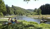
![Tour Zu Fuß Bouillon - AU FIL DE L'EAU DES ALEINES ALISNA asbl - Photo](https://media.geolcdn.com/t/1900/400/ext.pjpeg?maxdim=2&url=https%3A%2F%2Fpivotmedia.tourismewallonie.be%2FOTH-A0-0061-1FBG%2FOTH-A0-0061-1FBG.jpg)
AU FIL DE L'EAU DES ALEINES ALISNA asbl
Commissariat général au Tourisme
Randonnées du CGT GUIDE+
![Länge](/images/other/stat-length.png)
Länge
7,3 km
![Maximale Höhe](https://static1.geolcdn.com/siteimages/upload/files/1508320355ic_sort_altitude_max_24dp.png)
Maximale Höhe
329 m
![Positive Höhendifferenz](https://static1.geolcdn.com/siteimages/upload/files/1508320355ic_sort_den_pos_24dp.png)
Positive Höhendifferenz
209 m
![Km-Effort](/images/other/stat-length.png)
Km-Effort
10,1 km
![Min. Höhe](https://static1.geolcdn.com/siteimages/upload/files/1508320355ic_sort_altitude_min_24dp.png)
Min. Höhe
239 m
![Negative Höhendifferenz](https://static1.geolcdn.com/siteimages/upload/files/1508320355ic_sort_den_neg_24dp.png)
Negative Höhendifferenz
208 m
![Boucle](https://static1.geolcdn.com/siteimages/upload/files/16400158638029165_repeat_loop_refresh_sync_direction_icon.png)
Boucle
Ja
Erstellungsdatum :
2022-02-08 11:25:27.516
Letzte Änderung :
2022-02-21 10:06:48.699
![Zu Fuß](https://static1.geolcdn.com/sitytour/trail-icons/100.png)
2h17
Schwierigkeit : Einfach
![Scannen Sie diesen QR-Code, um die Tour in der SityTrail-Anwendung zu öffnen](https://capi.geolives.com/qq0zvz2zws4bq2lad0pu/sitytour/trails/3080474/qr.png?size=200)
Kostenlosegpshiking-Anwendung
Über SityTrail
Tour Zu Fuß von 7,3 km verfügbar auf Wallonien, Luxemburg, Bouillon. Diese Tour wird von Commissariat général au Tourisme vorgeschlagen.
Beschreibung
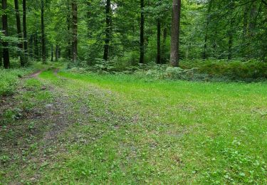
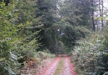
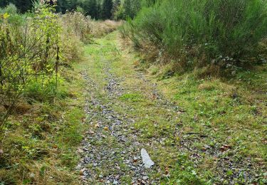
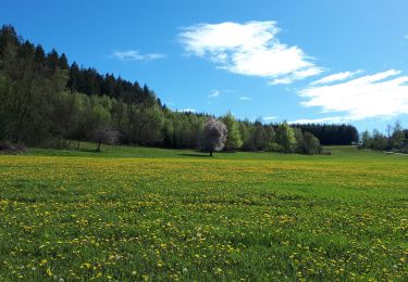
Trail created by Pays de Bouillon en Ardenne.
Ort
Land:
Belgium
Region :
Wallonien
Abteilung/Provinz :
Luxemburg
Kommune :
Bouillon
Standort:
Les Hayons
Gehen Sie:(Dec)
Gehen Sie:(UTM)
655717 ; 5519642 (31U) N.
Kommentare
Touren in der Umgebung
![Tour Andere Aktivitäten Bertrix - BX08 - Photo](https://media.geolcdn.com/t/375/260/ext.jpg?maxdim=2&url=https%3A%2F%2Fstatic1.geolcdn.com%2Fsiteimages%2Fupload%2Ffiles%2F1545311037marcheuse_200dpi.jpg)
![Andere Aktivitäten Andere Aktivitäten](https://static1.geolcdn.com/sitytour/trail-icons/900.png)
BX08
Andere Aktivitäten
Sehr leicht
(9)
Bertrix,
Wallonien,
Luxemburg,
Belgium
![](/images/other/stat-length.png)
7,3 km | 10 km-effort
2h 30min
![](https://static1.geolcdn.com/siteimages/upload/files/16400158638029165_repeat_loop_refresh_sync_direction_icon.png)
Ja
![Tour Andere Aktivitäten Bertrix - BX12 - Photo](https://media.geolcdn.com/t/375/260/ext.jpg?maxdim=2&url=https%3A%2F%2Fstatic1.geolcdn.com%2Fsiteimages%2Fupload%2Ffiles%2F1545311037marcheuse_200dpi.jpg)
![Andere Aktivitäten Andere Aktivitäten](https://static1.geolcdn.com/sitytour/trail-icons/900.png)
BX12
Andere Aktivitäten
Einfach
(16)
Bertrix,
Wallonien,
Luxemburg,
Belgium
![](/images/other/stat-length.png)
6,2 km | 7,9 km-effort
2h 0min
![](https://static1.geolcdn.com/siteimages/upload/files/16400158638029165_repeat_loop_refresh_sync_direction_icon.png)
Ja
![Tour Wandern Paliseul - En boucle Katanga Boi à Boule. - Photo](https://media.geolcdn.com/t/375/260/4aae9d99-5587-4453-9ca1-fd0154050aec.jpg&format=jpg&maxdim=2)
![Wandern Wandern](https://static1.geolcdn.com/sitytour/trail-icons/101.png)
En boucle Katanga Boi à Boule.
Wandern
Einfach
(1)
Paliseul,
Wallonien,
Luxemburg,
Belgium
![](/images/other/stat-length.png)
4,1 km | 5,5 km-effort
1h 14min
![](https://static1.geolcdn.com/siteimages/upload/files/16400158638029165_repeat_loop_refresh_sync_direction_icon.png)
Ja
![Tour Wandern Bertrix - cornichai 02 - Photo](https://media.geolcdn.com/t/375/260/ext.jpg?maxdim=2&url=https%3A%2F%2Fservices.sitytrail.com%2FGeolivesWS%2FDownloadMedia.ashx%3FTrailID%3D344278%26Media%3Dfix__20140911103800.jpg)
![Wandern Wandern](https://static1.geolcdn.com/sitytour/trail-icons/101.png)
cornichai 02
Wandern
Medium
(3)
Bertrix,
Wallonien,
Luxemburg,
Belgium
![](/images/other/stat-length.png)
10,5 km | 13,7 km-effort
2h 5min
![](https://static1.geolcdn.com/siteimages/upload/files/16400158638029165_repeat_loop_refresh_sync_direction_icon.png)
Ja
![Tour Wandern Paliseul - boucle Cul du Péreu par le Pont de Prêtre par le Pont de Prêtre - Photo](https://media.geolcdn.com/t/375/260/f763b6d6-ac3e-4070-9f93-6b225b212f44.jpg&format=jpg&maxdim=2)
![Wandern Wandern](https://static1.geolcdn.com/sitytour/trail-icons/101.png)
boucle Cul du Péreu par le Pont de Prêtre par le Pont de Prêtre
Wandern
Medium
(1)
Paliseul,
Wallonien,
Luxemburg,
Belgium
![](/images/other/stat-length.png)
6,1 km | 8 km-effort
1h 51min
![](https://static1.geolcdn.com/siteimages/upload/files/16400158638029165_repeat_loop_refresh_sync_direction_icon.png)
Ja
![Tour Wandern Bouillon - GR16 SEMOIS 1 : Dohan - Photo](https://media.geolcdn.com/t/375/260/5a72d435-6e63-4e10-8243-a0a93e161c94.jpg&format=jpg&maxdim=2)
![Wandern Wandern](https://static1.geolcdn.com/sitytour/trail-icons/101.png)
GR16 SEMOIS 1 : Dohan
Wandern
Einfach
(1)
Bouillon,
Wallonien,
Luxemburg,
Belgium
![](/images/other/stat-length.png)
6,7 km | 8,3 km-effort
1h 19min
![](https://static1.geolcdn.com/siteimages/upload/files/16400158638029165_repeat_loop_refresh_sync_direction_icon.png)
Ja
![Tour Andere Aktivitäten Bertrix - BX14 - Photo](https://media.geolcdn.com/t/375/260/ext.jpg?maxdim=2&url=https%3A%2F%2Fstatic1.geolcdn.com%2Fsiteimages%2Fupload%2Ffiles%2F1545311037marcheuse_200dpi.jpg)
![Andere Aktivitäten Andere Aktivitäten](https://static1.geolcdn.com/sitytour/trail-icons/900.png)
BX14
Andere Aktivitäten
Medium
(5)
Bertrix,
Wallonien,
Luxemburg,
Belgium
![](/images/other/stat-length.png)
10,3 km | 12,8 km-effort
3h 0min
![](https://static1.geolcdn.com/siteimages/upload/files/16400158638029165_repeat_loop_refresh_sync_direction_icon.png)
Ja
![Tour Andere Aktivitäten Bertrix - BX13 - Photo](https://media.geolcdn.com/t/375/260/ext.jpg?maxdim=2&url=https%3A%2F%2Fstatic1.geolcdn.com%2Fsiteimages%2Fupload%2Ffiles%2F1545311037marcheuse_200dpi.jpg)
![Andere Aktivitäten Andere Aktivitäten](https://static1.geolcdn.com/sitytour/trail-icons/900.png)
BX13
Andere Aktivitäten
Medium
(7)
Bertrix,
Wallonien,
Luxemburg,
Belgium
![](/images/other/stat-length.png)
9,6 km | 12,6 km-effort
2h 40min
![](https://static1.geolcdn.com/siteimages/upload/files/16400158638029165_repeat_loop_refresh_sync_direction_icon.png)
Ja
![Tour Andere Aktivitäten Bertrix - BX18 - Photo](https://media.geolcdn.com/t/375/260/ext.jpg?maxdim=2&url=https%3A%2F%2Fstatic1.geolcdn.com%2Fsiteimages%2Fupload%2Ffiles%2F1545311037marcheuse_200dpi.jpg)
![Andere Aktivitäten Andere Aktivitäten](https://static1.geolcdn.com/sitytour/trail-icons/900.png)
BX18
Andere Aktivitäten
Medium
(3)
Bertrix,
Wallonien,
Luxemburg,
Belgium
![](/images/other/stat-length.png)
7,2 km | 10 km-effort
2h 20min
![](https://static1.geolcdn.com/siteimages/upload/files/16400158638029165_repeat_loop_refresh_sync_direction_icon.png)
Ja
mooie omgeving