![](/images/other/stat-length.png)
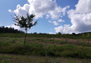
![Tour Mountainbike Manhay - VTT 2 - Photo](https://media.geolcdn.com/t/1900/400/ext.pjpeg?maxdim=2&url=https%3A%2F%2Fpivotmedia.tourismewallonie.be%2FOTH-A0-005A-4LMF%2FOTH-A0-005A-4LMF.jpg)
VTT 2
Commissariat général au Tourisme
Randonnées du CGT GUIDE+
![Länge](/images/other/stat-length.png)
Länge
22 km
![Maximale Höhe](https://static1.geolcdn.com/siteimages/upload/files/1508320355ic_sort_altitude_max_24dp.png)
Maximale Höhe
636 m
![Positive Höhendifferenz](https://static1.geolcdn.com/siteimages/upload/files/1508320355ic_sort_den_pos_24dp.png)
Positive Höhendifferenz
557 m
![Km-Effort](/images/other/stat-length.png)
Km-Effort
30 km
![Min. Höhe](https://static1.geolcdn.com/siteimages/upload/files/1508320355ic_sort_altitude_min_24dp.png)
Min. Höhe
415 m
![Negative Höhendifferenz](https://static1.geolcdn.com/siteimages/upload/files/1508320355ic_sort_den_neg_24dp.png)
Negative Höhendifferenz
557 m
![Boucle](https://static1.geolcdn.com/siteimages/upload/files/16400158638029165_repeat_loop_refresh_sync_direction_icon.png)
Boucle
Ja
Erstellungsdatum :
2022-02-08 11:22:25.152
Letzte Änderung :
2022-02-21 10:03:34.312
![Mountainbike](https://static1.geolcdn.com/sitytour/trail-icons/202.png)
2h03
Schwierigkeit : Medium
![Scannen Sie diesen QR-Code, um die Tour in der SityTrail-Anwendung zu öffnen](https://capi.geolives.com/qq0zvz2zws4bq2lad0pu/sitytour/trails/3080152/qr.png?size=200)
Kostenlosegpshiking-Anwendung
Über SityTrail
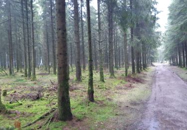
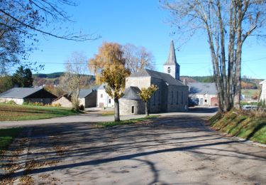
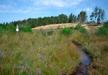
Tour Mountainbike von 22 km verfügbar auf Wallonien, Luxemburg, Manhay. Diese Tour wird von Commissariat général au Tourisme vorgeschlagen.
Beschreibung
Trail created by Cœur de l'Ardenne, au fil de l'Ourthe & de l'Aisne.
Ort
Land:
Belgium
Region :
Wallonien
Abteilung/Provinz :
Luxemburg
Kommune :
Manhay
Standort:
Unknown
Gehen Sie:(Dec)
Gehen Sie:(UTM)
690544 ; 5574414 (31U) N.
Kommentare
Touren in der Umgebung
![Tour Wandern Érezée - Hoursinne. Natura 2000, des sites qui valent le détour. Lx 1 - Photo](https://media.geolcdn.com/t/375/260/ext.jpg?maxdim=2&url=https%3A%2F%2Fservices.sitytrail.com%2FGeolivesWS%2FDownloadMedia.ashx%3FTrailID%3D142589%26Media%3Df0338fc2-a78f-45f3-92a6-ccf3ccce12cc.JPG)
![Wandern Wandern](https://static1.geolcdn.com/sitytour/trail-icons/101.png)
Hoursinne. Natura 2000, des sites qui valent le détour. Lx 1
Wandern
Schwierig
(9)
Érezée,
Wallonien,
Luxemburg,
Belgium
![](/images/other/stat-length.png)
8,1 km | 10,8 km-effort
2h 19min
![](https://static1.geolcdn.com/siteimages/upload/files/16400158638029165_repeat_loop_refresh_sync_direction_icon.png)
Ja
![Tour Wandern Manhay - 2021-06-30_10h25m20_Cirkwi-PLANTISSE_(Commune_de_MANHAY) - Photo](https://media.geolcdn.com/t/375/260/b60c879b-a532-47f8-9457-412a61021edd.jpg&format=jpg&maxdim=2)
![Wandern Wandern](https://static1.geolcdn.com/sitytour/trail-icons/101.png)
2021-06-30_10h25m20_Cirkwi-PLANTISSE_(Commune_de_MANHAY)
Wandern
Einfach
(3)
Manhay,
Wallonien,
Luxemburg,
Belgium
![](/images/other/stat-length.png)
12,8 km | 16,7 km-effort
3h 47min
![](https://static1.geolcdn.com/siteimages/upload/files/16400158638029165_repeat_loop_refresh_sync_direction_icon.png)
Ja
![Tour Wandern Vielsalm - baraque fraiture . rocher du diable . vallée de la géhe . la fondroule . Thier de la forge . las des cignes grognons . fraiture . baraque fraiture - Photo](https://media.geolcdn.com/t/375/260/1a4faef5-7559-417e-99e4-27ecaefd718d.jpg&format=jpg&maxdim=2)
![Wandern Wandern](https://static1.geolcdn.com/sitytour/trail-icons/101.png)
baraque fraiture . rocher du diable . vallée de la géhe . la fondroule . Thi...
Wandern
Sehr leicht
(4)
Vielsalm,
Wallonien,
Luxemburg,
Belgium
![](/images/other/stat-length.png)
12,1 km | 16,5 km-effort
3h 24min
![](https://static1.geolcdn.com/siteimages/upload/files/16400158638029165_repeat_loop_refresh_sync_direction_icon.png)
Ja
![Wandern Wandern](https://static1.geolcdn.com/sitytour/trail-icons/101.png)
RB-Lu-32_Malempré_Boucle-1
Wandern
Medium
(1)
Manhay,
Wallonien,
Luxemburg,
Belgium
![](/images/other/stat-length.png)
23 km | 30 km-effort
6h 18min
![](https://static1.geolcdn.com/siteimages/upload/files/16400158638029165_repeat_loop_refresh_sync_direction_icon.png)
Ja
![Wandern Wandern](https://static1.geolcdn.com/sitytour/trail-icons/101.png)
RB-Lu-32_Malempré
Wandern
Sehr schwierig
(2)
Manhay,
Wallonien,
Luxemburg,
Belgium
![](/images/other/stat-length.png)
22 km | 29 km-effort
6h 29min
![](https://static1.geolcdn.com/siteimages/upload/files/16400158638029165_repeat_loop_refresh_sync_direction_icon.png)
Ja
![Tour Wandern Manhay - Odeigne, Natura 2000 - Des sites qui valent le détour. Lx10 - Photo](https://media.geolcdn.com/t/375/260/ext.jpg?maxdim=2&url=https%3A%2F%2Fservices.sitytrail.com%2FGeolivesWS%2FDownloadMedia.ashx%3FTrailID%3D181914%26Media%3D2ebe3571-d68b-4ddb-98f1-22a093149033.jpg)
![Wandern Wandern](https://static1.geolcdn.com/sitytour/trail-icons/101.png)
Odeigne, Natura 2000 - Des sites qui valent le détour. Lx10
Wandern
Einfach
(5)
Manhay,
Wallonien,
Luxemburg,
Belgium
![](/images/other/stat-length.png)
8,8 km | 10,9 km-effort
2h 23min
![](https://static1.geolcdn.com/siteimages/upload/files/16400158638029165_repeat_loop_refresh_sync_direction_icon.png)
Ja
![Tour Wandern Érezée - Hoursine-Hoursine 12kms - Photo](https://media.geolcdn.com/t/375/260/c996774c-2642-4a86-94e0-eab3c7bcc053.jpg&format=jpg&maxdim=2)
![Wandern Wandern](https://static1.geolcdn.com/sitytour/trail-icons/101.png)
Hoursine-Hoursine 12kms
Wandern
Schwierig
(1)
Érezée,
Wallonien,
Luxemburg,
Belgium
![](/images/other/stat-length.png)
12,5 km | 17,1 km-effort
3h 37min
![](https://static1.geolcdn.com/siteimages/upload/files/16400158638029165_repeat_loop_refresh_sync_direction_icon.png)
Ja
![Tour Wandern Manhay - Derieux - Photo](https://media.geolcdn.com/t/375/260/ext.jpg?maxdim=2&url=https%3A%2F%2Fservices.sitytrail.com%2FGeolivesWS%2FDownloadMedia.ashx%3FTrailID%3D203687%26Media%3D881bc979-a407-486b-a86a-96a8c5851a06.jpg)
![Wandern Wandern](https://static1.geolcdn.com/sitytour/trail-icons/101.png)
Derieux
Wandern
Sehr leicht
(4)
Manhay,
Wallonien,
Luxemburg,
Belgium
![](/images/other/stat-length.png)
10,1 km | 12,8 km-effort
2h 44min
![](https://static1.geolcdn.com/siteimages/upload/files/16400158638029165_repeat_loop_refresh_sync_direction_icon.png)
Ja
![Tour Wandern Manhay - Adeps Manhay 2019 - Photo](https://media.geolcdn.com/t/375/260/973befab-8fc0-4d15-a847-1005c7bc733e.jpg&format=jpg&maxdim=2)
![Wandern Wandern](https://static1.geolcdn.com/sitytour/trail-icons/101.png)
Adeps Manhay 2019
Wandern
(1)
Manhay,
Wallonien,
Luxemburg,
Belgium
![](/images/other/stat-length.png)
10,2 km | 13,3 km-effort
1h 58min
![](https://static1.geolcdn.com/siteimages/upload/files/16400158638029165_repeat_loop_refresh_sync_direction_icon.png)
Ja
Belle rando, à recommander.