![](/images/other/stat-length.png)
![Tour Wandern Aucelon - Col de Pennes - Photo](https://media.geolcdn.com/t/1900/400/e2c39de6-5320-415f-8eb7-c526a1164e2d.jpg&format=pjpeg&maxdim=2)
Col de Pennes
ajd26
Benutzer
![Länge](/images/other/stat-length.png)
![Maximale Höhe](https://static1.geolcdn.com/siteimages/upload/files/1508320355ic_sort_altitude_max_24dp.png)
![Positive Höhendifferenz](https://static1.geolcdn.com/siteimages/upload/files/1508320355ic_sort_den_pos_24dp.png)
![Km-Effort](/images/other/stat-length.png)
![Min. Höhe](https://static1.geolcdn.com/siteimages/upload/files/1508320355ic_sort_altitude_min_24dp.png)
![Negative Höhendifferenz](https://static1.geolcdn.com/siteimages/upload/files/1508320355ic_sort_den_neg_24dp.png)
![Boucle](https://static1.geolcdn.com/siteimages/upload/files/16400158638029165_repeat_loop_refresh_sync_direction_icon.png)
![Wandern](https://static1.geolcdn.com/sitytour/trail-icons/101.png)
4h46
Schwierigkeit : Medium
![Scannen Sie diesen QR-Code, um die Tour in der SityTrail-Anwendung zu öffnen](https://capi.geolives.com/qq0zvz2zws4bq2lad0pu/sitytour/trails/3074928/qr.png?size=200)
Kostenlosegpshiking-Anwendung
Über SityTrail
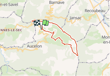
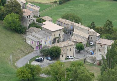
Tour Wandern von 14,2 km verfügbar auf Auvergne-Rhone-Alpen, Drôme, Aucelon. Diese Tour wird von ajd26 vorgeschlagen.
Beschreibung
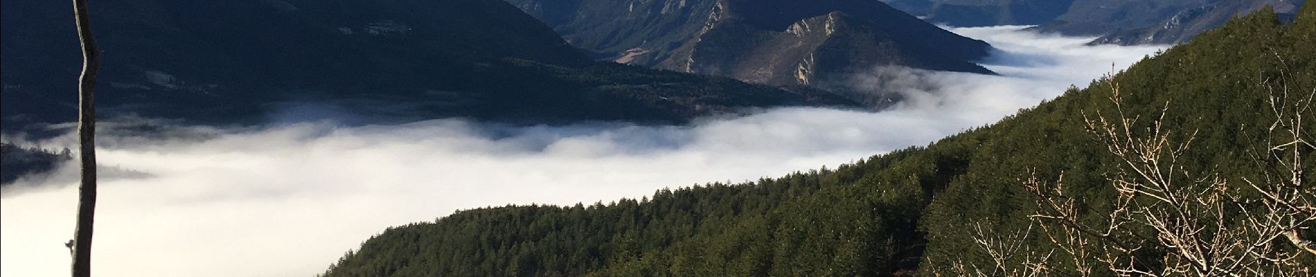
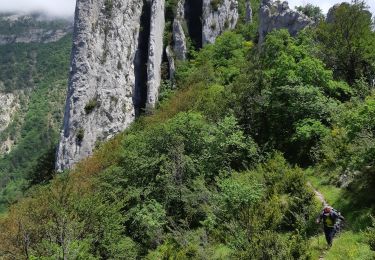
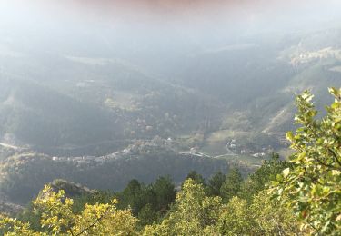
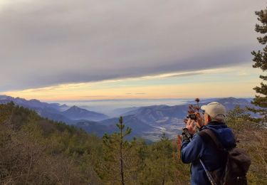
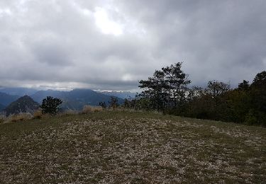
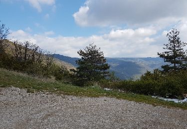
depuis le Deves, montée au col de Pennes et déambulation sur les crêtes (6km) avec de superbes panoramas sur la vallée de la Drome et le Dévoluy magnifique
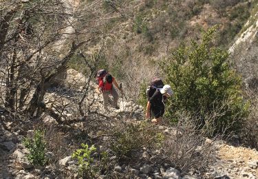
sur le retour, au km 12, possibilité de continuer par la piste car le petit sentier est un peu hasardeux sur la fin
Ort
Kommentare
Touren in der Umgebung
![Tour Wandern Rimon-et-Savel - 26 lames de pennes savel jp - Photo](https://media.geolcdn.com/t/375/260/f2bea45a-9c65-4d39-b93d-6507c3374444.jpg&format=jpg&maxdim=2)
![Wandern Wandern](https://static1.geolcdn.com/sitytour/trail-icons/101.png)
Wandern
![](/images/other/stat-length.png)
![](https://static1.geolcdn.com/siteimages/upload/files/16400158638029165_repeat_loop_refresh_sync_direction_icon.png)
![Tour Wandern Rimon-et-Savel - balcons de la Roanne - Photo](https://media.geolcdn.com/t/375/260/6f529a2b-52ed-4864-b6b1-e2b0e3236399.jpg&format=jpg&maxdim=2)
![Wandern Wandern](https://static1.geolcdn.com/sitytour/trail-icons/101.png)
Wandern
![](/images/other/stat-length.png)
![](https://static1.geolcdn.com/siteimages/upload/files/16400158638029165_repeat_loop_refresh_sync_direction_icon.png)
![Tour Wandern Rimon-et-Savel - rimon 2/1/2022 - Photo](https://media.geolcdn.com/t/375/260/d71302a3-bf5b-468d-ad27-fcad37c90032.jpg&format=jpg&maxdim=2)
![Wandern Wandern](https://static1.geolcdn.com/sitytour/trail-icons/101.png)
Wandern
![](/images/other/stat-length.png)
![](https://static1.geolcdn.com/siteimages/upload/files/16400158638029165_repeat_loop_refresh_sync_direction_icon.png)
![Tour Rennrad Recoubeau-Jansac - col de Penne - Photo](https://media.geolcdn.com/t/375/260/47037570-c0aa-4718-9214-10ee3d6f6cd7.jpg&format=jpg&maxdim=2)
![Rennrad Rennrad](https://static1.geolcdn.com/sitytour/trail-icons/201.png)
Rennrad
![](/images/other/stat-length.png)
![](https://static1.geolcdn.com/siteimages/upload/files/16400158638029165_repeat_loop_refresh_sync_direction_icon.png)
![Tour Wandern Aucelon - la montagne d Aucelon - Photo](https://media.geolcdn.com/t/375/260/418d345f-bb1e-4446-b000-4d78372a3cd9.jpg&format=jpg&maxdim=2)
![Wandern Wandern](https://static1.geolcdn.com/sitytour/trail-icons/101.png)
Wandern
![](/images/other/stat-length.png)
![](https://static1.geolcdn.com/siteimages/upload/files/16400158638029165_repeat_loop_refresh_sync_direction_icon.png)
![Tour Wandern Rimon-et-Savel - Savel - La Pale - Photo](https://media.geolcdn.com/t/375/260/6ba554c1-703a-4efa-8a00-2064218d8db8.jpg&format=jpg&maxdim=2)
![Wandern Wandern](https://static1.geolcdn.com/sitytour/trail-icons/101.png)
Wandern
![](/images/other/stat-length.png)
![](https://static1.geolcdn.com/siteimages/upload/files/16400158638029165_repeat_loop_refresh_sync_direction_icon.png)
![Wandern Wandern](https://static1.geolcdn.com/sitytour/trail-icons/101.png)
Wandern
![](/images/other/stat-length.png)
![](https://static1.geolcdn.com/siteimages/upload/files/16400158638029165_repeat_loop_refresh_sync_direction_icon.png)
![Tour Mountainbike Recoubeau-Jansac - 08/05/2017 Recoubeau/Luc/Claps/ Col de Clamontard/Clpas/Recoubeau - Photo](https://media.geolcdn.com/t/375/260/ext.jpg?maxdim=2&url=https%3A%2F%2Fservices.sitytrail.com%2FGeolivesWS%2FDownloadMedia.ashx%3FTrailID%3D749284%26Media%3Dfix__20170508102853.jpg)
![Mountainbike Mountainbike](https://static1.geolcdn.com/sitytour/trail-icons/202.png)
Mountainbike
![](/images/other/stat-length.png)
![](https://static1.geolcdn.com/siteimages/upload/files/16400158638029165_repeat_loop_refresh_sync_direction_icon.png)
![Tour Mountainbike Recoubeau-Jansac - 28-04-2017 Recoubeau - Col de Pennes - Photo](https://media.geolcdn.com/t/375/260/ext.jpg?maxdim=2&url=https%3A%2F%2Fservices.sitytrail.com%2FGeolivesWS%2FDownloadMedia.ashx%3FTrailID%3D744501%26Media%3Dfix__20170428161817.jpg)
![Mountainbike Mountainbike](https://static1.geolcdn.com/sitytour/trail-icons/202.png)
Mountainbike
![](/images/other/stat-length.png)
![](https://static1.geolcdn.com/siteimages/upload/files/16400158638029165_repeat_loop_refresh_sync_direction_icon.png)