![](/images/other/stat-length.png)
![Tour Wandern Aramits - ARAMITS reco une virée chez les mousquetaires - Photo](https://media.geolcdn.com/t/1900/400/50c51182-6ae8-4170-a0f8-16c80cc5d770.jpg&format=pjpeg&maxdim=2)
ARAMITS reco une virée chez les mousquetaires
marmotte65
Benutzer GUIDE
![Länge](/images/other/stat-length.png)
![Maximale Höhe](https://static1.geolcdn.com/siteimages/upload/files/1508320355ic_sort_altitude_max_24dp.png)
![Positive Höhendifferenz](https://static1.geolcdn.com/siteimages/upload/files/1508320355ic_sort_den_pos_24dp.png)
![Km-Effort](/images/other/stat-length.png)
![Min. Höhe](https://static1.geolcdn.com/siteimages/upload/files/1508320355ic_sort_altitude_min_24dp.png)
![Negative Höhendifferenz](https://static1.geolcdn.com/siteimages/upload/files/1508320355ic_sort_den_neg_24dp.png)
![Boucle](https://static1.geolcdn.com/siteimages/upload/files/16400158638029165_repeat_loop_refresh_sync_direction_icon.png)
![Wandern](https://static1.geolcdn.com/sitytour/trail-icons/101.png)
4h56
Schwierigkeit : Medium
![Scannen Sie diesen QR-Code, um die Tour in der SityTrail-Anwendung zu öffnen](https://capi.geolives.com/qq0zvz2zws4bq2lad0pu/sitytour/trails/3072478/qr.png?size=200)
Kostenlosegpshiking-Anwendung
Über SityTrail
Tour Wandern von 11,3 km verfügbar auf Neu-Aquitanien, Pyrenäen-Atlantik, Aramits. Diese Tour wird von marmotte65 vorgeschlagen.
Beschreibung
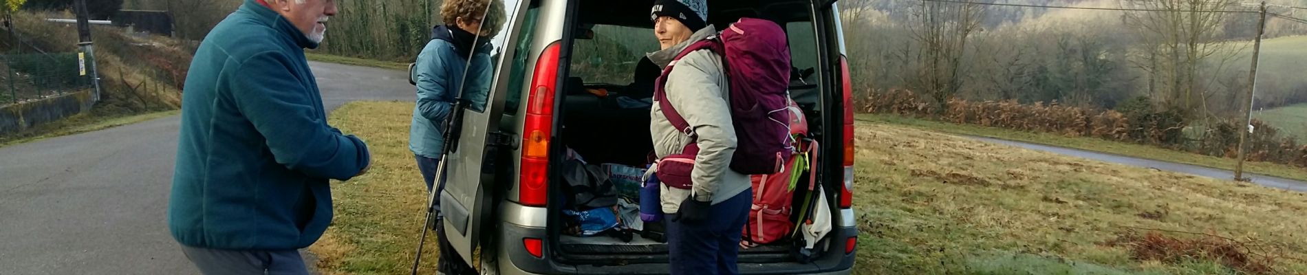
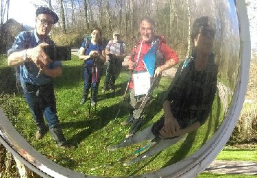
Randonnée reconnue le 1/02/2022 avec May J-c et M-J Launai.
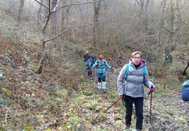
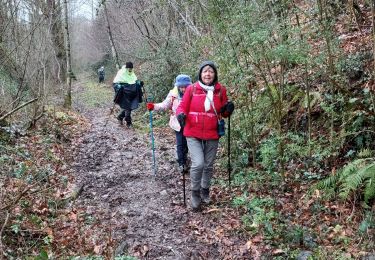
ça commence mal une barrière à 200m du départ. Donc on prend la route du retour. 2eme Barriere, on continue sur la route jusqu'au lieu dit Serres. Là une gentille dame nous explique que , au dessus d'une barrière canadienne (que nous avons effectivement trouver entre Aramits et le parking) , les animaux sont en liberté et les barrières sont faite pour éviter que les dit animaux ne viennent dans les jardins ou autre propriété privée. Donc nous pouvons passer ces barrières moyennant bien sur de les refermer. Nous trouverons plus loin des passages boueux voire même très boueux, et un talus de 3 mètres environ mais très très glissant heureusement. que de jeunes arbres ont prévus de nous donner un coup de main.
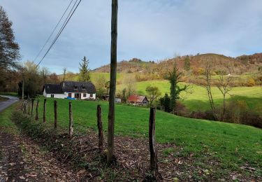
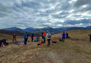
un magnifique plateau nous attend il sera d'ailleurs le lieu de notre PN le jour de la sortie. Le soum de Casteigts sera contourné par la droite ce qui va réduire la distance, mais c'était le but recherché. et apres 4h56 de reconnaissance nous retrouvons mon Kangoo préféré
Ort
Kommentare
Touren in der Umgebung
![Tour Wandern Lanne-en-Barétous - Chemin des pantières - Lanne en Barétous - Photo](https://media.geolcdn.com/t/375/260/ext.jpg?maxdim=2&url=https%3A%2F%2Fservices.sitytrail.com%2FGeolivesWS%2FDownloadMedia.ashx%3FTrailID%3D111301%26Media%3D6944_1.jpg)
![Wandern Wandern](https://static1.geolcdn.com/sitytour/trail-icons/101.png)
Wandern
![](/images/other/stat-length.png)
![](https://static1.geolcdn.com/siteimages/upload/files/16400158638029165_repeat_loop_refresh_sync_direction_icon.png)
![Tour Wandern Aramits - ARAMITS](https://media.geolcdn.com/t/375/260/c7b1e929-0ed2-4e23-bdf2-493bd9adce6a.jpg&format=jpg&maxdim=2)
![Wandern Wandern](https://static1.geolcdn.com/sitytour/trail-icons/101.png)
Wandern
![](/images/other/stat-length.png)
![](https://static1.geolcdn.com/siteimages/upload/files/16400158638029165_repeat_loop_refresh_sync_direction_icon.png)
![Tour Wandern Ance-Féas - Ance Unars G3 2021 - Photo](https://media.geolcdn.com/t/375/260/5484398e-627e-4050-b331-9b372303d130.jpg&format=jpg&maxdim=2)
![Wandern Wandern](https://static1.geolcdn.com/sitytour/trail-icons/101.png)
Wandern
![](/images/other/stat-length.png)
![](https://static1.geolcdn.com/siteimages/upload/files/16400158638029165_repeat_loop_refresh_sync_direction_icon.png)
![Tour Wandern Lanne-en-Barétous - lanneenbaretous fait - Photo](https://media.geolcdn.com/t/375/260/ext.jpg?maxdim=2&url=https%3A%2F%2Fservices.sitytrail.com%2FGeolivesWS%2FDownloadMedia.ashx%3FTrailID%3D914539%26Media%3Dfix__20180216145645.jpg)
![Wandern Wandern](https://static1.geolcdn.com/sitytour/trail-icons/101.png)
Wandern
![](/images/other/stat-length.png)
![](https://static1.geolcdn.com/siteimages/upload/files/16400158638029165_repeat_loop_refresh_sync_direction_icon.png)
![Tour Zu Fuß Arette - ARETTE le tour du Soum de Casteigt](https://media.geolcdn.com/t/375/260/ext.jpg?maxdim=2&url=https%3A%2F%2Fstatic1.geolcdn.com%2Fsiteimages%2Fupload%2Ffiles%2F1545311037marcheuse_200dpi.jpg)
![Zu Fuß Zu Fuß](https://static1.geolcdn.com/sitytour/trail-icons/100.png)
Zu Fuß
![](/images/other/stat-length.png)
![](https://static1.geolcdn.com/siteimages/upload/files/16400158638029165_repeat_loop_refresh_sync_direction_icon.png)
![Tour Wandern Lanne-en-Barétous - G4 lanne baretous fait - Photo](https://media.geolcdn.com/t/375/260/3c01b4ab-28a4-4173-8668-e8ae72bd17f2.jpg&format=jpg&maxdim=2)
![Wandern Wandern](https://static1.geolcdn.com/sitytour/trail-icons/101.png)
Wandern
![](/images/other/stat-length.png)
![](https://static1.geolcdn.com/siteimages/upload/files/16400158638029165_repeat_loop_refresh_sync_direction_icon.png)
![Tour Wandern Aramits - G3Aramits fait2022 - Photo](https://media.geolcdn.com/t/375/260/162ec701-cfcb-43c4-8f78-e759a71026b5.jpg&format=jpg&maxdim=2)
![Wandern Wandern](https://static1.geolcdn.com/sitytour/trail-icons/101.png)
Wandern
![](/images/other/stat-length.png)
![](https://static1.geolcdn.com/siteimages/upload/files/16400158638029165_repeat_loop_refresh_sync_direction_icon.png)
![Tour Zu Fuß Arette - Crêtes d'Issor - Photo](https://media.geolcdn.com/t/375/260/ext.jpg?maxdim=2&url=https%3A%2F%2Fstatic1.geolcdn.com%2Fsiteimages%2Fupload%2Ffiles%2F1545311037marcheuse_200dpi.jpg)
![Zu Fuß Zu Fuß](https://static1.geolcdn.com/sitytour/trail-icons/100.png)
Zu Fuß
![](/images/other/stat-length.png)
![](https://static1.geolcdn.com/siteimages/upload/files/16400158638029165_repeat_loop_refresh_sync_direction_icon.png)
![Tour Wandern Aramits - De Aramits à Ance - Photo](https://media.geolcdn.com/t/375/260/ext.jpg?maxdim=2&url=https%3A%2F%2Fservices.sitytrail.com%2FGeolivesWS%2FDownloadMedia.ashx%3FTrailID%3D172350%26Media%3D13684_1.jpg)
![Wandern Wandern](https://static1.geolcdn.com/sitytour/trail-icons/101.png)
Wandern
![](/images/other/stat-length.png)
![](https://static1.geolcdn.com/siteimages/upload/files/16400158638029165_repeat_loop_refresh_sync_direction_icon.png)