


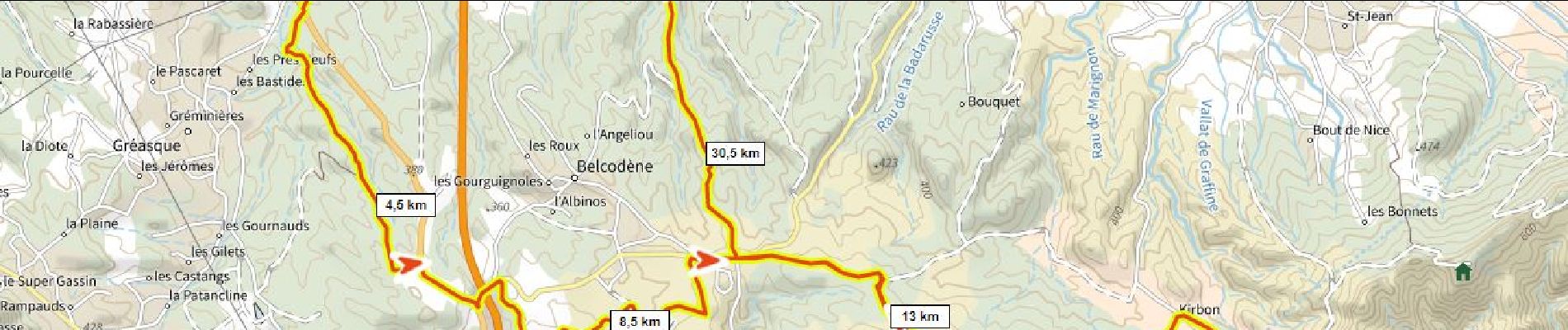
33 km | 43 km-effort

Benutzer


Kostenlosegpshiking-Anwendung
 SityTrail
IGN / Geografische Institute
SityTrail World
Die Welt öffnet sich für Sie
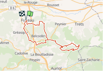
Tour Mountainbike von 38 km verfügbar auf Provence-Alpes-Côte d'Azur, Bouches-du-Rhône, Fuveau. Diese Tour wird von ericberlin vorgeschlagen.
Fuveau Pigeonnier par GR dans la foret de Gréasque, Vigie du Regagnas, Pas de la Couelle, Kirbon, Pigeonnier, Les Michels, Fuveau.
Variante de retour plus courte: retour du Pigeonnier a Fuveau via la route de Belcodène


Mountainbike

Wandern

Mountainbike

Rennrad

Mountainbike

Wandern

Rennrad

Rennrad
Rennrad