![](/images/other/stat-length.png)
![Tour Wandern Offlanges - Offlange_Hermitage_Moissey 18km - Photo](https://media.geolcdn.com/t/1900/400/ext.pjpeg?maxdim=2&url=https%3A%2F%2Fservices.sitytrail.com%2FGeolivesWS%2FDownloadMedia.ashx%3FTrailID%3D305458%26Media%3Dfix__20140525154041.jpg)
Offlange_Hermitage_Moissey 18km
cmike39
Benutzer
![Länge](/images/other/stat-length.png)
Länge
17,9 km
![Maximale Höhe](https://static1.geolcdn.com/siteimages/upload/files/1508320355ic_sort_altitude_max_24dp.png)
Maximale Höhe
384 m
![Positive Höhendifferenz](https://static1.geolcdn.com/siteimages/upload/files/1508320355ic_sort_den_pos_24dp.png)
Positive Höhendifferenz
364 m
![Km-Effort](/images/other/stat-length.png)
Km-Effort
23 km
![Min. Höhe](https://static1.geolcdn.com/siteimages/upload/files/1508320355ic_sort_altitude_min_24dp.png)
Min. Höhe
219 m
![Negative Höhendifferenz](https://static1.geolcdn.com/siteimages/upload/files/1508320355ic_sort_den_neg_24dp.png)
Negative Höhendifferenz
363 m
![Boucle](https://static1.geolcdn.com/siteimages/upload/files/16400158638029165_repeat_loop_refresh_sync_direction_icon.png)
Boucle
Ja
Erstellungsdatum :
2014-12-10 00:00:00.0
Letzte Änderung :
2014-12-10 00:00:00.0
![Wandern](https://static1.geolcdn.com/sitytour/trail-icons/101.png)
4h51
Schwierigkeit : Medium
![Scannen Sie diesen QR-Code, um die Tour in der SityTrail-Anwendung zu öffnen](https://capi.geolives.com/qq0zvz2zws4bq2lad0pu/sitytour/trails/305458/qr.png?size=200)
Kostenlosegpshiking-Anwendung
Über SityTrail
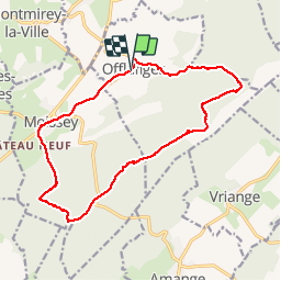
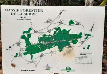
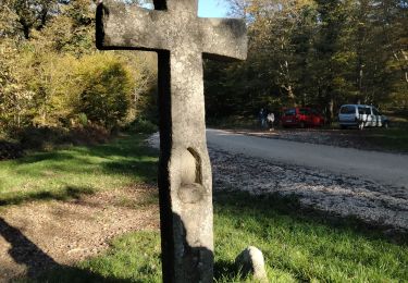
Tour Wandern von 17,9 km verfügbar auf Burgund und Freigrafschaft, Jura, Offlanges. Diese Tour wird von cmike39 vorgeschlagen.
Beschreibung
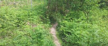
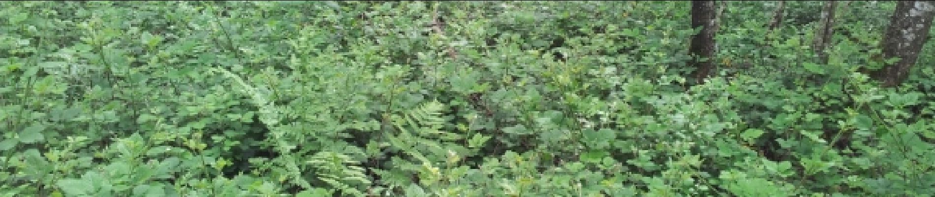
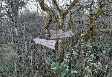
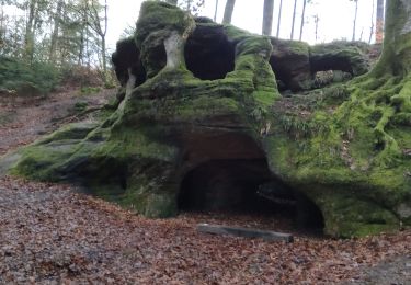
Randonnée FRA. Chemin dans le Ruisseau des Gorges probablement impraticable en période humide si le débit est important.
Ort
Land:
France
Region :
Burgund und Freigrafschaft
Abteilung/Provinz :
Jura
Kommune :
Offlanges
Standort:
Unknown
Gehen Sie:(Dec)
Gehen Sie:(UTM)
693099 ; 5231370 (31T) N.
Kommentare
Touren in der Umgebung
![Tour Nordic Walking Vriange - Vriange - La Serre - Photo](https://media.geolcdn.com/t/375/260/ext.jpg?maxdim=2&url=https%3A%2F%2Fservices.sitytrail.com%2FGeolivesWS%2FDownloadMedia.ashx%3FTrailID%3D215897%26Media%3Dfix__20130822171149.jpg)
![Nordic Walking Nordic Walking](https://static1.geolcdn.com/sitytour/trail-icons/102.png)
Vriange - La Serre
Nordic Walking
Schwierig
(1)
Vriange,
Burgund und Freigrafschaft,
Jura,
France
![](/images/other/stat-length.png)
8,5 km | 11,4 km-effort
1h 47min
![](https://static1.geolcdn.com/siteimages/upload/files/16400158638029165_repeat_loop_refresh_sync_direction_icon.png)
Ja
![Tour Wandern Amange - Malange 20171009 - Photo](https://media.geolcdn.com/t/375/260/ext.jpg?maxdim=2&url=https%3A%2F%2Fstatic1.geolcdn.com%2Fsiteimages%2Fupload%2Ffiles%2F1553511878bg_sport_marche.png)
![Wandern Wandern](https://static1.geolcdn.com/sitytour/trail-icons/101.png)
Malange 20171009
Wandern
Sehr leicht
(1)
Amange,
Burgund und Freigrafschaft,
Jura,
France
![](/images/other/stat-length.png)
10 km | 13,3 km-effort
2h 45min
![](https://static1.geolcdn.com/siteimages/upload/files/16400158638029165_repeat_loop_refresh_sync_direction_icon.png)
Ja
![Tour Wandern Vriange - Le massif de la Serre. - Photo](https://media.geolcdn.com/t/375/260/2556d62c-7072-4944-b1e9-45e09ff6cd79.jpg&format=jpg&maxdim=2)
![Wandern Wandern](https://static1.geolcdn.com/sitytour/trail-icons/101.png)
Le massif de la Serre.
Wandern
Schwierig
Vriange,
Burgund und Freigrafschaft,
Jura,
France
![](/images/other/stat-length.png)
13,3 km | 19 km-effort
5h 46min
![](https://static1.geolcdn.com/siteimages/upload/files/16400158638029165_repeat_loop_refresh_sync_direction_icon.png)
Ja
![Tour Wandern Menotey - Menotey 6.1 km 20230107 - Photo](https://media.geolcdn.com/t/375/260/b0dcaba6-2582-4de9-a721-24859ee6865e.jpg&format=jpg&maxdim=2)
![Wandern Wandern](https://static1.geolcdn.com/sitytour/trail-icons/101.png)
Menotey 6.1 km 20230107
Wandern
Medium
Menotey,
Burgund und Freigrafschaft,
Jura,
France
![](/images/other/stat-length.png)
6,4 km | 8 km-effort
1h 29min
![](https://static1.geolcdn.com/siteimages/upload/files/16400158638029165_repeat_loop_refresh_sync_direction_icon.png)
Ja
![Tour Wandern Menotey - Menotey 6.1 km 20230107 - Photo](https://media.geolcdn.com/t/375/260/9d6bc004-c494-40b4-a3db-502b478c6648.jpg&format=jpg&maxdim=2)
![Wandern Wandern](https://static1.geolcdn.com/sitytour/trail-icons/101.png)
Menotey 6.1 km 20230107
Wandern
Medium
Menotey,
Burgund und Freigrafschaft,
Jura,
France
![](/images/other/stat-length.png)
6,4 km | 8 km-effort
1h 29min
![](https://static1.geolcdn.com/siteimages/upload/files/16400158638029165_repeat_loop_refresh_sync_direction_icon.png)
Ja
![Tour Wandern Moissey - MOISSEY 20131226 - Photo](https://media.geolcdn.com/t/375/260/ext.jpg?maxdim=2&url=https%3A%2F%2Fservices.sitytrail.com%2FGeolivesWS%2FDownloadMedia.ashx%3FTrailID%3D325563%26Media%3Dfix__20131227170531.jpg)
![Wandern Wandern](https://static1.geolcdn.com/sitytour/trail-icons/101.png)
MOISSEY 20131226
Wandern
Medium
Moissey,
Burgund und Freigrafschaft,
Jura,
France
![](/images/other/stat-length.png)
14,2 km | 18,3 km-effort
3h 25min
![](https://static1.geolcdn.com/siteimages/upload/files/16400158638029165_repeat_loop_refresh_sync_direction_icon.png)
Ja
![Tour Wandern Amange - amange stade - Photo](https://media.geolcdn.com/t/375/260/270b2990-5e8a-475b-b9d9-febd7a31b5ec.jpg&format=jpg&maxdim=2)
![Wandern Wandern](https://static1.geolcdn.com/sitytour/trail-icons/101.png)
amange stade
Wandern
Schwierig
Amange,
Burgund und Freigrafschaft,
Jura,
France
![](/images/other/stat-length.png)
10,8 km | 14,8 km-effort
3h 3min
![](https://static1.geolcdn.com/siteimages/upload/files/16400158638029165_repeat_loop_refresh_sync_direction_icon.png)
Ja
![Tour Nordic Walking Amange - hermitage amange - Photo](https://media.geolcdn.com/t/375/260/c36d0f73-f309-4de0-98e4-dd101cb0af30.jpg&format=jpg&maxdim=2)
![Nordic Walking Nordic Walking](https://static1.geolcdn.com/sitytour/trail-icons/102.png)
hermitage amange
Nordic Walking
Medium
Amange,
Burgund und Freigrafschaft,
Jura,
France
![](/images/other/stat-length.png)
9,3 km | 12 km-effort
2h 39min
![](https://static1.geolcdn.com/siteimages/upload/files/16400158638029165_repeat_loop_refresh_sync_direction_icon.png)
Ja
![Tour Nordic Walking Amange - amange - Photo](https://media.geolcdn.com/t/375/260/eb9f2b9f-cb07-4aad-9143-a182aab3059d.jpg&format=jpg&maxdim=2)
![Nordic Walking Nordic Walking](https://static1.geolcdn.com/sitytour/trail-icons/102.png)
amange
Nordic Walking
Sehr leicht
Amange,
Burgund und Freigrafschaft,
Jura,
France
![](/images/other/stat-length.png)
4 km | 5,8 km-effort
1h 39min
![](https://static1.geolcdn.com/siteimages/upload/files/16400158638029165_repeat_loop_refresh_sync_direction_icon.png)
Nein