


6,5 km | 7,7 km-effort


Club randonnées SERVON


Kostenlosegpshiking-Anwendung
 SityTrail
IGN / Geografische Institute
SityTrail World
Die Welt öffnet sich für Sie
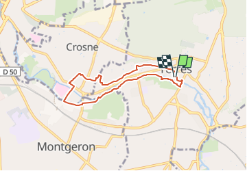
Tour Zu Fuß von 6,6 km verfügbar auf Île-de-France, Essonne, Yerres. Diese Tour wird von Les 1000 pattes vorgeschlagen.
Parking du collège Guillaume Budé (rue Charles De Gaulle) à Yerres
Trajet Servon-->Parking (11km: 20mn)

Zu Fuß

Wandern

Wandern

Wandern
Wandern

Zu Fuß

Wandern

Zu Fuß

Wandern