


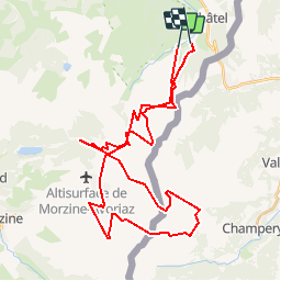


16,5 km | 30 km-effort


Benutzer


Kostenlosegpshiking-Anwendung
 SityTrail
IGN / Geografische Institute
SityTrail World
Die Welt öffnet sich für Sie
Tour Andere Aktivitäten von 42 km verfügbar auf Auvergne-Rhone-Alpen, Hochsavoyen, Châtel. Diese Tour wird von astronaef vorgeschlagen.
Au départ de Châtel, petit tour des Portes du Soleil. Châtel-Avoriaz-Les Crozets-Les Lindarets-Châtel.

Wandern

Wandern

Schneeschuhwandern

Schneeschuhwandern
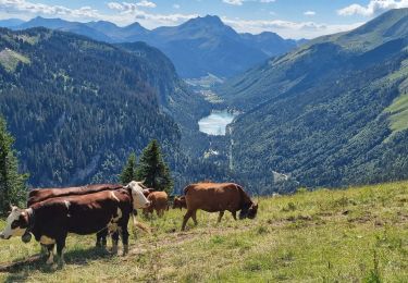
Wandern
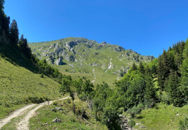
Wandern

Schneeschuhwandern

Wandern
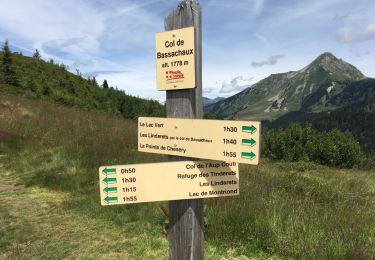
Wandern