![](/images/other/stat-length.png)
![Tour Wandern Neufchâteau - GRANDVOIR - Photo](https://media.geolcdn.com/t/1900/400/ext.pjpeg?maxdim=2&url=https%3A%2F%2Fstatic1.geolcdn.com%2Fsiteimages%2Fupload%2Ffiles%2F1553511878bg_sport_marche.png)
GRANDVOIR
BVB
Benutzer
![Länge](/images/other/stat-length.png)
Länge
20 km
![Maximale Höhe](https://static1.geolcdn.com/siteimages/upload/files/1508320355ic_sort_altitude_max_24dp.png)
Maximale Höhe
480 m
![Positive Höhendifferenz](https://static1.geolcdn.com/siteimages/upload/files/1508320355ic_sort_den_pos_24dp.png)
Positive Höhendifferenz
385 m
![Km-Effort](/images/other/stat-length.png)
Km-Effort
25 km
![Min. Höhe](https://static1.geolcdn.com/siteimages/upload/files/1508320355ic_sort_altitude_min_24dp.png)
Min. Höhe
380 m
![Negative Höhendifferenz](https://static1.geolcdn.com/siteimages/upload/files/1508320355ic_sort_den_neg_24dp.png)
Negative Höhendifferenz
389 m
![Boucle](https://static1.geolcdn.com/siteimages/upload/files/16400158638029165_repeat_loop_refresh_sync_direction_icon.png)
Boucle
Ja
Erstellungsdatum :
2021-12-30 09:52:25.429
Letzte Änderung :
2021-12-30 14:43:27.394
![Wandern](https://static1.geolcdn.com/sitytour/trail-icons/101.png)
4h17
Schwierigkeit : Einfach
![Scannen Sie diesen QR-Code, um die Tour in der SityTrail-Anwendung zu öffnen](https://capi.geolives.com/qq0zvz2zws4bq2lad0pu/sitytour/trails/3036953/qr.png?size=200)
Kostenlosegpshiking-Anwendung
Über SityTrail
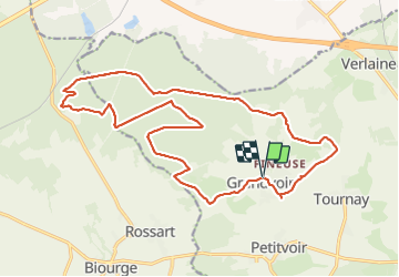
Tour Wandern von 20 km verfügbar auf Wallonien, Luxemburg, Neufchâteau. Diese Tour wird von BVB vorgeschlagen.
Beschreibung
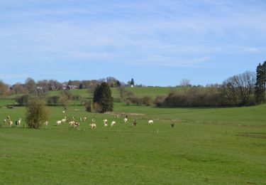
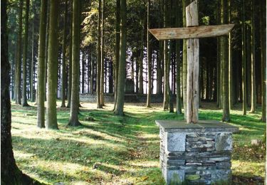
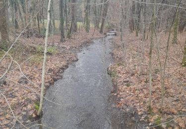
Promenade autour de GRANDVOIR.
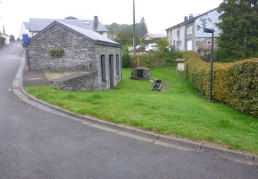
Pas de village à traverser.
Bien veiller à se renseigner préalablement sur les risques de chasse.
Ort
Land:
Belgium
Region :
Wallonien
Abteilung/Provinz :
Luxemburg
Kommune :
Neufchâteau
Standort:
Unknown
Gehen Sie:(Dec)
Gehen Sie:(UTM)
670526 ; 5525606 (31U) N.
Kommentare
Touren in der Umgebung
![Wandern Wandern](https://static1.geolcdn.com/sitytour/trail-icons/101.png)
RB-Lu-21_Neufchâteau
Wandern
Sehr leicht
(8)
Neufchâteau,
Wallonien,
Luxemburg,
Belgium
![](/images/other/stat-length.png)
24 km | 31 km-effort
6h 29min
![](https://static1.geolcdn.com/siteimages/upload/files/16400158638029165_repeat_loop_refresh_sync_direction_icon.png)
Ja
![Wandern Wandern](https://static1.geolcdn.com/sitytour/trail-icons/101.png)
RB-Lu-21_Neufchâteau_via-racc-1
Wandern
Sehr leicht
(2)
Neufchâteau,
Wallonien,
Luxemburg,
Belgium
![](/images/other/stat-length.png)
11,2 km | 14,4 km-effort
3h 4min
![](https://static1.geolcdn.com/siteimages/upload/files/16400158638029165_repeat_loop_refresh_sync_direction_icon.png)
Ja
![Tour Wandern Libramont-Chevigny - 5. Wandeling op niet-verharde weg aan het begin van het dorp Lamouline - Photo](https://media.geolcdn.com/t/375/260/ext.jpg?maxdim=2&url=https%3A%2F%2Fservices.sitytrail.com%2FGeolivesWS%2FDownloadMedia.ashx%3FTrailID%3D537894%26Media%3Dd4f09763-3f4e-4f58-b9ef-7a20178fcd7b.jpg)
![Wandern Wandern](https://static1.geolcdn.com/sitytour/trail-icons/101.png)
5. Wandeling op niet-verharde weg aan het begin van het dorp Lamouline
Wandern
Einfach
(2)
Libramont-Chevigny,
Wallonien,
Luxemburg,
Belgium
![](/images/other/stat-length.png)
5 km | 6,1 km-effort
1h 21min
![](https://static1.geolcdn.com/siteimages/upload/files/16400158638029165_repeat_loop_refresh_sync_direction_icon.png)
Ja
![Tour Wandern Libramont-Chevigny - Libramont - 8. La promenade des Tchèts - LB011 - Photo](https://media.geolcdn.com/t/375/260/ext.jpg?maxdim=2&url=https%3A%2F%2Fservices.sitytrail.com%2FGeolivesWS%2FDownloadMedia.ashx%3FTrailID%3D442633%26Media%3D8ab8b917-8443-457f-8363-9f761d3ed013.JPG)
![Wandern Wandern](https://static1.geolcdn.com/sitytour/trail-icons/101.png)
Libramont - 8. La promenade des Tchèts - LB011 ...
Wandern
Schwierig
(2)
Libramont-Chevigny,
Wallonien,
Luxemburg,
Belgium
![](/images/other/stat-length.png)
10,6 km | 13,1 km-effort
3h 9min
![](https://static1.geolcdn.com/siteimages/upload/files/16400158638029165_repeat_loop_refresh_sync_direction_icon.png)
Ja
![Tour Andere Aktivitäten Bertrix - BX10 - Photo](https://media.geolcdn.com/t/375/260/ext.jpg?maxdim=2&url=https%3A%2F%2Fstatic1.geolcdn.com%2Fsiteimages%2Fupload%2Ffiles%2F1545311037marcheuse_200dpi.jpg)
![Andere Aktivitäten Andere Aktivitäten](https://static1.geolcdn.com/sitytour/trail-icons/900.png)
BX10
Andere Aktivitäten
Schwierig
(2)
Bertrix,
Wallonien,
Luxemburg,
Belgium
![](/images/other/stat-length.png)
13,3 km | 16,6 km-effort
3h 30min
![](https://static1.geolcdn.com/siteimages/upload/files/16400158638029165_repeat_loop_refresh_sync_direction_icon.png)
Ja
![Tour Andere Aktivitäten Bertrix - BX09 - Photo](https://media.geolcdn.com/t/375/260/ext.jpg?maxdim=2&url=https%3A%2F%2Fstatic1.geolcdn.com%2Fsiteimages%2Fupload%2Ffiles%2F1545311037marcheuse_200dpi.jpg)
![Andere Aktivitäten Andere Aktivitäten](https://static1.geolcdn.com/sitytour/trail-icons/900.png)
BX09
Andere Aktivitäten
Sehr leicht
(2)
Bertrix,
Wallonien,
Luxemburg,
Belgium
![](/images/other/stat-length.png)
9,6 km | 11,9 km-effort
3h 0min
![](https://static1.geolcdn.com/siteimages/upload/files/16400158638029165_repeat_loop_refresh_sync_direction_icon.png)
Ja
![Tour Wandern Neufchâteau - Le Sentier du Bois d'Ospôt - Photo](https://media.geolcdn.com/t/375/260/ext.jpg?maxdim=2&url=https%3A%2F%2Fservices.sitytrail.com%2FGeolivesWS%2FDownloadMedia.ashx%3FTrailID%3D314177%26Media%3Da3f0c943-b6aa-42ba-a976-375fc630bff4.jpg)
![Wandern Wandern](https://static1.geolcdn.com/sitytour/trail-icons/101.png)
Le Sentier du Bois d'Ospôt
Wandern
Einfach
(2)
Neufchâteau,
Wallonien,
Luxemburg,
Belgium
![](/images/other/stat-length.png)
6,6 km | 8,2 km-effort
1h 48min
![](https://static1.geolcdn.com/siteimages/upload/files/16400158638029165_repeat_loop_refresh_sync_direction_icon.png)
Ja
![Tour Wandern Bertrix - rando 10 km à Biourge. - Photo](https://media.geolcdn.com/t/375/260/4739c308-1983-4f0a-a633-b6182505858a.jpg&format=jpg&maxdim=2)
![Wandern Wandern](https://static1.geolcdn.com/sitytour/trail-icons/101.png)
rando 10 km à Biourge.
Wandern
Einfach
Bertrix,
Wallonien,
Luxemburg,
Belgium
![](/images/other/stat-length.png)
9,5 km | 11,7 km-effort
2h 0min
![](https://static1.geolcdn.com/siteimages/upload/files/16400158638029165_repeat_loop_refresh_sync_direction_icon.png)
Ja
![Tour Zu Fuß Neufchâteau - Promenade des Vannettes - Photo](https://media.geolcdn.com/t/375/260/c94cab10-49b6-4e98-8b22-803163741678.jpeg&format=jpg&maxdim=2)
![Zu Fuß Zu Fuß](https://static1.geolcdn.com/sitytour/trail-icons/100.png)
Promenade des Vannettes
Zu Fuß
Einfach
Neufchâteau,
Wallonien,
Luxemburg,
Belgium
![](/images/other/stat-length.png)
12,4 km | 16 km-effort
3h 38min
![](https://static1.geolcdn.com/siteimages/upload/files/16400158638029165_repeat_loop_refresh_sync_direction_icon.png)
Ja