![](/images/other/stat-length.png)
![Tour Wandern Saint-Bauzille-de-Montmel - stbauzilledemontmel_fontanes_stecroixdequintilllargue - Photo](https://media.geolcdn.com/t/1900/400/5d9042db-183c-4625-a930-e6694d4a6729.jpg&format=pjpeg&maxdim=2)
stbauzilledemontmel_fontanes_stecroixdequintilllargue
v.rabot
Benutzer
![Länge](/images/other/stat-length.png)
![Maximale Höhe](https://static1.geolcdn.com/siteimages/upload/files/1508320355ic_sort_altitude_max_24dp.png)
![Positive Höhendifferenz](https://static1.geolcdn.com/siteimages/upload/files/1508320355ic_sort_den_pos_24dp.png)
![Km-Effort](/images/other/stat-length.png)
![Min. Höhe](https://static1.geolcdn.com/siteimages/upload/files/1508320355ic_sort_altitude_min_24dp.png)
![Negative Höhendifferenz](https://static1.geolcdn.com/siteimages/upload/files/1508320355ic_sort_den_neg_24dp.png)
![Boucle](https://static1.geolcdn.com/siteimages/upload/files/16400158638029165_repeat_loop_refresh_sync_direction_icon.png)
![Wandern](https://static1.geolcdn.com/sitytour/trail-icons/101.png)
5h23
Schwierigkeit : Medium
![Scannen Sie diesen QR-Code, um die Tour in der SityTrail-Anwendung zu öffnen](https://capi.geolives.com/qq0zvz2zws4bq2lad0pu/sitytour/trails/3036861/qr.png?size=200)
Kostenlosegpshiking-Anwendung
Über SityTrail
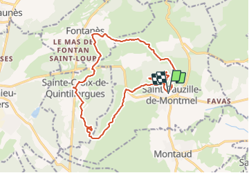
Tour Wandern von 19,9 km verfügbar auf Okzitanien, Hérault, Saint-Bauzille-de-Montmel. Diese Tour wird von v.rabot vorgeschlagen.
Beschreibung
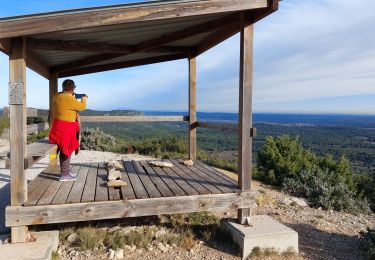
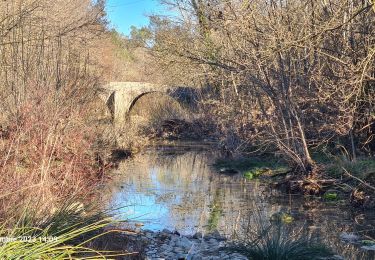
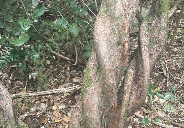
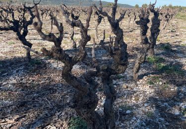
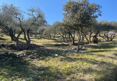
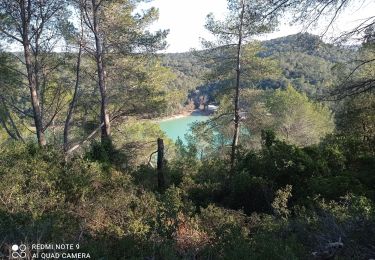
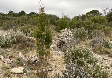
Partant du parking près du cimetière de saint bauzille de Montmel, nous contournons le Puech des mourgues pour nous rendre à Fontanès, puis sur sainte croix de Quintillargues en passant par la spirale, puis revenons au point de vue du bois de Mounié où on pourra admirer sur le parcours les anciens four à chaud ou les charbonnières puis retour vers le puech de Mourgues, attention un petit passage de rû où il faut faire attention , dans l'épingle la table d'orientation où on pourra par beau temps voir le canigou, passage aux ruines du couvent et redescente sur le parking.
Ort
Kommentare
Touren in der Umgebung
![Tour Wandern Sainte-Croix-de-Quintillargues - Ste Croix de Quintillargues - Photo](https://media.geolcdn.com/t/375/260/ext.jpg?maxdim=2&url=https%3A%2F%2Fstatic1.geolcdn.com%2Fsiteimages%2Fupload%2Ffiles%2F1553511878bg_sport_marche.png)
![Wandern Wandern](https://static1.geolcdn.com/sitytour/trail-icons/101.png)
Wandern
![](/images/other/stat-length.png)
![](https://static1.geolcdn.com/siteimages/upload/files/16400158638029165_repeat_loop_refresh_sync_direction_icon.png)
![Tour sport Fontanès - Fontanes - Photo](https://media.geolcdn.com/t/375/260/1d9c4f50-de68-4de6-a46d-3eba75c7d0ac.jpg&format=jpg&maxdim=2)
![Tour Wandern Saint-Bauzille-de-Montmel - Puech des Mourgues - Photo](https://media.geolcdn.com/t/375/260/778d0258-477b-444e-94ad-029be09d1018.jpg&format=jpg&maxdim=2)
![Wandern Wandern](https://static1.geolcdn.com/sitytour/trail-icons/101.png)
Wandern
![](/images/other/stat-length.png)
![](https://static1.geolcdn.com/siteimages/upload/files/16400158638029165_repeat_loop_refresh_sync_direction_icon.png)
![Tour Wandern Vacquières - chapelle D'Aleyrac vers vacquieres parc du duc - Photo](https://media.geolcdn.com/t/375/260/1016cbc1-84d7-4082-b269-d91c1919b57d.jpg&format=jpg&maxdim=2)
![Wandern Wandern](https://static1.geolcdn.com/sitytour/trail-icons/101.png)
Wandern
![](/images/other/stat-length.png)
![](https://static1.geolcdn.com/siteimages/upload/files/16400158638029165_repeat_loop_refresh_sync_direction_icon.png)
![Tour Wandern Garrigues - Le bois de Paris - Photo](https://media.geolcdn.com/t/375/260/8deae6f9-09fb-4d62-a1cb-2b84c26d3682.jpg&format=jpg&maxdim=2)
![Wandern Wandern](https://static1.geolcdn.com/sitytour/trail-icons/101.png)
Wandern
![](/images/other/stat-length.png)
![](https://static1.geolcdn.com/siteimages/upload/files/16400158638029165_repeat_loop_refresh_sync_direction_icon.png)
![Tour Wandern Sainte-Croix-de-Quintillargues - St croix de quintillargues Mas du Greffier M’ont la Suque - Photo](https://media.geolcdn.com/t/375/260/2f227888-4e40-44ad-b59b-0e71e99ca2dc.jpg&format=jpg&maxdim=2)
![Wandern Wandern](https://static1.geolcdn.com/sitytour/trail-icons/101.png)
Wandern
![](/images/other/stat-length.png)
![](https://static1.geolcdn.com/siteimages/upload/files/16400158638029165_repeat_loop_refresh_sync_direction_icon.png)
![Tour Wandern Valflaunès - Lancyre en Liberté - Photo](https://media.geolcdn.com/t/375/260/2bc24bf9-7978-483e-952c-4da54ff91812.jpg&format=jpg&maxdim=2)
![Wandern Wandern](https://static1.geolcdn.com/sitytour/trail-icons/101.png)
Wandern
![](/images/other/stat-length.png)
![](https://static1.geolcdn.com/siteimages/upload/files/16400158638029165_repeat_loop_refresh_sync_direction_icon.png)
![Tour Wandern Sainte-Croix-de-Quintillargues - 34 lac de ceceles par la suque26 01 2023 - Photo](https://media.geolcdn.com/t/375/260/62d02f8e-4b6c-4448-983c-345b9727b6c2.jpg&format=jpg&maxdim=2)
![Wandern Wandern](https://static1.geolcdn.com/sitytour/trail-icons/101.png)
Wandern
![](/images/other/stat-length.png)
![](https://static1.geolcdn.com/siteimages/upload/files/16400158638029165_repeat_loop_refresh_sync_direction_icon.png)
![Tour Wandern Saint-Bauzille-de-Montmel - Le puech des Mourgues - Photo](https://media.geolcdn.com/t/375/260/ba8498e5-37b7-400d-b727-112a8855b4e1.jpg&format=jpg&maxdim=2)
![Wandern Wandern](https://static1.geolcdn.com/sitytour/trail-icons/101.png)
Wandern
![](/images/other/stat-length.png)
![](https://static1.geolcdn.com/siteimages/upload/files/16400158638029165_repeat_loop_refresh_sync_direction_icon.png)