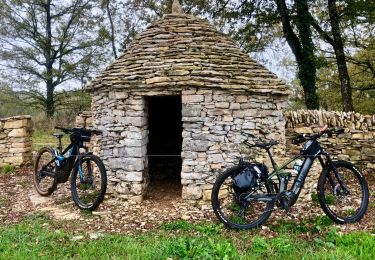

VTT Ste Croix-Bannac 40km 750D+

Levillefranchois
Benutzer

Länge
40 km

Maximale Höhe
429 m

Positive Höhendifferenz
627 m

Km-Effort
48 km

Min. Höhe
330 m

Negative Höhendifferenz
627 m
Boucle
Ja
Erstellungsdatum :
2021-12-23 08:48:18.603
Letzte Änderung :
2021-12-23 08:54:02.396
--
Schwierigkeit : Einfach

Kostenlosegpshiking-Anwendung
Über SityTrail
Tour Mountainbike von 40 km verfügbar auf Okzitanien, Aveyron, Sainte-Croix. Diese Tour wird von Levillefranchois vorgeschlagen.
Beschreibung
Départ à l'église de Ste Croix.
Parcours très roulant dans l'ensemble.
Joli tour du lac de Bannac et tables de picnic.
Ort
Land:
France
Region :
Okzitanien
Abteilung/Provinz :
Aveyron
Kommune :
Sainte-Croix
Standort:
Unknown
Gehen Sie:(Dec)
Gehen Sie:(UTM)
417742 ; 4919750 (31T) N.
Kommentare
Touren in der Umgebung

Balade autour de Sainte-Croix - Circuit 1


Zu Fuß
Einfach
Sainte-Croix,
Okzitanien,
Aveyron,
France

4,2 km | 5,3 km-effort
1h 12min
Ja

Balade autour de Sainte-Croix - Circuit 2


Zu Fuß
Einfach
Sainte-Croix,
Okzitanien,
Aveyron,
France

4,9 km | 6,2 km-effort
1h 24min
Nein

Balade autour de Sainte-Croix - Circuit 3


Zu Fuß
Einfach
Sainte-Croix,
Okzitanien,
Aveyron,
France

6,5 km | 8,1 km-effort
1h 50min
Ja

Circuit des 3 clochers


Zu Fuß
Einfach
Sainte-Croix,
Okzitanien,
Aveyron,
France

13,9 km | 17,4 km-effort
3h 57min
Ja

VTT Ste Croix 37km 840D+ (+Christian) 2024-11-18 17:24:00


Mountainbike
Medium
Sainte-Croix,
Okzitanien,
Aveyron,
France

36 km | 46 km-effort
3h 9min
Ja

la capelle maroule puyjourdes loule anglars les buis lacapelle


Mountainbike
Medium
La Capelle-Balaguier,
Okzitanien,
Aveyron,
France

31 km | 40 km-effort
2h 52min
Ja

la capelle anglars estrabols borieangle croix belge saut mounine trep et reto...


Mountainbike
Medium
La Capelle-Balaguier,
Okzitanien,
Aveyron,
France

32 km | 40 km-effort
3h 8min
Ja

Boucle de Lacapelle Balaguier


Wandern
Medium
La Capelle-Balaguier,
Okzitanien,
Aveyron,
France

14 km | 18,4 km-effort
3h 0min
Ja

VTT La Capelle B.


Mountainbike
Medium
Saujac,
Okzitanien,
Aveyron,
France

38 km | 48 km-effort
3h 18min
Ja


 SityTrail


