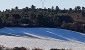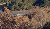

1Callelongue, vers Valensole

liocol
Benutzer

Länge
9 km

Maximale Höhe
466 m

Positive Höhendifferenz
173 m

Km-Effort
11,3 km

Min. Höhe
305 m

Negative Höhendifferenz
175 m
Boucle
Ja
Erstellungsdatum :
2021-12-13 08:18:12.969
Letzte Änderung :
2021-12-14 10:28:29.915
2h32
Schwierigkeit : Medium

Kostenlosegpshiking-Anwendung
Über SityTrail
Tour Wandern von 9 km verfügbar auf Provence-Alpes-Côte d'Azur, Alpes-de-Haute-Provence, Gréoux-les-Bains. Diese Tour wird von liocol vorgeschlagen.
Beschreibung
Direction Valensole, après les 4 chemins, garez vous 200 m à droite.
Au début du retour, le sentier n'est pas bien marqué, mais vous voyez en dessous le chemin à prendre.
Prenez le chemin de la Villa Romaine.
Ort
Land:
France
Region :
Provence-Alpes-Côte d'Azur
Abteilung/Provinz :
Alpes-de-Haute-Provence
Kommune :
Gréoux-les-Bains
Standort:
Unknown
Gehen Sie:(Dec)
Gehen Sie:(UTM)
728495 ; 4853354 (31T) N.
Kommentare
Touren in der Umgebung
20220612 - Gréoux les Bains - Découverte


Wandern
Medium
(1)
Gréoux-les-Bains,
Provence-Alpes-Côte d'Azur,
Alpes-de-Haute-Provence,
France

6,2 km | 7,8 km-effort
2h 5min
Ja
De Gréoux les Bains au Lac d'Esparron


Mountainbike
Medium
(2)
Gréoux-les-Bains,
Provence-Alpes-Côte d'Azur,
Alpes-de-Haute-Provence,
France

22 km | 30 km-effort
2h 0min
Ja

MANOSQUE VOLX PAR LES COLLINES O S


Wandern
Schwierig
Manosque,
Provence-Alpes-Côte d'Azur,
Alpes-de-Haute-Provence,
France

17,7 km | 24 km-effort
4h 15min
Ja
20220617 - Gréoux 6.5 Km


Wandern
Medium
Gréoux-les-Bains,
Provence-Alpes-Côte d'Azur,
Alpes-de-Haute-Provence,
France

6,5 km | 7,9 km-effort
2h 0min
Ja
20220616 - Gréoux-les-Bains - Visite château


Wandern
Medium
Gréoux-les-Bains,
Provence-Alpes-Côte d'Azur,
Alpes-de-Haute-Provence,
France

6,9 km | 9 km-effort
2h 34min
Ja
08-04-2022 Gréoux - Les Maurras


Wandern
Einfach
Gréoux-les-Bains,
Provence-Alpes-Côte d'Azur,
Alpes-de-Haute-Provence,
France

15,2 km | 21 km-effort
3h 43min
Ja

Le tour de la borie '' pain de sucre ''


Wandern
Einfach
(1)
Manosque,
Provence-Alpes-Côte d'Azur,
Alpes-de-Haute-Provence,
France

5,1 km | 7,4 km-effort
1h 43min
Ja

VTT Single spirit - Gréoux les Bains


Mountainbike
Schwierig
(2)
Gréoux-les-Bains,
Provence-Alpes-Côte d'Azur,
Alpes-de-Haute-Provence,
France

18,2 km | 25 km-effort
1h 30min
Ja
Marchand de nuages court


Wandern
Medium
Gréoux-les-Bains,
Provence-Alpes-Côte d'Azur,
Alpes-de-Haute-Provence,
France

6,8 km | 9,3 km-effort
2h 3min
Ja


 SityTrail


