![](/images/other/stat-length.png)
![Tour Wandern Villedômer - Villedomer - Étang de l'Arche - Photo](https://media.geolcdn.com/t/1900/400/cc6a816a-f3f4-48e1-b54d-93d3dbb3b0cd.jpg&format=pjpeg&maxdim=2)
Villedomer - Étang de l'Arche
guydu41
Benutzer
![Länge](/images/other/stat-length.png)
![Maximale Höhe](https://static1.geolcdn.com/siteimages/upload/files/1508320355ic_sort_altitude_max_24dp.png)
![Positive Höhendifferenz](https://static1.geolcdn.com/siteimages/upload/files/1508320355ic_sort_den_pos_24dp.png)
![Km-Effort](/images/other/stat-length.png)
![Min. Höhe](https://static1.geolcdn.com/siteimages/upload/files/1508320355ic_sort_altitude_min_24dp.png)
![Negative Höhendifferenz](https://static1.geolcdn.com/siteimages/upload/files/1508320355ic_sort_den_neg_24dp.png)
![Boucle](https://static1.geolcdn.com/siteimages/upload/files/16400158638029165_repeat_loop_refresh_sync_direction_icon.png)
![Wandern](https://static1.geolcdn.com/sitytour/trail-icons/101.png)
2h34
Schwierigkeit : Sehr leicht
![Scannen Sie diesen QR-Code, um die Tour in der SityTrail-Anwendung zu öffnen](https://capi.geolives.com/qq0zvz2zws4bq2lad0pu/sitytour/trails/3023586/qr.png?size=200)
Kostenlosegpshiking-Anwendung
Über SityTrail
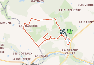
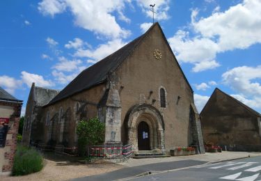
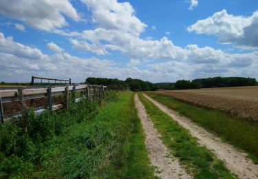
Tour Wandern von 8,7 km verfügbar auf Zentrum-Loiretal, Indre-et-Loire, Villedômer. Diese Tour wird von guydu41 vorgeschlagen.
Beschreibung
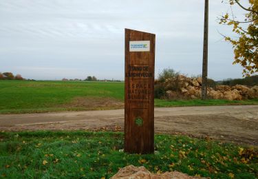
Petite randonnée depuis le parking au bord de l'étang de l'Arche sur la commune de Villedômer.
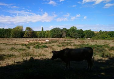
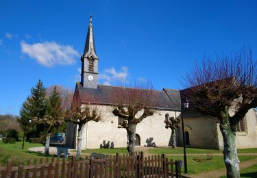
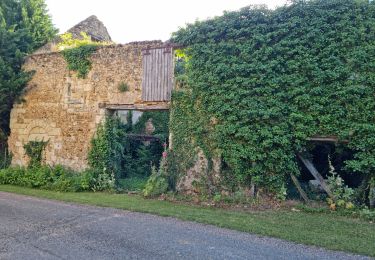
Traversée d'un ruisseau sur une mini passerelle au milieu d'un bois puis marche au milieu de champs et prairies avant de découvrir les caves Margolines.
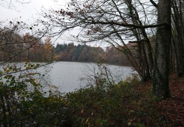
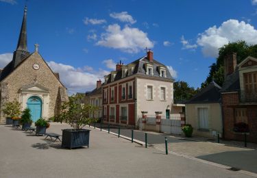
Fin du parcours en empruntant des sentiers et chemins montants et descendants autour du très bel étang de l'Arche.
Ort
Kommentare
Touren in der Umgebung
![Tour Wandern Villedômer - la Grand'Vallée - Saint-Laurent-en-Gâtines via PRs - 26.8km 225m 5h35 (35mn) - 2022 12 03 - Photo](https://media.geolcdn.com/t/375/260/8b7d114e-fe4f-44eb-8278-b583e99468bd.jpg&format=jpg&maxdim=2)
![Wandern Wandern](https://static1.geolcdn.com/sitytour/trail-icons/101.png)
Wandern
![](/images/other/stat-length.png)
![](https://static1.geolcdn.com/siteimages/upload/files/16400158638029165_repeat_loop_refresh_sync_direction_icon.png)
![Tour Wandern Villedômer - Étang de l'Archevêque - Crotelles la Grand' Vallée - 20.3km 215m 4h25 (35mn) - 2022 11 26 - Photo](https://media.geolcdn.com/t/375/260/8eae5aaa-0c3c-4826-a622-21410b89935e.jpg&format=jpg&maxdim=2)
![Wandern Wandern](https://static1.geolcdn.com/sitytour/trail-icons/101.png)
Wandern
![](/images/other/stat-length.png)
![](https://static1.geolcdn.com/siteimages/upload/files/16400158638029165_repeat_loop_refresh_sync_direction_icon.png)
![Tour Wandern Auzouer-en-Touraine - Auzouer-en-Touraine - Circuit Bec Sec variante - 18.4km 220m 4h10 (30mn) - 2022 09 06 - Photo](https://media.geolcdn.com/t/375/260/38a4be1b-598c-4a27-bdce-82573aabedf8.jpg&format=jpg&maxdim=2)
![Wandern Wandern](https://static1.geolcdn.com/sitytour/trail-icons/101.png)
Wandern
![](/images/other/stat-length.png)
![](https://static1.geolcdn.com/siteimages/upload/files/16400158638029165_repeat_loop_refresh_sync_direction_icon.png)
![Tour Wandern Château-Renault - Château-Renault - GR655ouest Villechauve - 21.9km 235m 4h55 (30mn) - 2021 10 23 - Photo](https://media.geolcdn.com/t/375/260/f56af21b-37d8-43a1-8e30-6f94c58a9a00.jpg&format=jpg&maxdim=2)
![Wandern Wandern](https://static1.geolcdn.com/sitytour/trail-icons/101.png)
Wandern
![](/images/other/stat-length.png)
![](https://static1.geolcdn.com/siteimages/upload/files/16400158638029165_repeat_loop_refresh_sync_direction_icon.png)
![Tour Wandern Auzouer-en-Touraine - Auzouer-en-Touraine - circuit de la Quintaine - 12.7km 150m 2h40 - 2021 07 06 - Photo](https://media.geolcdn.com/t/375/260/3b343954-d302-40ba-b336-fb9df6b89cbf.jpg&format=jpg&maxdim=2)
![Wandern Wandern](https://static1.geolcdn.com/sitytour/trail-icons/101.png)
Wandern
![](/images/other/stat-length.png)
![](https://static1.geolcdn.com/siteimages/upload/files/16400158638029165_repeat_loop_refresh_sync_direction_icon.png)
![Tour Wandern Crotelles - Crotelles - PR avec variante - 21.4km 285m 4h35 (30mn) - 2021 03 20 - Photo](https://media.geolcdn.com/t/375/260/bceaf6e3-80b3-4324-91c6-ae12af2bbf7f.jpg&format=jpg&maxdim=2)
![Wandern Wandern](https://static1.geolcdn.com/sitytour/trail-icons/101.png)
Wandern
![](/images/other/stat-length.png)
![](https://static1.geolcdn.com/siteimages/upload/files/16400158638029165_repeat_loop_refresh_sync_direction_icon.png)
![Tour Wandern Villedômer - Villedômer - Le sentier des Bois - 22.4km 265m 5h05 (25mn) - 2019 08 10 - Photo](https://media.geolcdn.com/t/375/260/bf722cc0-91b1-46aa-bfeb-b4446fdcac70.jpg&format=jpg&maxdim=2)
![Wandern Wandern](https://static1.geolcdn.com/sitytour/trail-icons/101.png)
Wandern
![](/images/other/stat-length.png)
![](https://static1.geolcdn.com/siteimages/upload/files/16400158638029165_repeat_loop_refresh_sync_direction_icon.png)
![Tour Wandern Villedômer - Villedômer - Photo](https://media.geolcdn.com/t/375/260/01205bfa-a16a-4b1b-9536-49c99ad5bf3a.jpg&format=jpg&maxdim=2)
![Wandern Wandern](https://static1.geolcdn.com/sitytour/trail-icons/101.png)
Wandern
![](/images/other/stat-length.png)
![](https://static1.geolcdn.com/siteimages/upload/files/16400158638029165_repeat_loop_refresh_sync_direction_icon.png)
![Tour Wandern Neuillé-le-Lierre - Neuillé-le-Lierre - Château-Renault - 25.4km 300m 5h00 (30mn) - 2019 02 16 - Photo](https://media.geolcdn.com/t/375/260/1825a49e-9bcd-4895-83ba-af7468c33b8b.jpg&format=jpg&maxdim=2)
![Wandern Wandern](https://static1.geolcdn.com/sitytour/trail-icons/101.png)
Wandern
![](/images/other/stat-length.png)
![](https://static1.geolcdn.com/siteimages/upload/files/16400158638029165_repeat_loop_refresh_sync_direction_icon.png)