![](/images/other/stat-length.png)
![Tour Wandern Saint-Marcel - 01-st-Marcel-Birieux-20km-140m-dec21 - Photo](https://media.geolcdn.com/t/1900/400/4225ef8e-0485-4fc5-8080-1e17ac116351.jpg&format=pjpeg&maxdim=2)
01-st-Marcel-Birieux-20km-140m-dec21
SyMA
Benutzer
![Länge](/images/other/stat-length.png)
Länge
20 km
![Maximale Höhe](https://static1.geolcdn.com/siteimages/upload/files/1508320355ic_sort_altitude_max_24dp.png)
Maximale Höhe
296 m
![Positive Höhendifferenz](https://static1.geolcdn.com/siteimages/upload/files/1508320355ic_sort_den_pos_24dp.png)
Positive Höhendifferenz
139 m
![Km-Effort](/images/other/stat-length.png)
Km-Effort
22 km
![Min. Höhe](https://static1.geolcdn.com/siteimages/upload/files/1508320355ic_sort_altitude_min_24dp.png)
Min. Höhe
277 m
![Negative Höhendifferenz](https://static1.geolcdn.com/siteimages/upload/files/1508320355ic_sort_den_neg_24dp.png)
Negative Höhendifferenz
139 m
![Boucle](https://static1.geolcdn.com/siteimages/upload/files/16400158638029165_repeat_loop_refresh_sync_direction_icon.png)
Boucle
Ja
Erstellungsdatum :
2021-12-09 07:55:46.935
Letzte Änderung :
2021-12-09 17:27:19.529
![Wandern](https://static1.geolcdn.com/sitytour/trail-icons/101.png)
5h14
Schwierigkeit : Medium
![Scannen Sie diesen QR-Code, um die Tour in der SityTrail-Anwendung zu öffnen](https://capi.geolives.com/qq0zvz2zws4bq2lad0pu/sitytour/trails/3022345/qr.png?size=200)
Kostenlosegpshiking-Anwendung
Über SityTrail
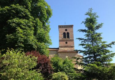
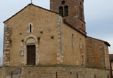
Tour Wandern von 20 km verfügbar auf Auvergne-Rhone-Alpen, Ain, Saint-Marcel. Diese Tour wird von SyMA vorgeschlagen.
Beschreibung
Parking face mairie de St Marcel
Restau Auberge de Birieux
1/2 chemin 1/2 goudron mais en route trés peu fréquentées
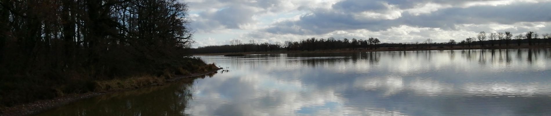
Nouvel observatoire ornitho sortie Birieux niveau maison Neuve Km12.8 droite vers Etang de Birieux
Ort
Land:
France
Region :
Auvergne-Rhone-Alpen
Abteilung/Provinz :
Ain
Kommune :
Saint-Marcel
Standort:
Unknown
Gehen Sie:(Dec)
Gehen Sie:(UTM)
653882 ; 5090196 (31T) N.
Kommentare
Touren in der Umgebung
![Tour Zu Fuß Monthieux - Observatoire sur l'Étang Grange Volet - Photo](https://media.geolcdn.com/t/375/260/e506b7e7-fee1-446a-9ebe-9e47fc2d0a38.jpeg&format=jpg&maxdim=2)
![Zu Fuß Zu Fuß](https://static1.geolcdn.com/sitytour/trail-icons/100.png)
Observatoire sur l'Étang Grange Volet
Zu Fuß
Einfach
Monthieux,
Auvergne-Rhone-Alpen,
Ain,
France
![](/images/other/stat-length.png)
7,3 km | 7,9 km-effort
1h 47min
![](https://static1.geolcdn.com/siteimages/upload/files/16400158638029165_repeat_loop_refresh_sync_direction_icon.png)
Ja
![Tour Wandern Monthieux - Monthieux-11km-78m - Photo](https://media.geolcdn.com/t/375/260/ext.jpg?maxdim=2&url=https%3A%2F%2Fstatic1.geolcdn.com%2Fsiteimages%2Fupload%2Ffiles%2F1553511878bg_sport_marche.png)
![Wandern Wandern](https://static1.geolcdn.com/sitytour/trail-icons/101.png)
Monthieux-11km-78m
Wandern
Medium
(2)
Monthieux,
Auvergne-Rhone-Alpen,
Ain,
France
![](/images/other/stat-length.png)
10,9 km | 11,9 km-effort
2h 39min
![](https://static1.geolcdn.com/siteimages/upload/files/16400158638029165_repeat_loop_refresh_sync_direction_icon.png)
Ja
![Tour Wandern Monthieux - Étangs Monthieux - Photo](https://media.geolcdn.com/t/375/260/ext.jpg?maxdim=2&url=https%3A%2F%2Fservices.sitytrail.com%2FGeolivesWS%2FDownloadMedia.ashx%3FTrailID%3D394087%26Media%3Dfix__20150309174831.jpg)
![Wandern Wandern](https://static1.geolcdn.com/sitytour/trail-icons/101.png)
Étangs Monthieux
Wandern
Sehr leicht
Monthieux,
Auvergne-Rhone-Alpen,
Ain,
France
![](/images/other/stat-length.png)
5,9 km | 6,3 km-effort
2h 16min
![](https://static1.geolcdn.com/siteimages/upload/files/16400158638029165_repeat_loop_refresh_sync_direction_icon.png)
Ja
![Tour Motorrad Birieux - Moto - Photo](https://media.geolcdn.com/t/375/260/ext.jpg?maxdim=2&url=https%3A%2F%2Fstatic1.geolcdn.com%2Fsiteimages%2Fupload%2Ffiles%2F1524743155moto.jpg)
![Motorrad Motorrad](https://static1.geolcdn.com/sitytour/trail-icons/402.png)
![Tour Wandern Saint-Marcel - 01-St-Marcel-Birieux-resto-19km-140m - Photo](https://media.geolcdn.com/t/375/260/ext.jpg?maxdim=2&url=https%3A%2F%2Fstatic1.geolcdn.com%2Fsiteimages%2Fupload%2Ffiles%2F1553511878bg_sport_marche.png)
![Wandern Wandern](https://static1.geolcdn.com/sitytour/trail-icons/101.png)
01-St-Marcel-Birieux-resto-19km-140m
Wandern
Einfach
Saint-Marcel,
Auvergne-Rhone-Alpen,
Ain,
France
![](/images/other/stat-length.png)
19,3 km | 21 km-effort
5h 54min
![](https://static1.geolcdn.com/siteimages/upload/files/16400158638029165_repeat_loop_refresh_sync_direction_icon.png)
Ja
![Tour Wandern Saint-Marcel - st Marcel en Dombes 12.9 2021 - Photo](https://media.geolcdn.com/t/375/260/ext.jpg?maxdim=2&url=https%3A%2F%2Fstatic1.geolcdn.com%2Fsiteimages%2Fupload%2Ffiles%2F1553511878bg_sport_marche.png)
![Wandern Wandern](https://static1.geolcdn.com/sitytour/trail-icons/101.png)
st Marcel en Dombes 12.9 2021
Wandern
Schwierig
Saint-Marcel,
Auvergne-Rhone-Alpen,
Ain,
France
![](/images/other/stat-length.png)
13,7 km | 14,8 km-effort
3h 0min
![](https://static1.geolcdn.com/siteimages/upload/files/16400158638029165_repeat_loop_refresh_sync_direction_icon.png)
Ja
![Tour Wandern Saint-André-de-Corcy - L'étang des Vavres dans la Dombes - Photo](https://media.geolcdn.com/t/375/260/ext.jpg?maxdim=2&url=https%3A%2F%2Fstatic1.geolcdn.com%2Fsiteimages%2Fupload%2Ffiles%2F1553511878bg_sport_marche.png)
![Wandern Wandern](https://static1.geolcdn.com/sitytour/trail-icons/101.png)
L'étang des Vavres dans la Dombes
Wandern
Einfach
Saint-André-de-Corcy,
Auvergne-Rhone-Alpen,
Ain,
France
![](/images/other/stat-length.png)
12,6 km | 13,9 km-effort
Unbekannt
![](https://static1.geolcdn.com/siteimages/upload/files/16400158638029165_repeat_loop_refresh_sync_direction_icon.png)
Ja
![Tour Wandern Monthieux - balade Monthieux - Photo](https://media.geolcdn.com/t/375/260/ext.jpg?maxdim=2&url=https%3A%2F%2Fstatic1.geolcdn.com%2Fsiteimages%2Fupload%2Ffiles%2F1553511878bg_sport_marche.png)
![Wandern Wandern](https://static1.geolcdn.com/sitytour/trail-icons/101.png)
balade Monthieux
Wandern
Medium
Monthieux,
Auvergne-Rhone-Alpen,
Ain,
France
![](/images/other/stat-length.png)
9,9 km | 10,9 km-effort
2h 40min
![](https://static1.geolcdn.com/siteimages/upload/files/16400158638029165_repeat_loop_refresh_sync_direction_icon.png)
Ja
![Tour Elektrofahrrad Saint-Marcel - La route des etangs - Photo](https://media.geolcdn.com/t/375/260/ext.jpg?maxdim=2&url=https%3A%2F%2Fstatic1.geolcdn.com%2Fsiteimages%2Fupload%2Ffiles%2F1524743154velo.jpg)
![Elektrofahrrad Elektrofahrrad](https://static1.geolcdn.com/sitytour/trail-icons/205.png)
La route des etangs
Elektrofahrrad
Schwierig
Saint-Marcel,
Auvergne-Rhone-Alpen,
Ain,
France
![](/images/other/stat-length.png)
73 km | 81 km-effort
4h 0min
![](https://static1.geolcdn.com/siteimages/upload/files/16400158638029165_repeat_loop_refresh_sync_direction_icon.png)
Ja