![](/images/other/stat-length.png)
![Tour Wandern Bouxières-aux-Chênes - Bouxières-aux-Chênes (Blanzey) 10 000m +238m - Photo](https://media.geolcdn.com/t/1900/400/ext.pjpeg?maxdim=2&url=https%3A%2F%2Fstatic1.geolcdn.com%2Fsiteimages%2Fupload%2Ffiles%2F1553511878bg_sport_marche.png)
Bouxières-aux-Chênes (Blanzey) 10 000m +238m
DanielROLLET
Benutzer
![Länge](/images/other/stat-length.png)
Länge
10 km
![Maximale Höhe](https://static1.geolcdn.com/siteimages/upload/files/1508320355ic_sort_altitude_max_24dp.png)
Maximale Höhe
381 m
![Positive Höhendifferenz](https://static1.geolcdn.com/siteimages/upload/files/1508320355ic_sort_den_pos_24dp.png)
Positive Höhendifferenz
238 m
![Km-Effort](/images/other/stat-length.png)
Km-Effort
13,1 km
![Min. Höhe](https://static1.geolcdn.com/siteimages/upload/files/1508320355ic_sort_altitude_min_24dp.png)
Min. Höhe
219 m
![Negative Höhendifferenz](https://static1.geolcdn.com/siteimages/upload/files/1508320355ic_sort_den_neg_24dp.png)
Negative Höhendifferenz
236 m
![Boucle](https://static1.geolcdn.com/siteimages/upload/files/16400158638029165_repeat_loop_refresh_sync_direction_icon.png)
Boucle
Ja
Erstellungsdatum :
2021-12-02 08:00:12.351
Letzte Änderung :
2021-12-02 13:43:32.183
![Wandern](https://static1.geolcdn.com/sitytour/trail-icons/101.png)
2h25
Schwierigkeit : Einfach
![Scannen Sie diesen QR-Code, um die Tour in der SityTrail-Anwendung zu öffnen](https://capi.geolives.com/qq0zvz2zws4bq2lad0pu/sitytour/trails/3017331/qr.png?size=200)
Kostenlosegpshiking-Anwendung
Über SityTrail
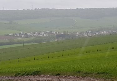
Tour Wandern von 10 km verfügbar auf Großer Osten, Mörthe und Mosel, Bouxières-aux-Chênes. Diese Tour wird von DanielROLLET vorgeschlagen.
Beschreibung
2021 12 02 - Marche nordique - 9h00 à 11h25 - 3 participants
Temps couvert et pluvieux la 1ère heure, Léger vent.
Trop lent (avec Laurent) mais terrain gras
Ort
Land:
France
Region :
Großer Osten
Abteilung/Provinz :
Mörthe und Mosel
Kommune :
Bouxières-aux-Chênes
Standort:
Unknown
Gehen Sie:(Dec)
Gehen Sie:(UTM)
297624 ; 5404521 (32U) N.
Kommentare
Touren in der Umgebung
![Tour Zu Fuß Agincourt - Circuit M - Photo](https://media.geolcdn.com/t/375/260/af3027bd-6d38-4135-8a9f-8cca4de624d0.jpeg&format=jpg&maxdim=2)
![Zu Fuß Zu Fuß](https://static1.geolcdn.com/sitytour/trail-icons/100.png)
Circuit M
Zu Fuß
Einfach
Agincourt,
Großer Osten,
Mörthe und Mosel,
France
![](/images/other/stat-length.png)
13,3 km | 17,8 km-effort
4h 3min
![](https://static1.geolcdn.com/siteimages/upload/files/16400158638029165_repeat_loop_refresh_sync_direction_icon.png)
Nein
![Tour Zu Fuß Lay-Saint-Christophe - Circuit L - Photo](https://media.geolcdn.com/t/375/260/8edc069d-a9b9-439a-9f46-3e2f5923a387.jpeg&format=jpg&maxdim=2)
![Zu Fuß Zu Fuß](https://static1.geolcdn.com/sitytour/trail-icons/100.png)
Circuit L
Zu Fuß
Einfach
Lay-Saint-Christophe,
Großer Osten,
Mörthe und Mosel,
France
![](/images/other/stat-length.png)
14,7 km | 18,5 km-effort
4h 11min
![](https://static1.geolcdn.com/siteimages/upload/files/16400158638029165_repeat_loop_refresh_sync_direction_icon.png)
Ja
![Tour Wandern Leyr - LEYR - LE PLATEAU DE LA ROCHETTE - Photo](https://media.geolcdn.com/t/375/260/a23adc35-c5be-4844-8e67-6acd661e64b6.jpg&format=jpg&maxdim=2)
![Wandern Wandern](https://static1.geolcdn.com/sitytour/trail-icons/101.png)
LEYR - LE PLATEAU DE LA ROCHETTE
Wandern
Einfach
Leyr,
Großer Osten,
Mörthe und Mosel,
France
![](/images/other/stat-length.png)
12,1 km | 15,5 km-effort
5h 59min
![](https://static1.geolcdn.com/siteimages/upload/files/16400158638029165_repeat_loop_refresh_sync_direction_icon.png)
Ja
![Tour Wandern Montenoy - MONTENOY - LE COL DE VASSUCHAMP - Photo](https://media.geolcdn.com/t/375/260/1b7346bf-b740-4cc9-8679-e8b003a9b130.jpg&format=jpg&maxdim=2)
![Wandern Wandern](https://static1.geolcdn.com/sitytour/trail-icons/101.png)
MONTENOY - LE COL DE VASSUCHAMP
Wandern
Einfach
Montenoy,
Großer Osten,
Mörthe und Mosel,
France
![](/images/other/stat-length.png)
12,4 km | 16,4 km-effort
4h 33min
![](https://static1.geolcdn.com/siteimages/upload/files/16400158638029165_repeat_loop_refresh_sync_direction_icon.png)
Ja
![Tour Wandern Eulmont - 2020-12-11_18h42m13_Eulmont_La tour du Crany_10kms - Photo](https://media.geolcdn.com/t/375/260/ext.jpg?maxdim=2&url=https%3A%2F%2Fstatic1.geolcdn.com%2Fsiteimages%2Fupload%2Ffiles%2F1553511878bg_sport_marche.png)
![Wandern Wandern](https://static1.geolcdn.com/sitytour/trail-icons/101.png)
2020-12-11_18h42m13_Eulmont_La tour du Crany_10kms
Wandern
Schwierig
(2)
Eulmont,
Großer Osten,
Mörthe und Mosel,
France
![](/images/other/stat-length.png)
9,6 km | 12,6 km-effort
2h 51min
![](https://static1.geolcdn.com/siteimages/upload/files/16400158638029165_repeat_loop_refresh_sync_direction_icon.png)
Ja
![Tour Wandern Dommartemont - Dommartemont - Photo](https://media.geolcdn.com/t/375/260/8cd51545-df85-4589-bd14-ed6d542f080f.jpg&format=jpg&maxdim=2)
![Wandern Wandern](https://static1.geolcdn.com/sitytour/trail-icons/101.png)
Dommartemont
Wandern
Medium
Dommartemont,
Großer Osten,
Mörthe und Mosel,
France
![](/images/other/stat-length.png)
29 km | 34 km-effort
3h 5min
![](https://static1.geolcdn.com/siteimages/upload/files/16400158638029165_repeat_loop_refresh_sync_direction_icon.png)
Nein
![Tour Wandern Bouxières-aux-Chênes - tour crany 29/5/2019 - Photo](https://media.geolcdn.com/t/375/260/ext.jpg?maxdim=2&url=https%3A%2F%2Fstatic1.geolcdn.com%2Fsiteimages%2Fupload%2Ffiles%2F1553511878bg_sport_marche.png)
![Wandern Wandern](https://static1.geolcdn.com/sitytour/trail-icons/101.png)
tour crany 29/5/2019
Wandern
Sehr leicht
(1)
Bouxières-aux-Chênes,
Großer Osten,
Mörthe und Mosel,
France
![](/images/other/stat-length.png)
11,1 km | 14 km-effort
3h 42min
![](https://static1.geolcdn.com/siteimages/upload/files/16400158638029165_repeat_loop_refresh_sync_direction_icon.png)
Ja
![Tour Wandern Bouxières-aux-Chênes - Amance blanzey boucles des amance - Photo](https://media.geolcdn.com/t/375/260/682c5f23-15d3-4fdf-8eeb-a74f6e61dda1.jpg&format=jpg&maxdim=2)
![Wandern Wandern](https://static1.geolcdn.com/sitytour/trail-icons/101.png)
Amance blanzey boucles des amance
Wandern
Medium
Bouxières-aux-Chênes,
Großer Osten,
Mörthe und Mosel,
France
![](/images/other/stat-length.png)
9,2 km | 12,5 km-effort
4h 52min
![](https://static1.geolcdn.com/siteimages/upload/files/16400158638029165_repeat_loop_refresh_sync_direction_icon.png)
Ja
![Tour Wandern Bouxières-aux-Chênes - bouxieres aux chênes - Blanzey - Photo](https://media.geolcdn.com/t/375/260/53a8e14a-fcca-41b7-ba10-e0d8828d01da.jpg&format=jpg&maxdim=2)
![Wandern Wandern](https://static1.geolcdn.com/sitytour/trail-icons/101.png)
bouxieres aux chênes - Blanzey
Wandern
Medium
Bouxières-aux-Chênes,
Großer Osten,
Mörthe und Mosel,
France
![](/images/other/stat-length.png)
12 km | 14,7 km-effort
19h 32min
![](https://static1.geolcdn.com/siteimages/upload/files/16400158638029165_repeat_loop_refresh_sync_direction_icon.png)
Ja