Tour Wandern Ferrières - promenade-du-vicinal-et-de-la-croix-saint-christophe - Photo

promenade-du-vicinal-et-de-la-croix-saint-christophe

 c.watrin
c.watrin

Benutzer

© OpenStreetMap contributors
Länge
Länge
8,2 km
Maximale Höhe
Maximale Höhe
371 m
Positive Höhendifferenz
140 m
Km-Effort
Km-Effort  
10,1 km
Min. Höhe
Min. Höhe
255 m
Negative Höhendifferenz
141 m
Boucle
Boucle
Ja
Erstellungsdatum :
2021-11-27 14:44:24.519
Letzte Änderung :
2021-11-29 20:09:48.875

(1 Nachricht)

Wandern
Wandern
--
Schwierigkeit : Unbekannt

Scannen Sie diesen QR-Code, um die Tour in der SityTrail-Anwendung zu öffnen

Kostenlosegpshiking-Anwendung

Logo SityTrail SityTrail

IGN / Geografische Institute

SityTrail aus dem App Store herunterladen SityTrail von Google Play herunterladen

Logo SityTrail SityTrail World

Die Welt öffnet sich für Sie

SityTrail aus dem App Store herunterladen SityTrail von Google Play herunterladen SityTrail auf Huawei AppGallery herunterladen

Über SityTrail

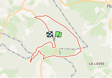
Tour Wandern von 8,2 km verfügbar auf Wallonien, Lüttich, Ferrières. Diese Tour wird von c.watrin vorgeschlagen.

Beschreibung

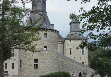
Départ : Barbecue du Vicinal - Rue de St-Roch
Balade créée par l'office du tourisme de Ferrières. (Fléchage vert).
Attention : cette trace GPX est faite dans le sens inverse des aiguilles d'une montre alors que le fléchage placé par l'office du tourisme est dans l'autre sens.
En conclusion, il suffit d'inverser le sens du tracé si on souhaite le faire comme prévu par l'office du tourisme de Ferrières (balises vertes).

Höhenprofil

Ort

Land:
Belgium
Region :
Wallonien
Abteilung/Provinz :
Lüttich
Kommune :
Ferrières
Standort:
Unknown
Gehen Sie:(Dec)
Gehen Sie:(UTM)
687114 ; 5589579 (31U) N.

Kommentare

Bitte melden Sie sich an, um einen Kommentar oder eine Bewertung zu hinterlassen


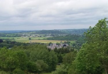
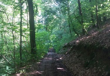
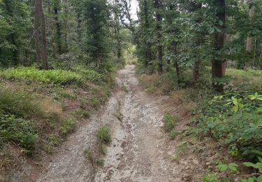
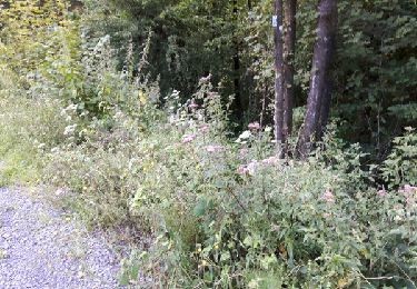
Superbe balade … beaucoup de bois et de sentiers…. A refaire


Touren in der Umgebung

Tour Wandern Ferrières - Rouge-Minière. Natura 2000, des sites qui valent le détour ! Lg 3 - Photo
Wandern
GUIDE+

Wandern

Einfach
(17)
Ferrières, Wallonien, Lüttich, Belgium
6,8 km | 8,9 km-effort
Unbekannt
Ja
Tour Wandern Aywaille - RB-Lg-15 - À la porte de l’Ardenne - Photo
Wandern
PRO

Wandern

Schwierig
(7)
Aywaille, Wallonien, Lüttich, Belgium
22 km | 30 km-effort
6h 10min
Ja
Tour Wandern Aywaille - houssonloge . bois du pouhon . trou de bosson . paradis . houssonloge  - Photo
Wandern
GUIDE
stef789

Wandern

Sehr leicht
(4)
Aywaille, Wallonien, Lüttich, Belgium
9,1 km | 12,4 km-effort
2h 49min
Ja
Tour Wandern Aywaille - aywaille . martinrive . awan . croix septroux . aywaille - Photo
Wandern
GUIDE
stef789

Wandern

Einfach
(2)
Aywaille, Wallonien, Lüttich, Belgium
10,9 km | 15,1 km-effort
2h 31min
Ja
Tour Wandern Aywaille - aywaille gare . raborive . chambralles . croix de septroux . aywaille gare - Photo
Wandern
GUIDE
stef789

Wandern

Sehr leicht
(1)
Aywaille, Wallonien, Lüttich, Belgium
10,4 km | 14,2 km-effort
2h 16min
Ja
Tour Wandern Aywaille - Harzé - Photo
Wandern
Jacques Guisse

Wandern

Schwierig
(1)
Aywaille, Wallonien, Lüttich, Belgium
10,1 km | 13,5 km-effort
3h 22min
Ja
Tour Wandern Aywaille - RB-Lg-15-BC-2019-Rac2 - Photo
Wandern
PRO

Wandern

Medium
(4)
Aywaille, Wallonien, Lüttich, Belgium
11,4 km | 15,9 km-effort
3h 21min
Ja
Tour Mountainbike Ferrières - st-roch - Photo
Mountainbike
exogarix

Mountainbike

Medium
(1)
Ferrières, Wallonien, Lüttich, Belgium
11,9 km | 14,9 km-effort
1h 45min
Ja
Tour Wandern Ferrières - en passant par la chapelle Saint Roch  - Photo
Wandern
naturaliste

Wandern

Einfach
(3)
Ferrières, Wallonien, Lüttich, Belgium
4,8 km | 5,9 km-effort
58min
Ja


Schließen
Meine Abonnements