


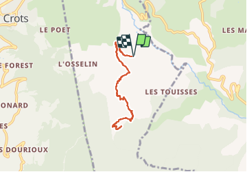

11,1 km | 19 km-effort


Benutzer


Kostenlosegpshiking-Anwendung
 SityTrail
IGN / Geografische Institute
SityTrail World
Die Welt öffnet sich für Sie
Tour Wandern von 7,5 km verfügbar auf Provence-Alpes-Côte d'Azur, Hochalpen, Baratier. Diese Tour wird von damlou vorgeschlagen.
un a-r difficille, glissant, avec endroits étroits.
pour marcheurs confirmés
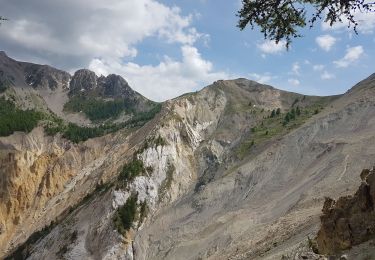
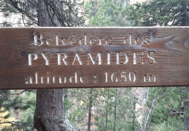
Très belle vue au sommet.
Temps 3H 30
7 km 500
Dénivilé 563

Wandern

Wandern

Mountainbike

Wandern

Wandern
Wandern
Wandern

Wandern

Wandern