![](/images/other/stat-length.png)
![Tour Wandern Seillans - Seillans Circuit des Pignes - Photo](https://media.geolcdn.com/t/1900/400/f6a5cdd0-96d0-41a9-9548-f0b8b9eb030d.jpg&format=pjpeg&maxdim=2)
Seillans Circuit des Pignes
domi06
Benutzer
![Länge](/images/other/stat-length.png)
![Maximale Höhe](https://static1.geolcdn.com/siteimages/upload/files/1508320355ic_sort_altitude_max_24dp.png)
![Positive Höhendifferenz](https://static1.geolcdn.com/siteimages/upload/files/1508320355ic_sort_den_pos_24dp.png)
![Km-Effort](/images/other/stat-length.png)
![Min. Höhe](https://static1.geolcdn.com/siteimages/upload/files/1508320355ic_sort_altitude_min_24dp.png)
![Negative Höhendifferenz](https://static1.geolcdn.com/siteimages/upload/files/1508320355ic_sort_den_neg_24dp.png)
![Boucle](https://static1.geolcdn.com/siteimages/upload/files/16400158638029165_repeat_loop_refresh_sync_direction_icon.png)
![Wandern](https://static1.geolcdn.com/sitytour/trail-icons/101.png)
6h20
Schwierigkeit : Medium
![Scannen Sie diesen QR-Code, um die Tour in der SityTrail-Anwendung zu öffnen](https://capi.geolives.com/qq0zvz2zws4bq2lad0pu/sitytour/trails/3007827/qr.png?size=200)
Kostenlosegpshiking-Anwendung
Über SityTrail
Tour Wandern von 19 km verfügbar auf Provence-Alpes-Côte d'Azur, Var, Seillans. Diese Tour wird von domi06 vorgeschlagen.
Beschreibung
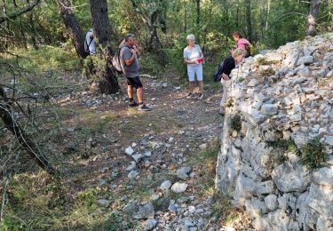
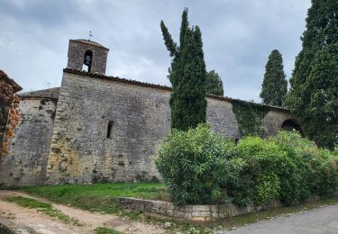
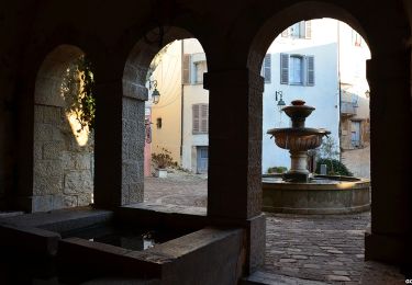
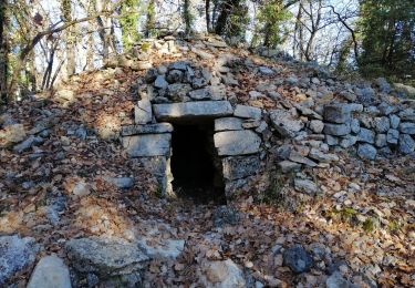
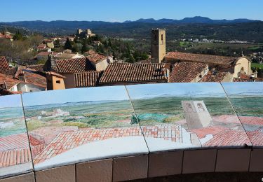
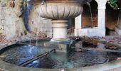
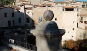
De la porte Sarrasine, repérer les marques jaunes. Celles-ci permettent de sortir du village par une route qui descend vers la rivière : La franchir par un pont et prendre la route du Moulin et continuer tout droit en direction du vallon des Combes Longues. Remonter ce vallon par un sentier qui monte sur la gauche. Celui-ci amène à une large piste sur laquelle on bifurque à gauche. On suit celle-ci jusqu'au col de St Arnoux (voir la chapelle St Arnoux sur la droite). Traverser la RD19 et prendre la piste qui s'élève sur la droite. Du sommet de la Pigne, on arrive à un beau panorama qui permet de voir la plaine de Fayence, l'Estérel et la mer. On redescend ensuite progressivement vers Seillans par une piste puis des petites routes. On croise la RD19 que l'on quitte immédiatement pour emprunter une ruelle moins passagère. On arrive sans difficulté à Seillans.
Ort
Kommentare
Touren in der Umgebung
![Tour Wandern Fayence - Fayence. Le circuit des trois chapelles - Photo](https://media.geolcdn.com/t/375/260/441da39e-224e-4e50-b6f0-490d073d6503.jpg&format=jpg&maxdim=2)
![Wandern Wandern](https://static1.geolcdn.com/sitytour/trail-icons/101.png)
Wandern
![](/images/other/stat-length.png)
![](https://static1.geolcdn.com/siteimages/upload/files/16400158638029165_repeat_loop_refresh_sync_direction_icon.png)
![Tour Wandern Seillans - z seillans 03-10-23 - Photo](https://media.geolcdn.com/t/375/260/14f0fa50-1112-40e8-b814-f7d4ea93bf43.jpg&format=jpg&maxdim=2)
![Wandern Wandern](https://static1.geolcdn.com/sitytour/trail-icons/101.png)
Wandern
![](/images/other/stat-length.png)
![](https://static1.geolcdn.com/siteimages/upload/files/16400158638029165_repeat_loop_refresh_sync_direction_icon.png)
![Tour Wandern Fayence - FAYENCE - TOUR DES CHAPELLES - Photo](https://media.geolcdn.com/t/375/260/e73cd254-a552-492e-8747-dfbc8bfa6c7b.jpg&format=jpg&maxdim=2)
![Wandern Wandern](https://static1.geolcdn.com/sitytour/trail-icons/101.png)
Wandern
![](/images/other/stat-length.png)
![](https://static1.geolcdn.com/siteimages/upload/files/16400158638029165_repeat_loop_refresh_sync_direction_icon.png)
![Tour Wandern Seillans - La Pigne - Photo](https://media.geolcdn.com/t/375/260/c2efac09-daf0-46db-8bd0-b025f5018efe.jpg&format=jpg&maxdim=2)
![Wandern Wandern](https://static1.geolcdn.com/sitytour/trail-icons/101.png)
Wandern
![](/images/other/stat-length.png)
![](https://static1.geolcdn.com/siteimages/upload/files/16400158638029165_repeat_loop_refresh_sync_direction_icon.png)
![Wandern Wandern](https://static1.geolcdn.com/sitytour/trail-icons/101.png)
Wandern
![](/images/other/stat-length.png)
![](https://static1.geolcdn.com/siteimages/upload/files/16400158638029165_repeat_loop_refresh_sync_direction_icon.png)
![Tour Wandern Seillans - Bories de Seillans, la Camandre, vallon des combes longues - Photo](https://media.geolcdn.com/t/375/260/9e152e07-be81-4aca-8140-01ab0859ae30.jpg&format=jpg&maxdim=2)
![Wandern Wandern](https://static1.geolcdn.com/sitytour/trail-icons/101.png)
Wandern
![](/images/other/stat-length.png)
![](https://static1.geolcdn.com/siteimages/upload/files/16400158638029165_repeat_loop_refresh_sync_direction_icon.png)
![Wandern Wandern](https://static1.geolcdn.com/sitytour/trail-icons/101.png)
Wandern
![](/images/other/stat-length.png)
![](https://static1.geolcdn.com/siteimages/upload/files/16400158638029165_repeat_loop_refresh_sync_direction_icon.png)
![Tour Wandern Seillans - 20190327 rando réelle Seillans - Photo](https://media.geolcdn.com/t/375/260/ebb31106-6760-4c85-ad9f-1b1597c6cca8.jpg&format=jpg&maxdim=2)
![Wandern Wandern](https://static1.geolcdn.com/sitytour/trail-icons/101.png)
Wandern
![](/images/other/stat-length.png)
![](https://static1.geolcdn.com/siteimages/upload/files/16400158638029165_repeat_loop_refresh_sync_direction_icon.png)
![Tour Wandern Fayence - fayence vallon de la camandre - Photo](https://media.geolcdn.com/t/375/260/7a999e91-02c0-4273-b84d-c13a0bbf95f5.jpg&format=jpg&maxdim=2)
![Wandern Wandern](https://static1.geolcdn.com/sitytour/trail-icons/101.png)
Wandern
![](/images/other/stat-length.png)
![](https://static1.geolcdn.com/siteimages/upload/files/16400158638029165_repeat_loop_refresh_sync_direction_icon.png)