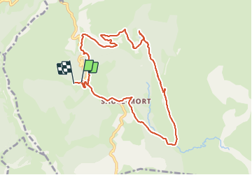
![](/images/other/stat-length.png)
![Tour Wandern Senez - boucle autour du village de poil depuis le parking de chabrejas - Photo](https://media.geolcdn.com/t/1900/400/ef910f25-8d23-46f9-b65c-5d4f7b28c0b3.jpg&format=pjpeg&maxdim=2)
boucle autour du village de poil depuis le parking de chabrejas
famillerudent
Benutzer
![Länge](/images/other/stat-length.png)
![Maximale Höhe](https://static1.geolcdn.com/siteimages/upload/files/1508320355ic_sort_altitude_max_24dp.png)
![Positive Höhendifferenz](https://static1.geolcdn.com/siteimages/upload/files/1508320355ic_sort_den_pos_24dp.png)
![Km-Effort](/images/other/stat-length.png)
![Min. Höhe](https://static1.geolcdn.com/siteimages/upload/files/1508320355ic_sort_altitude_min_24dp.png)
![Negative Höhendifferenz](https://static1.geolcdn.com/siteimages/upload/files/1508320355ic_sort_den_neg_24dp.png)
![Boucle](https://static1.geolcdn.com/siteimages/upload/files/16400158638029165_repeat_loop_refresh_sync_direction_icon.png)
![Wandern](https://static1.geolcdn.com/sitytour/trail-icons/101.png)
5h54
Schwierigkeit : Einfach
![Scannen Sie diesen QR-Code, um die Tour in der SityTrail-Anwendung zu öffnen](https://capi.geolives.com/qq0zvz2zws4bq2lad0pu/sitytour/trails/3001783/qr.png?size=200)
Kostenlosegpshiking-Anwendung
Über SityTrail
Tour Wandern von 10,4 km verfügbar auf Provence-Alpes-Côte d'Azur, Alpes-de-Haute-Provence, Senez. Diese Tour wird von famillerudent vorgeschlagen.
Beschreibung
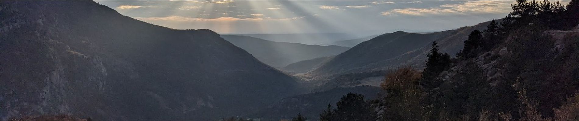
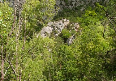
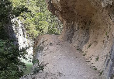
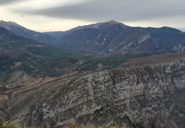
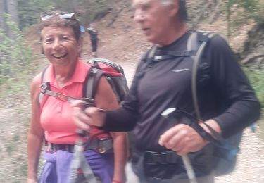
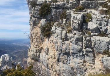
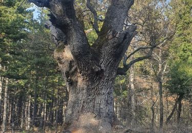
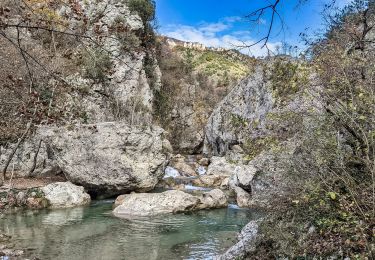
Une randonnée superbe avec de beaux points de vue dans un environnement sauvage pour découvrir l'ancien village
Le Poil (au XIXème siècle la commune comptait 350 habitants dont plus d'une centaine dans le village) nous avons fait cette rando dans le sens inverse du sens clasique pour avoir le soleil avec nous pour les photos.(cf faite en automne)
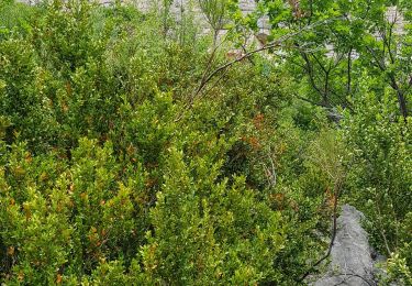
pas de difficultés particulieres
Ort
Kommentare
Touren in der Umgebung
![Tour Wandern Estoublon - Gorges de Trévans - Estoublon - Photo](https://media.geolcdn.com/t/375/260/ext.jpg?maxdim=2&url=https%3A%2F%2Fservices.sitytrail.com%2FGeolivesWS%2FDownloadMedia.ashx%3FTrailID%3D106721%26Media%3D11374_5.jpg)
![Wandern Wandern](https://static1.geolcdn.com/sitytour/trail-icons/101.png)
Wandern
![](/images/other/stat-length.png)
![](https://static1.geolcdn.com/siteimages/upload/files/16400158638029165_repeat_loop_refresh_sync_direction_icon.png)
![Tour Wandern Estoublon - TREVANS, Chateau de Trevans, les Beluguettes. Cotes Chaudes , Belvédère des Gorges , Turquet ,o quet - Photo](https://media.geolcdn.com/t/375/260/488d605b-c812-4edd-a2c1-2f4802305dc3.jpg&format=jpg&maxdim=2)
![Wandern Wandern](https://static1.geolcdn.com/sitytour/trail-icons/101.png)
Wandern
![](/images/other/stat-length.png)
![](https://static1.geolcdn.com/siteimages/upload/files/16400158638029165_repeat_loop_refresh_sync_direction_icon.png)
![Tour Wandern Beynes - Montagne de Beynes 11kms 720m - Photo](https://media.geolcdn.com/t/375/260/0924528c-4d8c-48ab-ad20-f85077c2766f.jpg&format=jpg&maxdim=2)
![Wandern Wandern](https://static1.geolcdn.com/sitytour/trail-icons/101.png)
Wandern
![](/images/other/stat-length.png)
![](https://static1.geolcdn.com/siteimages/upload/files/16400158638029165_repeat_loop_refresh_sync_direction_icon.png)
![Tour Wandern Estoublon - Trevans les gorges - Photo](https://media.geolcdn.com/t/375/260/2cbe37e7-5ddf-4213-89bc-0a9ca520d8c1.jpg&format=jpg&maxdim=2)
![Wandern Wandern](https://static1.geolcdn.com/sitytour/trail-icons/101.png)
Wandern
![](/images/other/stat-length.png)
![](https://static1.geolcdn.com/siteimages/upload/files/16400158638029165_repeat_loop_refresh_sync_direction_icon.png)
![Tour Wandern Beynes - 2023-03-17 Montagne de Beyne - Photo](https://media.geolcdn.com/t/375/260/a2f9f9ce-2317-441f-8351-fbd6bbd22b1f.jpg&format=jpg&maxdim=2)
![Wandern Wandern](https://static1.geolcdn.com/sitytour/trail-icons/101.png)
Wandern
![](/images/other/stat-length.png)
![](https://static1.geolcdn.com/siteimages/upload/files/16400158638029165_repeat_loop_refresh_sync_direction_icon.png)
![Tour Wandern Estoublon - Gorges de Trevans par Valbonnette - Photo](https://media.geolcdn.com/t/375/260/10517f6a-6ec3-4f7b-85a2-34d58762c642.jpg&format=jpg&maxdim=2)
![Wandern Wandern](https://static1.geolcdn.com/sitytour/trail-icons/101.png)
Wandern
![](/images/other/stat-length.png)
![](https://static1.geolcdn.com/siteimages/upload/files/16400158638029165_repeat_loop_refresh_sync_direction_icon.png)
![Tour Wandern Estoublon - 2023-02-21 Gorges de Trévans - Passerelle de la Délasse - Photo](https://media.geolcdn.com/t/375/260/0eeaaad3-f154-4199-b0d4-f7114f5176f6.jpg&format=jpg&maxdim=2)
![Wandern Wandern](https://static1.geolcdn.com/sitytour/trail-icons/101.png)
Wandern
![](/images/other/stat-length.png)
![](https://static1.geolcdn.com/siteimages/upload/files/16400158638029165_repeat_loop_refresh_sync_direction_icon.png)
![Tour Wandern Beynes - 04 La montagne de Beynes (Variante 05/2022) - Photo](https://media.geolcdn.com/t/375/260/00ffcda8-2af0-4879-a93e-d3abe306c026.jpg&format=jpg&maxdim=2)
![Wandern Wandern](https://static1.geolcdn.com/sitytour/trail-icons/101.png)
Wandern
![](/images/other/stat-length.png)
![](https://static1.geolcdn.com/siteimages/upload/files/16400158638029165_repeat_loop_refresh_sync_direction_icon.png)
![Tour Wandern Estoublon - gorges de trevans sentier de valbonette - Photo](https://media.geolcdn.com/t/375/260/e95b5ac0-ca3e-4559-bbd5-f5d21be426a1.jpg&format=jpg&maxdim=2)
![Wandern Wandern](https://static1.geolcdn.com/sitytour/trail-icons/101.png)
Wandern
![](/images/other/stat-length.png)
![](https://static1.geolcdn.com/siteimages/upload/files/16400158638029165_repeat_loop_refresh_sync_direction_icon.png)