


10,3 km | 12,3 km-effort


Benutzer


Kostenlosegpshiking-Anwendung
 SityTrail
IGN / Geografische Institute
SityTrail World
Die Welt öffnet sich für Sie
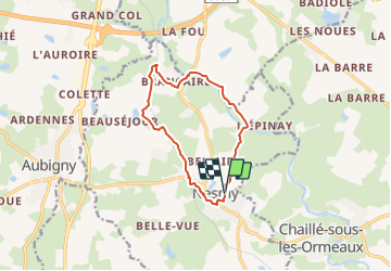
Tour Zu Fuß von 10,5 km verfügbar auf Pays de la Loire, Vendée, Nesmy. Diese Tour wird von cath310 vorgeschlagen.
appelée également Sentier de L'Aulne parcours 9 (PAYS DE YON & VIE)
D/R du parking du jumelage, face au foyer Laborit.
gps N46.59185°/W1.398850°
Balisage JAUNE N°9
durée 3h , facile
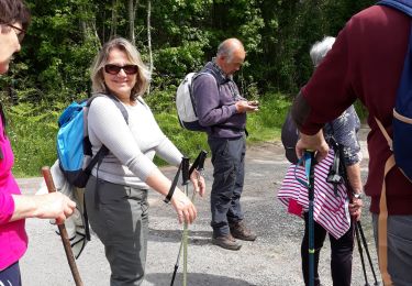
Wandern

Wandern
Wandern
Wandern
Wandern

Zu Fuß

Pfad
Zu Fuß

Fahrrad