Tour Mountainbike Fort-Mahon-Plage - ballade bord de mer - Photo
 Maxime Devaux
Maxime Devaux

Benutzer

© OpenStreetMap contributors
Länge
Länge
23 km
Maximale Höhe
Maximale Höhe
26 m
Positive Höhendifferenz
93 m
Km-Effort
Km-Effort  
24 km
Min. Höhe
Min. Höhe
0 m
Negative Höhendifferenz
92 m
Boucle
Boucle
Ja
Erstellungsdatum :
2021-10-25 07:42:57.201
Letzte Änderung :
2021-10-25 09:32:52.456

(0 Nachricht)

Mountainbike
Mountainbike
1h46
Schwierigkeit : Medium

Scannen Sie diesen QR-Code, um die Tour in der SityTrail-Anwendung zu öffnen

Kostenlosegpshiking-Anwendung

Logo SityTrail SityTrail

IGN / Geografische Institute

SityTrail aus dem App Store herunterladen SityTrail von Google Play herunterladen

Logo SityTrail SityTrail World

Die Welt öffnet sich für Sie

SityTrail aus dem App Store herunterladen SityTrail von Google Play herunterladen SityTrail auf Huawei AppGallery herunterladen

Über SityTrail

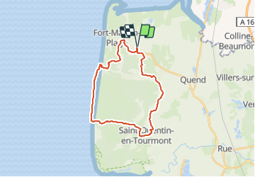
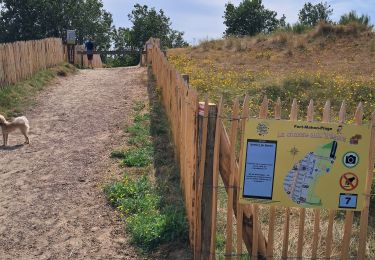
Tour Mountainbike von 23 km verfügbar auf Nordfrankreich, Somme, Fort-Mahon-Plage. Diese Tour wird von Maxime Devaux vorgeschlagen.

Beschreibung

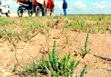
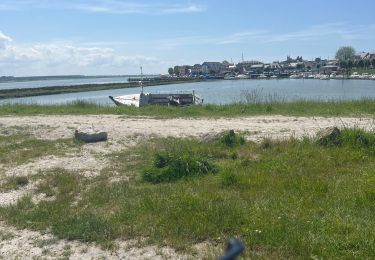
très difficile dans le sentier de la mer.
mais très beau spectacle pour les yeux à l'arrivée

Höhenprofil

Ort

Land:
France
Region :
Nordfrankreich
Abteilung/Provinz :
Somme
Kommune :
Fort-Mahon-Plage
Standort:
Unknown
Gehen Sie:(UTM)
399144 ; 5576931 (31U) N.

Touren in der Umgebung

Tour Wandern Quend - Le Colombier - Photo
Wandern
tracegps

Wandern

Schwierig
(2)
Quend, Nordfrankreich, Somme, France
9,9 km | 10,5 km-effort
3h 19min
Ja
Tour Wandern Fort-Mahon-Plage - La dune de Royon - Photo
Wandern
tracegps

Wandern

Medium
(1)
Fort-Mahon-Plage, Nordfrankreich, Somme, France
4,1 km | 4,5 km-effort
1h 30min
Ja
Tour Elektrofahrrad Fort-Mahon-Plage - Tour de la baie D’Authie - Photo
Elektrofahrrad
Boubby

Elektrofahrrad

Fort-Mahon-Plage, Nordfrankreich, Somme, France
50 km | 53 km-effort
3h 57min
Ja
Tour Wandern Quend - dixk-mônchaux - Photo
Wandern
Robert62

Wandern

Medium
Quend, Nordfrankreich, Somme, France
11,4 km | 12 km-effort
2h 17min
Nein
Tour Wandern Fort-Mahon-Plage -   les CROCS -SAINT QUENTIN EN TOURMONT - Photo
Wandern
Edgard

Wandern

Sehr schwierig
Fort-Mahon-Plage, Nordfrankreich, Somme, France
23 km | 24 km-effort
3h 32min
Nein
Tour Zu Fuß Quend - Le Colombier - Photo
Zu Fuß
GUIDE+

Zu Fuß

Einfach
Quend, Nordfrankreich, Somme, France
9,9 km | 10,4 km-effort
2h 22min
Ja
Tour Wandern Waben - Le Tour de Groffliers à pied - Photo
Wandern
tracegps

Wandern

Medium
Waben, Nordfrankreich, Pas-de-Calais, France
11,9 km | 12,5 km-effort
2h 55min
Ja
Tour Nordic Walking Fort-Mahon-Plage - fort mahon 2 Isabelle  - Photo
Nordic Walking
Isabelle Leclercq

Nordic Walking

Sehr leicht
Fort-Mahon-Plage, Nordfrankreich, Somme, France
13,2 km | 14 km-effort
3h 26min
Nein
Tour Rennrad Fort-Mahon-Plage - Entre Baie d’Authie et Baie de Somme - Photo
Rennrad
Boubby

Rennrad

Einfach
Fort-Mahon-Plage, Nordfrankreich, Somme, France
54 km | 57 km-effort
4h 3min
Ja


Schließen
Meine Abonnements