![](/images/other/stat-length.png)
![Tour Wandern Wolschweiler - Le sentier des douaniers - Wolschwiller - Photo](https://media.geolcdn.com/t/1900/400/0d080b06-f312-4f06-9433-5eb14ecc4ec1.jpg&format=pjpeg&maxdim=2)
Le sentier des douaniers - Wolschwiller
helmut68
Benutzer
![Länge](/images/other/stat-length.png)
![Maximale Höhe](https://static1.geolcdn.com/siteimages/upload/files/1508320355ic_sort_altitude_max_24dp.png)
![Positive Höhendifferenz](https://static1.geolcdn.com/siteimages/upload/files/1508320355ic_sort_den_pos_24dp.png)
![Km-Effort](/images/other/stat-length.png)
![Min. Höhe](https://static1.geolcdn.com/siteimages/upload/files/1508320355ic_sort_altitude_min_24dp.png)
![Negative Höhendifferenz](https://static1.geolcdn.com/siteimages/upload/files/1508320355ic_sort_den_neg_24dp.png)
![Boucle](https://static1.geolcdn.com/siteimages/upload/files/16400158638029165_repeat_loop_refresh_sync_direction_icon.png)
![Wandern](https://static1.geolcdn.com/sitytour/trail-icons/101.png)
3h30
Schwierigkeit : Medium
![Scannen Sie diesen QR-Code, um die Tour in der SityTrail-Anwendung zu öffnen](https://capi.geolives.com/qq0zvz2zws4bq2lad0pu/sitytour/trails/2981442/qr.png?size=200)
Kostenlosegpshiking-Anwendung
Über SityTrail
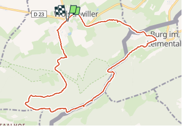
Tour Wandern von 12,2 km verfügbar auf Großer Osten, Oberelsass, Wolschweiler. Diese Tour wird von helmut68 vorgeschlagen.
Beschreibung
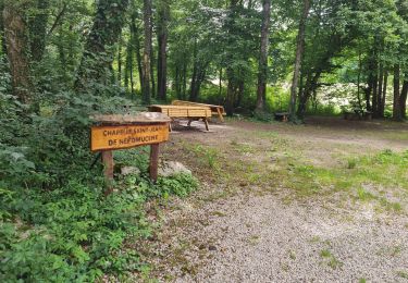
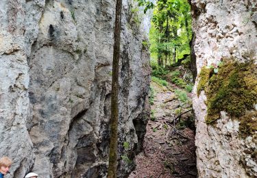
La chaîne du Raemel culmine à 832 m , c'est le point le plus haut du Jura alsacien , on y accède par le " sentier des douaniers " qui suit la frontière franco-suisse .
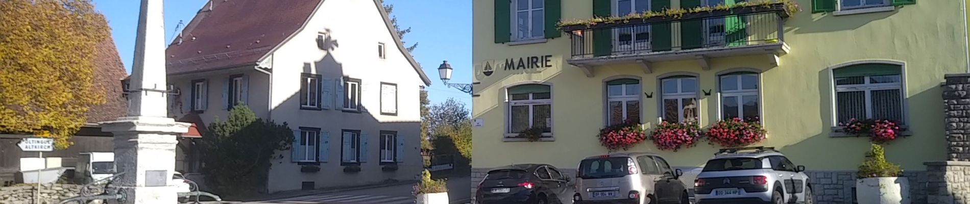
Départ du parking de la mairie de Wolschwiller , empruntez la rue de Kiffis puis 200 m plus loin , prenez à gauche en suivant le balisage " triangle rouge "
Environ 1,5 km plus loin , empruntez l'Unterabyweg toujours balisé " triangle rouge".
Ensuite prenez à gauche vers le Naegeliberg et
le Raemelsberg balisés " triangle bleu " pour rejoindre le sentier des douaniers balisé " chevalet jaune " .
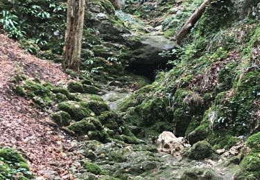
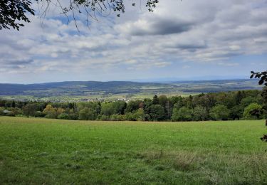
Profitez des multiples points de vue sur les Alpes Suisses , la vallée Suisse proche , les oiseaux ...
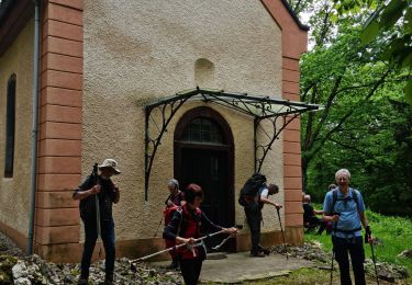
Continuez votre randonnée jusqu'au village Suisse de Burg en suivant le balisage " losange jaune " ( parfois peint sur le tronc des arbres ). Un château construit vers 1250 et encore habité mérite un petit détour . Redescendez vers la petite place de la fontaine et prenez la rue du Gassweg ( pas balisé) qui mène dans la forêt dont le chemin forestier est balisé à nouveau " losange jaune " jusqu'au parking de la mairie de Wolschwiller.
Alors à vos chaussures !
Ort
Kommentare
Touren in der Umgebung
![Tour Wandern Biederthal - JD 15/20 Pedibus Biederthal - Photo](https://media.geolcdn.com/t/375/260/0e1deb4c-d0cf-4f51-a238-4ec2c883b15c.jpg&format=jpg&maxdim=2)
![Wandern Wandern](https://static1.geolcdn.com/sitytour/trail-icons/101.png)
Wandern
![](/images/other/stat-length.png)
![](https://static1.geolcdn.com/siteimages/upload/files/16400158638029165_repeat_loop_refresh_sync_direction_icon.png)
![Tour Elektrofahrrad Buchsweiler - sortie vtt 14082024 - Photo](https://media.geolcdn.com/t/375/260/57774a68-62c2-4066-8aee-73258de3ab22.jpg&format=jpg&maxdim=2)
![Elektrofahrrad Elektrofahrrad](https://static1.geolcdn.com/sitytour/trail-icons/205.png)
Elektrofahrrad
![](/images/other/stat-length.png)
![](https://static1.geolcdn.com/siteimages/upload/files/16400158638029165_repeat_loop_refresh_sync_direction_icon.png)
![Tour Wandern Wolschweiler - Rando 05/07/2024 - Photo](https://media.geolcdn.com/t/375/260/52f45a08-faec-4e85-b2c9-8731019ba4b8.jpg&format=jpg&maxdim=2)
![Wandern Wandern](https://static1.geolcdn.com/sitytour/trail-icons/101.png)
Wandern
![](/images/other/stat-length.png)
![](https://static1.geolcdn.com/siteimages/upload/files/16400158638029165_repeat_loop_refresh_sync_direction_icon.png)
![Tour Wandern Wolschweiler - Rando CLAS du 09/05/202..par PBo - Photo](https://media.geolcdn.com/t/375/260/05829a5d-75d0-4f1b-a952-281cc59b84c3.jpg&format=jpg&maxdim=2)
![Wandern Wandern](https://static1.geolcdn.com/sitytour/trail-icons/101.png)
Wandern
![](/images/other/stat-length.png)
![](https://static1.geolcdn.com/siteimages/upload/files/16400158638029165_repeat_loop_refresh_sync_direction_icon.png)
![Tour Wandern Wolschweiler - Reco Rando CLAS du 09/05/2024 - Photo](https://media.geolcdn.com/t/375/260/6f8403e2-0fdd-411f-9b5c-bc30211abac6.jpg&format=jpg&maxdim=2)
![Wandern Wandern](https://static1.geolcdn.com/sitytour/trail-icons/101.png)
Wandern
![](/images/other/stat-length.png)
![](https://static1.geolcdn.com/siteimages/upload/files/16400158638029165_repeat_loop_refresh_sync_direction_icon.png)
![Tour Wandern Wolschweiler - wolschwiller - Photo](https://media.geolcdn.com/t/375/260/1f0cb837-9d36-4518-bba1-d3300cbfa60d.jpg&format=jpg&maxdim=2)
![Wandern Wandern](https://static1.geolcdn.com/sitytour/trail-icons/101.png)
Wandern
![](/images/other/stat-length.png)
![](https://static1.geolcdn.com/siteimages/upload/files/16400158638029165_repeat_loop_refresh_sync_direction_icon.png)
![Tour Pferd Buchsweiler - Bouxwiller Doubs Franche Montagne - Photo](https://media.geolcdn.com/t/375/260/ext.jpg?maxdim=2&url=https%3A%2F%2Fstatic1.geolcdn.com%2Fsiteimages%2Fupload%2Ffiles%2F1524743154cheval.jpg)
![Pferd Pferd](https://static1.geolcdn.com/sitytour/trail-icons/300.png)
Pferd
![](/images/other/stat-length.png)
![](https://static1.geolcdn.com/siteimages/upload/files/16400158638029165_repeat_loop_refresh_sync_direction_icon.png)
![Tour Wandern Oltingen - randonnée au départ d'Oltingue chapelle St Martin - Photo](https://media.geolcdn.com/t/375/260/da5da79b-7c2e-4a8e-960a-b17a962b5942.jpg&format=jpg&maxdim=2)
![Wandern Wandern](https://static1.geolcdn.com/sitytour/trail-icons/101.png)
Wandern
![](/images/other/stat-length.png)
![](https://static1.geolcdn.com/siteimages/upload/files/16400158638029165_repeat_loop_refresh_sync_direction_icon.png)
![Tour Reiten Kiffis - Circuit Sundgau - Kiffis - Hegenheim Opt02 - Photo](https://media.geolcdn.com/t/375/260/4065a843-eaff-4030-bd7d-37bfc99819b7.jpg&format=jpg&maxdim=2)
![Reiten Reiten](https://static1.geolcdn.com/sitytour/trail-icons/301.png)
Reiten
![](/images/other/stat-length.png)
![](https://static1.geolcdn.com/siteimages/upload/files/16400158638029165_repeat_loop_refresh_sync_direction_icon.png)