


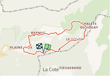

9 km | 14,3 km-effort

Benutzer


Kostenlosegpshiking-Anwendung
 SityTrail
IGN / Geografische Institute
SityTrail World
Die Welt öffnet sich für Sie
Tour Wandern von 8,8 km verfügbar auf Auvergne-Rhone-Alpen, Hochsavoyen, Passy. Diese Tour wird von GerardBouche vorgeschlagen.
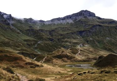
Depuis le lac Vert par les Mollays, les chalets des Ayères et la Barme Trappier. Très beau parcours sous la chaîne des Fiz.


Wandern

Wandern

Wandern

Wandern

Laufen

Wandern

Wandern

Wandern
Wandern