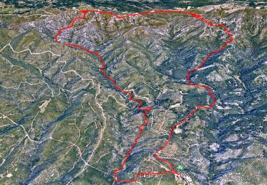
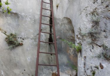
Tour Wandern Plan-de-Cuques - Le Vallon de Mauvelle et le Vallon des Ouides - Photo

Le Vallon de Mauvelle et le Vallon des Ouides

 Nathy8913
Nathy8913

Benutzer

© OpenStreetMap contributors
Länge
Länge
9 km
Maximale Höhe
Maximale Höhe
437 m
Positive Höhendifferenz
250 m
Km-Effort
Km-Effort  
12,3 km
Min. Höhe
Min. Höhe
189 m
Negative Höhendifferenz
251 m
Boucle
Boucle
Ja
Erstellungsdatum :
2021-10-13 06:38:09.418
Letzte Änderung :
2021-10-13 06:41:26.261

(1 Nachricht)

Wandern
Wandern
2h48
Schwierigkeit : Schwierig

Scannen Sie diesen QR-Code, um die Tour in der SityTrail-Anwendung zu öffnen

Kostenlosegpshiking-Anwendung

Logo SityTrail SityTrail

IGN / Geografische Institute

SityTrail aus dem App Store herunterladen SityTrail von Google Play herunterladen

Logo SityTrail SityTrail World

Die Welt öffnet sich für Sie

SityTrail aus dem App Store herunterladen SityTrail von Google Play herunterladen SityTrail auf Huawei AppGallery herunterladen

Über SityTrail

Tour Wandern von 9 km verfügbar auf Provence-Alpes-Côte d'Azur, Bouches-du-Rhône, Plan-de-Cuques. Diese Tour wird von Nathy8913 vorgeschlagen.

Höhenprofil

POIs

POI Plan-de-Cuques - Portail de la piste DFCI de la Montade - Photo
Nathy8913
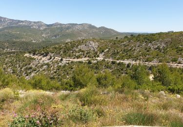
POI Plan-de-Cuques - À droite. Vallon de Mauvelle - Photo
Nathy8913
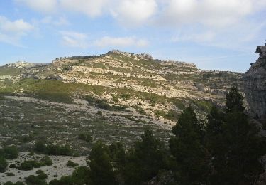
POI Plan-de-Cuques - À gauche vers la paroi rocheuse - Photo
Nathy8913
POI Plan-de-Cuques - epave - Photo
Nathy8913
PLAN-DE-CUQUES 
POI Plan-de-Cuques - baume - Photo
Nathy8913
PLAN-DE-CUQUES 
POI Plan-de-Cuques - large piste - Photo
Nathy8913
PLAN-DE-CUQUES 
POI Plan-de-Cuques - tout droit - Photo
Nathy8913
PLAN-DE-CUQUES 
POI Plan-de-Cuques - Sources des Cauvières - Photo
Nathy8913
PLAN-DE-CUQUES 
POI Plan-de-Cuques - Piste du milieu (poste de chasse) - Photo
Nathy8913
POI Plan-de-Cuques - chemin du milieu - Photo
Nathy8913
PLAN-DE-CUQUES 
POI Plan-de-Cuques - Puits du Gargoutier - Photo
Nathy8913
PLAN-DE-CUQUES 
POI Plan-de-Cuques - photos - Photo
Nathy8913
PLAN-DE-CUQUES 
POI Plan-de-Cuques - photo mardeille - Photo
Nathy8913
PLAN-DE-CUQUES 
POI Plan-de-Cuques - Carrefour de quatre pistes - Photo
Nathy8913
POI Plan-de-Cuques - À gauche dans la végétation - Photo
Nathy8913
POI Plan-de-Cuques - photo marmite oyides - Photo
Nathy8913
PLAN-DE-CUQUES 
POI Plan-de-Cuques - À gauche. Vallon des Ouides - Photo
Nathy8913
POI Marseille - pont - Photo
Nathy8913
MARSEILLE 
POI Marseille - 2eme pont - Photo
Nathy8913
MARSEILLE 
POI Marseille - 3eme pont - Photo
Nathy8913
MARSEILLE 
POI Marseille - À gauche - Photo
Nathy8913
MARSEILLE 
POI Marseille - photos marmites - Photo
Nathy8913
MARSEILLE 
POI Marseille - À gauche. Longer  les rochers - Photo
Nathy8913
POI Plan-de-Cuques - Portail de la piste DFCI de la Montade - Photo
Nathy8913

Ort

Land:
France
Region :
Provence-Alpes-Côte d'Azur
Abteilung/Provinz :
Bouches-du-Rhône
Kommune :
Plan-de-Cuques
Standort:
Unknown
Gehen Sie:(Dec)
Gehen Sie:(UTM)
699637 ; 4803991 (31T) N.

Kommentare

Bitte melden Sie sich an, um einen Kommentar oder eine Bewertung zu hinterlassen


Touren in der Umgebung

Tour Wandern Allauch - SityTrail - le Pilon - Photo
Wandern
GUIDE
affinetataille

Wandern

Medium
(1)
Allauch, Provence-Alpes-Côte d'Azur, Bouches-du-Rhône, France
13,7 km | 20 km-effort
6h 0min
Ja
Tour Mountainbike Allauch - les antennes du garlaban à modifier - Photo
Mountainbike
GUIDE
harydh

Mountainbike

Medium
Allauch, Provence-Alpes-Côte d'Azur, Bouches-du-Rhône, France
19,3 km | 28 km-effort
2h 8min
Ja
Tour Mountainbike Allauch - les antennes du garlaban - Photo
Mountainbike
GUIDE
harydh

Mountainbike

Medium
Allauch, Provence-Alpes-Côte d'Azur, Bouches-du-Rhône, France
19,3 km | 28 km-effort
2h 8min
Ja
Tour Wandern Allauch - Pic du Taoumé - Photo
Wandern
GUIDE
amiral13

Wandern

Einfach
Allauch, Provence-Alpes-Côte d'Azur, Bouches-du-Rhône, France
9,2 km | 15,2 km-effort
5h 5min
Ja
Tour Wandern Marseille - Etoile - Photo
Wandern
Spinnaker

Wandern

Sehr leicht
(1)
Marseille, Provence-Alpes-Côte d'Azur, Bouches-du-Rhône, France
10,7 km | 16,2 km-effort
2h 10min
Ja
Tour Mountainbike Marseille - 2013 05 04 l étoile - Photo
Mountainbike
lboubis

Mountainbike

Medium
(2)
Marseille, Provence-Alpes-Côte d'Azur, Bouches-du-Rhône, France
25 km | 36 km-effort
2h 19min
Ja
Tour Wandern Marseille - La Grande Etoile - Photo
Wandern
GUIDE
lhomme.ph

Wandern

Medium
Marseille, Provence-Alpes-Côte d'Azur, Bouches-du-Rhône, France
15,4 km | 23 km-effort
4h 48min
Ja
Tour Wandern Allauch - allauch amandiers - Photo
Wandern
lhags

Wandern

Medium
(2)
Allauch, Provence-Alpes-Côte d'Azur, Bouches-du-Rhône, France
12,6 km | 19,5 km-effort
3h 37min
Ja
Tour Wandern Plan-de-Cuques - Vallon de la Mauvelle et des Ouides - Photo
Wandern
cousam

Wandern

Schwierig
Plan-de-Cuques, Provence-Alpes-Côte d'Azur, Bouches-du-Rhône, France
9,6 km | 12,7 km-effort
3h 2min
Ja


Schließen
Meine Abonnements