![](/images/other/stat-length.png)
![Tour Zu Fuß Basse-Pointe - SLNA Projet de tracé - Photo](https://media.geolcdn.com/t/1900/400/2c5f6389-fb14-4710-bc0f-c5e827283513.jpg&format=pjpeg&maxdim=2)
SLNA Projet de tracé
Lamartiniere
Benutzer GUIDE
![Länge](/images/other/stat-length.png)
![Maximale Höhe](https://static1.geolcdn.com/siteimages/upload/files/1508320355ic_sort_altitude_max_24dp.png)
![Positive Höhendifferenz](https://static1.geolcdn.com/siteimages/upload/files/1508320355ic_sort_den_pos_24dp.png)
![Km-Effort](/images/other/stat-length.png)
![Min. Höhe](https://static1.geolcdn.com/siteimages/upload/files/1508320355ic_sort_altitude_min_24dp.png)
![Negative Höhendifferenz](https://static1.geolcdn.com/siteimages/upload/files/1508320355ic_sort_den_neg_24dp.png)
![Boucle](https://static1.geolcdn.com/siteimages/upload/files/16400158638029165_repeat_loop_refresh_sync_direction_icon.png)
![Zu Fuß](https://static1.geolcdn.com/sitytour/trail-icons/100.png)
3h33
Schwierigkeit : Einfach
![Wandern](https://static1.geolcdn.com/sitytour/trail-icons/101.png)
3h33
Schwierigkeit : Schwierig
![Scannen Sie diesen QR-Code, um die Tour in der SityTrail-Anwendung zu öffnen](https://capi.geolives.com/qq0zvz2zws4bq2lad0pu/sitytour/trails/2963580/qr.png?size=200)
Kostenlosegpshiking-Anwendung
Über SityTrail
Tour Zu Fuß von 11,4 km verfügbar auf Martinique, Unbekannt, Basse-Pointe. Diese Tour wird von Lamartiniere vorgeschlagen.
Beschreibung
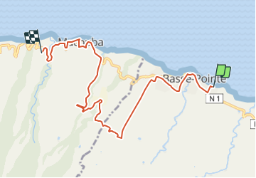
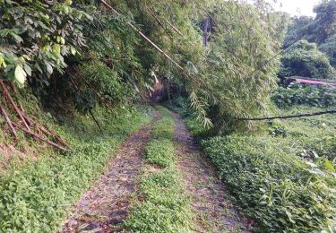
Sentier Littoral Nord-Atlantique, (SLNA) projet de tracé
Ce projet de tracé qui évite le plus possible d’emprunter la voie publique, permet de faire la jonction du SLNA en partant du terrain de pétanque de Basse-Pointe situé à Tapis-Vert vers le départ du circuit Désiles placé sur la D10 au niveau d’Hbt Cheneaux à Macouba.
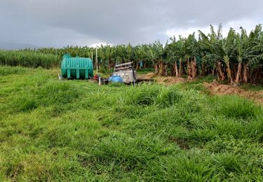
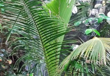
Le circuit proposé, d’une longueur de 11 kms environ, au dénivelé de 330 ms, traverse plusieurs exploitations agricoles, en l’occurrence, Hbt Gradis, Hbt Hackaert, Hbt Bellevue ainsi qu'une petite canneraie à la sortie du gué de rivière Hackaert.
Au niveau de Gros-Morne, un gué autorise la traversée de la rivière Hackaert, par beau temps vers le secteur Théolade.
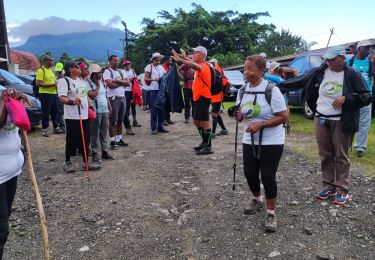
Des autorisations de passages seront nécessaires pour l'évolution des randonneurs
Quelques points d’intérêts sur cet itinéraire :
-Basse-Pointe :
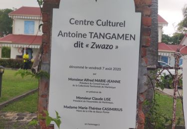
-Le Centre Culturel Tiers-Lieu Antoine Tangamen.
-Macouba :
-Rhumerie de Fonds Preville, à Rivière Roche (JM)
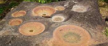
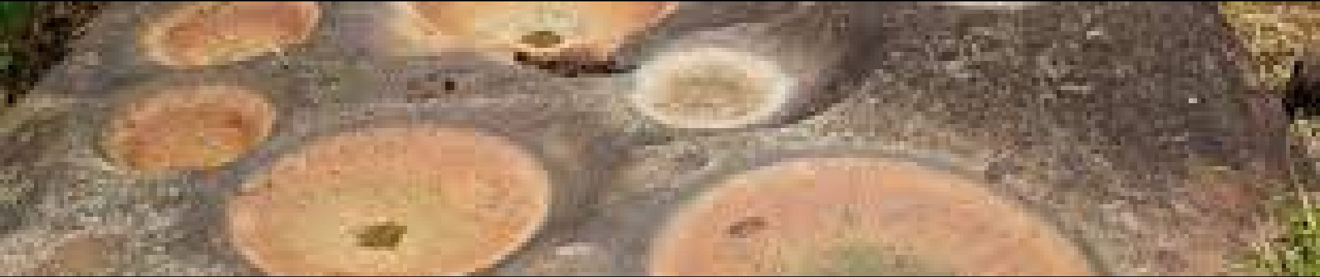
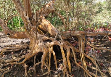
-Au niveau de Terre-Patate, « La roche à BonDieu ».
-A noter également la possibilité pour le marcheur de faire un aller-retour sur l’ancien quartier Nord-Plage où est installé un chemin de croix et un oratoire, puis reprise du parcours initial sur la D10.
Fernand LAMARTINIERE.
2ème Vice-Président et Administrateur
Comité de la Randonnée Pédestre de la Martinique
Ort
Kommentare
Touren in der Umgebung
![Tour Wandern Le Lorrain - Boucle Lorrinoise via Morne Wawa - Photo](https://media.geolcdn.com/t/375/260/2260d5fa-b236-443e-94b6-198d12135800.jpg&format=jpg&maxdim=2)
![Wandern Wandern](https://static1.geolcdn.com/sitytour/trail-icons/101.png)
Wandern
![](/images/other/stat-length.png)
![](https://static1.geolcdn.com/siteimages/upload/files/16400158638029165_repeat_loop_refresh_sync_direction_icon.png)
![Tour Wandern Le Lorrain - Boucle Morne Capot via La Pirogue - Photo](https://media.geolcdn.com/t/375/260/88d336cd-6544-44b1-ab6c-880c93dcc1a4.jpg&format=jpg&maxdim=2)
![Wandern Wandern](https://static1.geolcdn.com/sitytour/trail-icons/101.png)
Wandern
![](/images/other/stat-length.png)
![](https://static1.geolcdn.com/siteimages/upload/files/16400158638029165_repeat_loop_refresh_sync_direction_icon.png)
![Tour Wandern L'Ajoupa-Bouillon - Cascade Dany - Photo](https://media.geolcdn.com/t/375/260/3f4633dd-5480-45ae-9d52-d53ad8f8f6d0.jpg&format=jpg&maxdim=2)
![Wandern Wandern](https://static1.geolcdn.com/sitytour/trail-icons/101.png)
Wandern
![](/images/other/stat-length.png)
![](https://static1.geolcdn.com/siteimages/upload/files/16400158638029165_repeat_loop_refresh_sync_direction_icon.png)
![Wandern Wandern](https://static1.geolcdn.com/sitytour/trail-icons/101.png)
Wandern
![](/images/other/stat-length.png)
![](https://static1.geolcdn.com/siteimages/upload/files/16400158638029165_repeat_loop_refresh_sync_direction_icon.png)
![Tour Wandern Basse-Pointe - Exploitations agricoles en boucle N°1 - Photo](https://media.geolcdn.com/t/375/260/25d4e89e-0741-47b9-9c1b-39c4a8472812.jpg&format=jpg&maxdim=2)
![Wandern Wandern](https://static1.geolcdn.com/sitytour/trail-icons/101.png)
Wandern
![](/images/other/stat-length.png)
![](https://static1.geolcdn.com/siteimages/upload/files/16400158638029165_repeat_loop_refresh_sync_direction_icon.png)
![Tour Wandern Le Lorrain - Mornes Capot / Lorrain Martinique - Photo](https://media.geolcdn.com/t/375/260/bf3e9288-2731-4804-b2e5-dccb9a2b816e.jpg&format=jpg&maxdim=2)
![Wandern Wandern](https://static1.geolcdn.com/sitytour/trail-icons/101.png)
Wandern
![](/images/other/stat-length.png)
![](https://static1.geolcdn.com/siteimages/upload/files/16400158638029165_repeat_loop_refresh_sync_direction_icon.png)
![Tour Wandern Basse-Pointe - Boucle de chalvet, Pécoule vers Chalvet. - Photo](https://media.geolcdn.com/t/375/260/1e4cabaa-63c0-46f7-b111-2c87348cf0ee.jpg&format=jpg&maxdim=2)
![Wandern Wandern](https://static1.geolcdn.com/sitytour/trail-icons/101.png)
Wandern
![](/images/other/stat-length.png)
![](https://static1.geolcdn.com/siteimages/upload/files/16400158638029165_repeat_loop_refresh_sync_direction_icon.png)
![Tour Wandern Basse-Pointe - Grande Boucle sur Basse pointe. - Photo](https://media.geolcdn.com/t/375/260/08174d61-6359-47a0-ac79-c9191649aa79.jpg&format=jpg&maxdim=2)
![Wandern Wandern](https://static1.geolcdn.com/sitytour/trail-icons/101.png)
Wandern
![](/images/other/stat-length.png)
![](https://static1.geolcdn.com/siteimages/upload/files/16400158638029165_repeat_loop_refresh_sync_direction_icon.png)
![Tour Wandern Le Lorrain - trace des Amérindiens - Photo](https://media.geolcdn.com/t/375/260/5dbbcceb-f0b2-4ef7-8df6-def9c209f94d.jpg&format=jpg&maxdim=2)
![Wandern Wandern](https://static1.geolcdn.com/sitytour/trail-icons/101.png)
Wandern
![](/images/other/stat-length.png)
![](https://static1.geolcdn.com/siteimages/upload/files/16400158638029165_repeat_loop_refresh_sync_direction_icon.png)