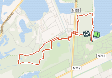
![](/images/other/stat-length.png)
![Tour Wandern Mol - 2021-09-29_15h22m36_Sun parc Kempense Meren 01 - Photo](https://media.geolcdn.com/t/1900/400/3cc67463-7b57-4172-992b-cc542ae8eb39.jpg&format=pjpeg&maxdim=2)
2021-09-29_15h22m36_Sun parc Kempense Meren 01
Mudry
Benutzer
![Länge](/images/other/stat-length.png)
Länge
5,3 km
![Maximale Höhe](https://static1.geolcdn.com/siteimages/upload/files/1508320355ic_sort_altitude_max_24dp.png)
Maximale Höhe
47 m
![Positive Höhendifferenz](https://static1.geolcdn.com/siteimages/upload/files/1508320355ic_sort_den_pos_24dp.png)
Positive Höhendifferenz
46 m
![Km-Effort](/images/other/stat-length.png)
Km-Effort
5,9 km
![Min. Höhe](https://static1.geolcdn.com/siteimages/upload/files/1508320355ic_sort_altitude_min_24dp.png)
Min. Höhe
28 m
![Negative Höhendifferenz](https://static1.geolcdn.com/siteimages/upload/files/1508320355ic_sort_den_neg_24dp.png)
Negative Höhendifferenz
46 m
![Boucle](https://static1.geolcdn.com/siteimages/upload/files/16400158638029165_repeat_loop_refresh_sync_direction_icon.png)
Boucle
Ja
Erstellungsdatum :
2021-09-29 13:22:37.267
Letzte Änderung :
2021-09-29 13:41:18.873
![Wandern](https://static1.geolcdn.com/sitytour/trail-icons/101.png)
1h20
Schwierigkeit : Einfach
![Scannen Sie diesen QR-Code, um die Tour in der SityTrail-Anwendung zu öffnen](https://capi.geolives.com/qq0zvz2zws4bq2lad0pu/sitytour/trails/2953525/qr.png?size=200)
Kostenlosegpshiking-Anwendung
Über SityTrail
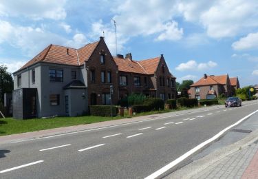
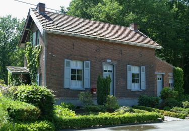
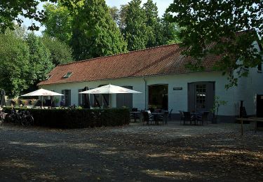
Tour Wandern von 5,3 km verfügbar auf Flandern, Antwerpen, Mol. Diese Tour wird von Mudry vorgeschlagen.
Beschreibung
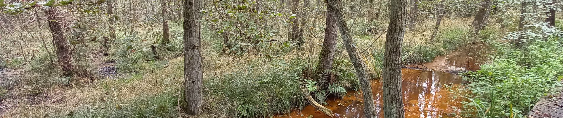
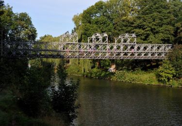
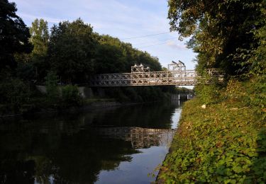
Promenade balisée au départ du Sun Park. Balisage top. Un dépliant papier est disponible à l'accueil du Sun Park. Pas de difficulté majeure mais le parcours le long du cours d'eau est parfois un peu glissant et...mouillé...
Ort
Land:
Belgium
Region :
Flandern
Abteilung/Provinz :
Antwerpen
Kommune :
Mol
Standort:
Unknown
Gehen Sie:(Dec)
Gehen Sie:(UTM)
652812 ; 5676297 (31U) N.
Kommentare
Touren in der Umgebung
![Tour Zu Fuß Mol - Merenpad 7km - Photo](https://media.geolcdn.com/t/375/260/4f059d46-9351-4bfb-b85c-d0034645b3fe.jpeg&format=jpg&maxdim=2)
![Zu Fuß Zu Fuß](https://static1.geolcdn.com/sitytour/trail-icons/100.png)
![Tour Zu Fuß Mol - Galbergenpad - Photo](https://media.geolcdn.com/t/375/260/ac6c45ad-0a3f-46f0-8730-3bf99148b3e6.jpeg&format=jpg&maxdim=2)
![Zu Fuß Zu Fuß](https://static1.geolcdn.com/sitytour/trail-icons/100.png)
![Tour Zu Fuß Mol - Netepad - Photo](https://media.geolcdn.com/t/375/260/b8d824ab-b7ec-46ac-901d-e1a19a60eee0.jpeg&format=jpg&maxdim=2)
![Zu Fuß Zu Fuß](https://static1.geolcdn.com/sitytour/trail-icons/100.png)
![Tour Zu Fuß Mol - Merenpad - Photo](https://media.geolcdn.com/t/375/260/03f8c97e-ed17-4356-a72b-3f3c82846f0d.jpeg&format=jpg&maxdim=2)
![Zu Fuß Zu Fuß](https://static1.geolcdn.com/sitytour/trail-icons/100.png)
![Tour Zu Fuß Lommel - Blauwe Kei Rode driehoek - Photo](https://media.geolcdn.com/t/375/260/9bca7f32-27e0-4e61-aadd-7c6bcb57fbd7.jpeg&format=jpg&maxdim=2)
![Zu Fuß Zu Fuß](https://static1.geolcdn.com/sitytour/trail-icons/100.png)
Blauwe Kei Rode driehoek
Zu Fuß
Einfach
Lommel,
Flandern,
Limburg,
Belgium
![](/images/other/stat-length.png)
11,4 km | 12,2 km-effort
2h 47min
![](https://static1.geolcdn.com/siteimages/upload/files/16400158638029165_repeat_loop_refresh_sync_direction_icon.png)
Ja
![Tour Zu Fuß Lommel - Blauwe Kei Groene rechthoek - Photo](https://media.geolcdn.com/t/375/260/9bca7f32-27e0-4e61-aadd-7c6bcb57fbd7.jpeg&format=jpg&maxdim=2)
![Zu Fuß Zu Fuß](https://static1.geolcdn.com/sitytour/trail-icons/100.png)
Blauwe Kei Groene rechthoek
Zu Fuß
Einfach
Lommel,
Flandern,
Limburg,
Belgium
![](/images/other/stat-length.png)
4,9 km | 5,3 km-effort
1h 11min
![](https://static1.geolcdn.com/siteimages/upload/files/16400158638029165_repeat_loop_refresh_sync_direction_icon.png)
Ja
![Tour Zu Fuß Lommel - Blauwe Kei Gele zeshoek - Photo](https://media.geolcdn.com/t/375/260/c27b7662-6e94-4e29-b3cf-5c4fe5dc9647.jpeg&format=jpg&maxdim=2)
![Zu Fuß Zu Fuß](https://static1.geolcdn.com/sitytour/trail-icons/100.png)
Blauwe Kei Gele zeshoek
Zu Fuß
Einfach
Lommel,
Flandern,
Limburg,
Belgium
![](/images/other/stat-length.png)
8,8 km | 9,6 km-effort
2h 10min
![](https://static1.geolcdn.com/siteimages/upload/files/16400158638029165_repeat_loop_refresh_sync_direction_icon.png)
Ja
![Tour Zu Fuß Lommel - De Maat blauwe vlam - Photo](https://media.geolcdn.com/t/375/260/feb75399-7b57-4327-8c6f-945ea77a910c.jpeg&format=jpg&maxdim=2)
![Zu Fuß Zu Fuß](https://static1.geolcdn.com/sitytour/trail-icons/100.png)
De Maat blauwe vlam
Zu Fuß
Einfach
Lommel,
Flandern,
Limburg,
Belgium
![](/images/other/stat-length.png)
5,7 km | 6,1 km-effort
1h 23min
![](https://static1.geolcdn.com/siteimages/upload/files/16400158638029165_repeat_loop_refresh_sync_direction_icon.png)
Ja
![Tour Zu Fuß Mol - Den Diel - Photo](https://media.geolcdn.com/t/375/260/c27b7662-6e94-4e29-b3cf-5c4fe5dc9647.jpeg&format=jpg&maxdim=2)
![Zu Fuß Zu Fuß](https://static1.geolcdn.com/sitytour/trail-icons/100.png)